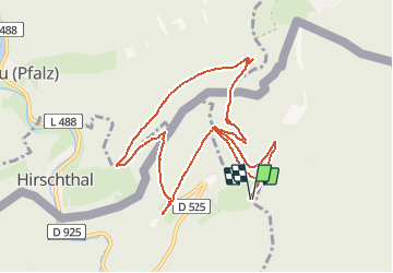
![](/images/other/stat-length.png)
![Trail Walking Lembach - Gimbelhof et Fleckenstein - Lembach - Photo](https://media.geolcdn.com/t/1900/400/ext.pjpeg?maxdim=2&url=https%3A%2F%2Fservices.sitytrail.com%2FGeolivesWS%2FDownloadMedia.ashx%3FTrailID%3D317818%26Media%3D17164_3.jpg)
Gimbelhof et Fleckenstein - Lembach
tracegps
User
![Length](/images/other/stat-length.png)
![Max alt](https://static1.geolcdn.com/siteimages/upload/files/1508320355ic_sort_altitude_max_24dp.png)
![Uphill gradient](https://static1.geolcdn.com/siteimages/upload/files/1508320355ic_sort_den_pos_24dp.png)
![Km-Effort](/images/other/stat-length.png)
![Min alt](https://static1.geolcdn.com/siteimages/upload/files/1508320355ic_sort_altitude_min_24dp.png)
![Downhill gradient](https://static1.geolcdn.com/siteimages/upload/files/1508320355ic_sort_den_neg_24dp.png)
![Boucle](https://static1.geolcdn.com/siteimages/upload/files/16400158638029165_repeat_loop_refresh_sync_direction_icon.png)
![Walking](https://static1.geolcdn.com/sitytour/trail-icons/101.png)
2h49
Difficulty : Medium
![Scan this QR Code to open this trail in the SityTrail application](https://capi.geolives.com/qq0zvz2zws4bq2lad0pu/sitytour/trails/317818/qr.png?size=200)
FREE GPS app for hiking
About
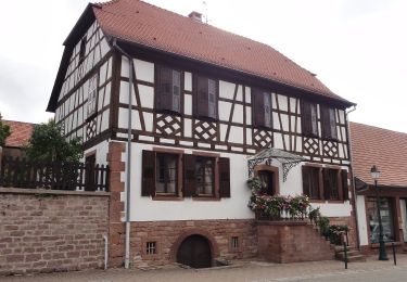
Trail Walking of 9.9 km to be discovered at Grand Est, Bas-Rhin, Lembach. This trail is proposed by tracegps.
Description
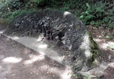
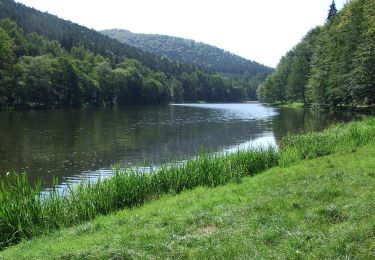
La randonnée démarre sur le parking de l’Auberge du Gimbelhof. Suivre disque bleu jusqu’au col du Litschhof, puis tourner à gauche et suivre rectangle rouge jusqu’au carrefour du Schlossberg. De là, suivre triangle rouge à droite pour monter au château de Loewenstein, puis le château de Hohenbourg. Descendre vers la frontière où se trouve le Kaiser Wilhelm Stein. Monter vers le château de Wegelnburg en Allemagne, en suivant rectangle bleu. Descendre vers Hirschthal et à l’arrivée à l’orée de la forêt, quitter le rectangle bleu, pour, sur un chemin non balisé, rejoindre l’aire de repos et de pique-nique au pied du château de Fleckenstein. De là remonter par le sentier des roches sur le Langenfels vers le carrefour de Schlossberg avant de redescendre vers le Gimbelhof en suivant le balisage disque bleu.
Positioning
Comments
Trails nearby
![Trail Horseback riding Wingen - 2018-04-07 CRTE Alsace Loewenstein Hohenbourg Fleckenstein - Photo](https://media.geolcdn.com/t/375/260/70102c74-cde7-4712-ad3f-8ece0b83e7cb.jpg&format=jpg&maxdim=2)
![Horseback riding Horseback riding](https://static1.geolcdn.com/sitytour/trail-icons/301.png)
Horseback riding
![](/images/other/stat-length.png)
![](https://static1.geolcdn.com/siteimages/upload/files/16400158638029165_repeat_loop_refresh_sync_direction_icon.png)
![Trail Walking Lembach - Fleckenstein, circuit des 5 châteaux. - Photo](https://media.geolcdn.com/t/375/260/ext.jpg?maxdim=2&url=https%3A%2F%2Fservices.sitytrail.com%2FGeolivesWS%2FDownloadMedia.ashx%3FTrailID%3D364388%26Media%3Dfix__20141120164801.jpg)
![Walking Walking](https://static1.geolcdn.com/sitytour/trail-icons/101.png)
Walking
![](/images/other/stat-length.png)
![](https://static1.geolcdn.com/siteimages/upload/files/16400158638029165_repeat_loop_refresh_sync_direction_icon.png)
![Trail On foot Lembach - Anneau vert - Photo](https://media.geolcdn.com/t/375/260/94c60cdc-936e-47ee-9965-23e9ec9e034a.jpeg&format=jpg&maxdim=2)
![On foot On foot](https://static1.geolcdn.com/sitytour/trail-icons/100.png)
![Trail On foot Lembach - Anneau jaune - Photo](https://media.geolcdn.com/t/375/260/ca3811e6-33d3-4810-a71b-1526bcfc4047.jpeg&format=jpg&maxdim=2)
![On foot On foot](https://static1.geolcdn.com/sitytour/trail-icons/100.png)
![Trail On foot Wingen - Croix rouge - Photo](https://media.geolcdn.com/t/375/260/59ca20a7-ed62-4c6a-9fd9-47494a5cdd7a.jpeg&format=jpg&maxdim=2)
![On foot On foot](https://static1.geolcdn.com/sitytour/trail-icons/100.png)
![Trail On foot Lembach - Croix bleue - Photo](https://media.geolcdn.com/t/375/260/06df198a-1199-44ec-a8d9-2d9a150b410c.jpeg&format=jpg&maxdim=2)
![On foot On foot](https://static1.geolcdn.com/sitytour/trail-icons/100.png)
![Trail On foot Wingen - Anneau rouge - Photo](https://media.geolcdn.com/t/375/260/06df198a-1199-44ec-a8d9-2d9a150b410c.jpeg&format=jpg&maxdim=2)
![On foot On foot](https://static1.geolcdn.com/sitytour/trail-icons/100.png)
![Trail On foot Lembach - Disque bleu - Photo](https://media.geolcdn.com/t/375/260/0eb9d5da-4d5d-4850-86c1-81932a32bac4.jpeg&format=jpg&maxdim=2)
![On foot On foot](https://static1.geolcdn.com/sitytour/trail-icons/100.png)
![Trail On foot Lembach - Croix rouge - Photo](https://media.geolcdn.com/t/375/260/8214d6ae-8b08-4cfc-b481-39fdcb8b7805.jpeg&format=jpg&maxdim=2)
![On foot On foot](https://static1.geolcdn.com/sitytour/trail-icons/100.png)