Trail Cycle Chauny - Sur les versants de l'Oise - 55 km - Chauny - Photo

Sur les versants de l'Oise - 55 km - Chauny

 tracegps
tracegps

User

© OpenStreetMap contributors
Length
Length
55 km
Max alt
Max alt
186 m
Uphill gradient
Uphill gradient
496 m
Km-Effort
Km-Effort  
62 km
Min alt
Min alt
38 m
Downhill gradient
Downhill gradient
496 m
Boucle
Boucle
Yes
Creation date :
2014-12-10 00:00:00.0
Updated on :
2014-12-10 00:00:00.0

(0 Reviews)

Cycle
Cycle
5h30
Difficulty : Difficult

Scan this QR Code to open this trail in the SityTrail application

FREE GPS app for hiking

Logo SityTrail SityTrail

IGN / Geographical institutes

Download SityTrail from the App Store Download SityTrail from Google Play

Logo SityTrail SityTrail World

The world is yours!

Download SityTrail from the App Store Download SityTrail from Google Play Download SityTrail on Huawei AppGallery

About

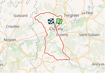
Trail Cycle of 55 km to be discovered at Hauts-de-France, Aisne, Chauny. This trail is proposed by tracegps.

Description

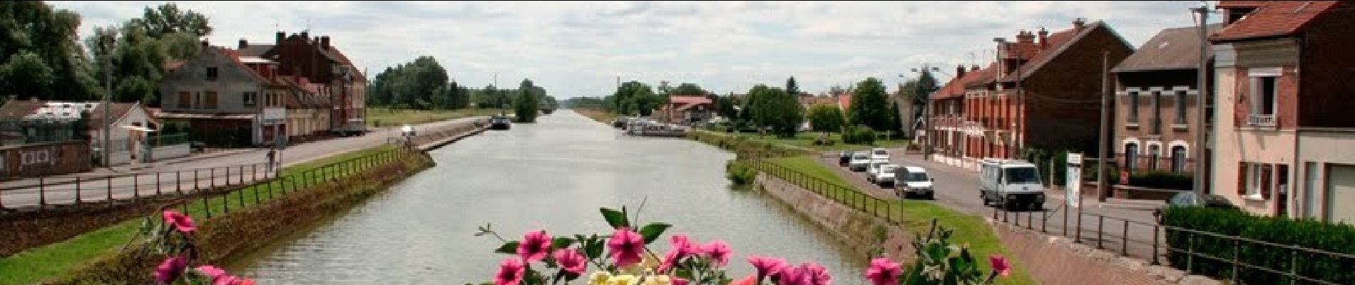
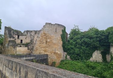
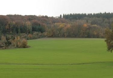
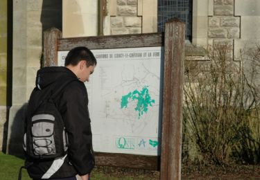
Au carrefour de l’Oise et de multiples canaux, Chauny a vécu une histoire bien tourmentée. De belles bâtisses Art Déco témoignent de sa reconstruction dans les années 1920 et 1930. Un circuit pour découvrir Chauny et la campagne environnante. Départ de la place Bouzier, parking pour véhicule gratuit. Retrouvez toutes les informations ICI.

Elevation profile

Photos

Positioning

Country:
France
Region :
Hauts-de-France
Department/Province :
Aisne
Municipality :
Chauny
Location:
Unknown
Start:(UTM)
515531 ; 5496082 (31U) N.

Trails nearby

Trail Mountain bike Sinceny - parcours vtt rond d'Orléans  - Photo
Mountain bike
alainwald

Mountain bike

Difficult
Sinceny, Hauts-de-France, Aisne, France
47 km | 56 km-effort
4h 20min
Yes
Trail On foot Caumont - Caumont - Photo
On foot
fitz2014

On foot

Medium
(1)
Caumont, Hauts-de-France, Aisne, France
18 km | 21 km-effort
4h 47min
Yes
Trail Cycle Chauny - Sur les versants de l'Oise - 27 km - Chauny - Photo
Cycle
tracegps

Cycle

Medium
Chauny, Hauts-de-France, Aisne, France
25 km | 30 km-effort
2h 30min
Yes
Trail Walking Bichancourt - Bichancourt - Le Canal Saint Lazare - Photo
Walking
tracegps

Walking

Medium
Bichancourt, Hauts-de-France, Aisne, France
6.6 km | 7.1 km-effort
1h 40min
Yes
Trail Walking Chauny - 3fontaine - Photo
Walking
Ludovic Fort

Walking

Medium
Chauny, Hauts-de-France, Aisne, France
20 km | 23 km-effort
4h 18min
Yes
Trail Mountain bike Sinceny - Sortie VTT - Photo
Mountain bike
patweb02

Mountain bike

Very easy
Sinceny, Hauts-de-France, Aisne, France
13.9 km | 14.9 km-effort
1h 0min
Yes
Trail Other activity Chauny - Picardie - Ligne 234 - Anizy-Pinon - Chauny - Photo
Other activity
mich54

Other activity

Very easy
Chauny, Hauts-de-France, Aisne, France
25 km | 27 km-effort
5min
No
Trail Walking Ugny-le-Gay - randonnée les Hezettes - Photo
Walking
José800

Walking

Difficult
Ugny-le-Gay, Hauts-de-France, Aisne, France
11.5 km | 14.7 km-effort
3h 19min
Yes
Trail Walking Villequier-Aumont - Sur les pas de josé - Photo
Walking
José800

Walking

Medium
Villequier-Aumont, Hauts-de-France, Aisne, France
9.2 km | 10.4 km-effort
2h 22min
Yes


Close
My subscriptions