![](/images/other/stat-length.png)
![Trail Mountain bike Saint-Germain-Nuelles - Entre Vignes et Pierres Dorées (2014-VTT-55km) - Saint Germain Nuelles - Photo](https://media.geolcdn.com/t/1900/400/ext.pjpeg?maxdim=2&url=https%3A%2F%2Fservices.sitytrail.com%2FGeolivesWS%2FDownloadMedia.ashx%3FTrailID%3D317759%26Media%3D17072_6.jpg)
Entre Vignes et Pierres Dorées (2014-VTT-55km) - Saint Germain Nuelles
tracegps
User
![Length](/images/other/stat-length.png)
![Max alt](https://static1.geolcdn.com/siteimages/upload/files/1508320355ic_sort_altitude_max_24dp.png)
![Uphill gradient](https://static1.geolcdn.com/siteimages/upload/files/1508320355ic_sort_den_pos_24dp.png)
![Km-Effort](/images/other/stat-length.png)
![Min alt](https://static1.geolcdn.com/siteimages/upload/files/1508320355ic_sort_altitude_min_24dp.png)
![Downhill gradient](https://static1.geolcdn.com/siteimages/upload/files/1508320355ic_sort_den_neg_24dp.png)
![Boucle](https://static1.geolcdn.com/siteimages/upload/files/16400158638029165_repeat_loop_refresh_sync_direction_icon.png)
![Mountain bike](https://static1.geolcdn.com/sitytour/trail-icons/202.png)
5h00
Difficulty : Very difficult
![Scan this QR Code to open this trail in the SityTrail application](https://capi.geolives.com/qq0zvz2zws4bq2lad0pu/sitytour/trails/317759/qr.png?size=200)
FREE GPS app for hiking
About
Trail Mountain bike of 56 km to be discovered at Auvergne-Rhône-Alpes, Rhône, Saint-Germain-Nuelles. This trail is proposed by tracegps.
Description
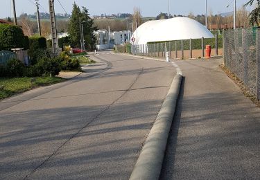
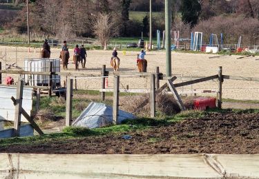
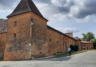
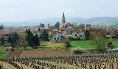
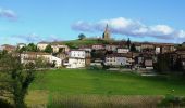
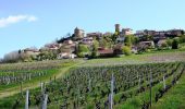
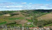
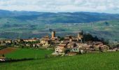
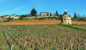
Parking et départ de la salle polyvalente. Saint-Germain-Nuelles est une nouvelle commune depuis le 1er janvier 2013. Elle regroupe les anciens villages de Saint-Germain-sur-l’Arbresle et de Nuelles. Comme toujours le parcours tracé par les organisateurs du « BSC Saint Germain » est EXTRAORDINAIRE et grand merci à eux de nous procurer un tel plaisir… Cette 7ème édition s’est déroulée le dimanche 6 avril 2014. Il y a peu de randonnées VTT avec autant de singles tracks et avec si peu de bitume... ce qui a le mérite d’être souligné. Tout comme le nom de cette rando l'indique, ce coin du Beaujolais est le paradis des vignes et des villages en pierres dorées (pierre ocre), plus beaux les uns que les autres (Bully, Sainte-Paule, Oingt, Bois d’Oingt, Bagnols, etc…). Mais attention c’est du lourd et du costaud. C'est un parcours qui démarre tranquillement et qui s’élève progressivement pour devenir technique, exigeant et très raide vers Sainte-Paule et au nord d’Oingt et du Bois-d’Oingt. Il faut être endurant et plutôt affuté pour ne pas y laisser des plumes… En garder un peu sous la semelle pour le final qui est assez relevé. Les VTTistes avides de sensations fortes seront servis !!! Je ne m'étendrai pas davantage sur ce circuit très réussi, alors grimpez sur vos VTT et partez à la découverte de cette boucle de rêve, avec l'appareil photo à portée de main tant les paysages sont remarquables. J’ai modifié le départ et le retour en passant par la route (car le jour J on part par les étangs qui sont normalement fermés par des barrières). Au cours de la randonnée, quelques passages dans le vignoble étaient signalés ouverts uniquement le jour de la randonnée. Respectez toute règle de courtoisie en cas de rappel à l’ordre. Topoguide : Circuits VTT des Pierres Dorées - Pays du Bois d'Oingt, 18 circuits sont proposés sur 18 communes différentes situées autour de Bagnols, Oingt et Theizé.
Positioning
Comments
Trails nearby
![Trail Walking L'Arbresle - 2022-04-18_21h43m42_Fiche Verte n°9_L_Arbresle-1 - Photo](https://media.geolcdn.com/t/375/260/00218e51-a692-486e-8923-38995b6815db.jpg&format=jpg&maxdim=2)
![Walking Walking](https://static1.geolcdn.com/sitytour/trail-icons/101.png)
Walking
![](/images/other/stat-length.png)
![](https://static1.geolcdn.com/siteimages/upload/files/16400158638029165_repeat_loop_refresh_sync_direction_icon.png)
![Trail Walking Lentilly - Santier des vaches LENTILLY - Photo](https://media.geolcdn.com/t/375/260/571590e7-6ce0-4ff1-b403-0f445cf01256.jpg&format=jpg&maxdim=2)
![Walking Walking](https://static1.geolcdn.com/sitytour/trail-icons/101.png)
Walking
![](/images/other/stat-length.png)
![](https://static1.geolcdn.com/siteimages/upload/files/16400158638029165_repeat_loop_refresh_sync_direction_icon.png)
![Trail Horseback riding Bully - BULLY nord 29k 38KF - Photo](https://media.geolcdn.com/t/375/260/ext.jpg?maxdim=2&url=https%3A%2F%2Fstatic1.geolcdn.com%2Fsiteimages%2Fupload%2Ffiles%2F1524743154cheval.jpg)
![Horseback riding Horseback riding](https://static1.geolcdn.com/sitytour/trail-icons/301.png)
Horseback riding
![](/images/other/stat-length.png)
![](https://static1.geolcdn.com/siteimages/upload/files/16400158638029165_repeat_loop_refresh_sync_direction_icon.png)
![Trail Walking Chessy - Chessy 11 km - Photo](https://media.geolcdn.com/t/375/260/ext.jpg?maxdim=2&url=https%3A%2F%2Fstatic1.geolcdn.com%2Fsiteimages%2Fupload%2Ffiles%2F1553511878bg_sport_marche.png)
![Walking Walking](https://static1.geolcdn.com/sitytour/trail-icons/101.png)
Walking
![](/images/other/stat-length.png)
![](https://static1.geolcdn.com/siteimages/upload/files/16400158638029165_repeat_loop_refresh_sync_direction_icon.png)
![Trail Walking Lentilly - Lentilly 1 La Rivoire - Photo](https://media.geolcdn.com/t/375/260/951abbe4-3e9f-4b40-bed3-81179a3216af.jpg&format=jpg&maxdim=2)
![Walking Walking](https://static1.geolcdn.com/sitytour/trail-icons/101.png)
Walking
![](/images/other/stat-length.png)
![](https://static1.geolcdn.com/siteimages/upload/files/16400158638029165_repeat_loop_refresh_sync_direction_icon.png)
![Trail Walking Sourcieux-les-Mines - 2023-11-27_00h47m21_fiche-verte-n17-sourcieux-les-mines_randonnee-22453089 - Photo](https://media.geolcdn.com/t/375/260/ext.jpg?maxdim=2&url=https%3A%2F%2Fstatic1.geolcdn.com%2Fsiteimages%2Fupload%2Ffiles%2F1553511878bg_sport_marche.png)
![Walking Walking](https://static1.geolcdn.com/sitytour/trail-icons/101.png)
Walking
![](/images/other/stat-length.png)
![](https://static1.geolcdn.com/siteimages/upload/files/16400158638029165_repeat_loop_refresh_sync_direction_icon.png)
![Trail Walking Chessy - Chessy à Bagnols - Photo](https://media.geolcdn.com/t/375/260/1a8d6b74-bd94-4883-b228-58b5e533ca39.jpg&format=jpg&maxdim=2)
![Walking Walking](https://static1.geolcdn.com/sitytour/trail-icons/101.png)
Walking
![](/images/other/stat-length.png)
![](https://static1.geolcdn.com/siteimages/upload/files/16400158638029165_repeat_loop_refresh_sync_direction_icon.png)
![Trail Walking Charnay - Charnay/Châtillon/Chessy (12 km - D. 330 m) - Photo](https://media.geolcdn.com/t/375/260/1a2d3b7e-3e2e-464b-b810-b35fd7c37452.jpeg&format=jpg&maxdim=2)
![Walking Walking](https://static1.geolcdn.com/sitytour/trail-icons/101.png)
Walking
![](/images/other/stat-length.png)
![](https://static1.geolcdn.com/siteimages/upload/files/16400158638029165_repeat_loop_refresh_sync_direction_icon.png)
![Trail Walking Bully - bully - Photo](https://media.geolcdn.com/t/375/260/ext.jpg?maxdim=2&url=https%3A%2F%2Fstatic1.geolcdn.com%2Fsiteimages%2Fupload%2Ffiles%2F1553511878bg_sport_marche.png)
![Walking Walking](https://static1.geolcdn.com/sitytour/trail-icons/101.png)
Walking
![](/images/other/stat-length.png)
![](https://static1.geolcdn.com/siteimages/upload/files/16400158638029165_repeat_loop_refresh_sync_direction_icon.png)