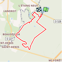
![](/images/other/stat-length.png)
![Trail Walking Liffré - La Fontaine de Saint-Raoul - Liffré - Photo](https://media.geolcdn.com/t/1900/400/ext.pjpeg?maxdim=2&url=https%3A%2F%2Fservices.sitytrail.com%2FGeolivesWS%2FDownloadMedia.ashx%3FTrailID%3D317704%26Media%3D17007_5.jpg)
La Fontaine de Saint-Raoul - Liffré
tracegps
User
![Length](/images/other/stat-length.png)
![Max alt](https://static1.geolcdn.com/siteimages/upload/files/1508320355ic_sort_altitude_max_24dp.png)
![Uphill gradient](https://static1.geolcdn.com/siteimages/upload/files/1508320355ic_sort_den_pos_24dp.png)
![Km-Effort](/images/other/stat-length.png)
![Min alt](https://static1.geolcdn.com/siteimages/upload/files/1508320355ic_sort_altitude_min_24dp.png)
![Downhill gradient](https://static1.geolcdn.com/siteimages/upload/files/1508320355ic_sort_den_neg_24dp.png)
![Boucle](https://static1.geolcdn.com/siteimages/upload/files/16400158638029165_repeat_loop_refresh_sync_direction_icon.png)
![Walking](https://static1.geolcdn.com/sitytour/trail-icons/101.png)
1h40
Difficulty : Easy
![Scan this QR Code to open this trail in the SityTrail application](https://capi.geolives.com/qq0zvz2zws4bq2lad0pu/sitytour/trails/317704/qr.png?size=200)
FREE GPS app for hiking
About
Trail Walking of 6.7 km to be discovered at Brittany, Ille-et-Vilaine, Liffré. This trail is proposed by tracegps.
Description
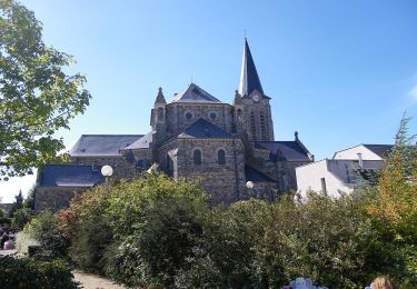
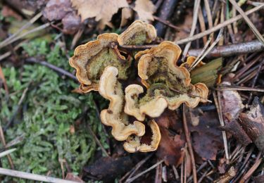
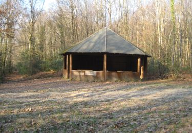
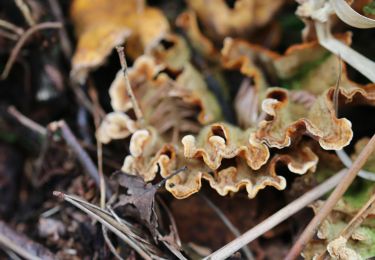
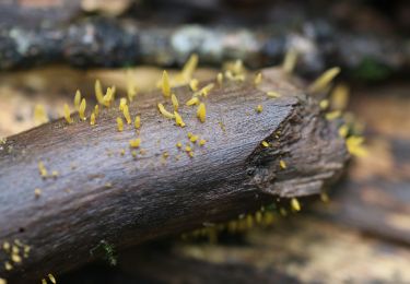
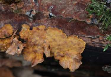
Cette balade, au départ des étangs des Malfrais de Liffré, en forêt de Rennes, classée Zone Naturelle d’Intérêt Faunistique et Floristique, est assez courte mais fort agréable. Elle emprunte tour à tour des petits chemins sinueux et de larges allées forestières. Ouvrez l’œil : cet itinéraire emprunte des tronçons de chemins balisés de différentes manières: traits jaunes, ronds blancs, voir le détail dans la rubrique balisage sur la carte téléchargeable. Retrouvez le circuit sur le site du Tourisme en Haute-Bretagne Ille-et-Vilaine. ou sur le site «balades.bretagne35.com» du Comité départemental du Tourisme Haute Bretagne Ille-et-Vilaine. Cette balade fait partie d'une sélection des "Plus belles balades" du département, réalisé par le Comité Départemental du Tourisme Haute Bretagne Ille-et-Vilaine.
Positioning
Comments
Trails nearby
![Trail On foot Liffré - Circuit du Bâton Roulant - Photo](https://media.geolcdn.com/t/375/260/0517ddbf-81fb-42ed-8a02-375f1086ac5d.jpeg&format=jpg&maxdim=2)
![On foot On foot](https://static1.geolcdn.com/sitytour/trail-icons/100.png)
On foot
![](/images/other/stat-length.png)
![](https://static1.geolcdn.com/siteimages/upload/files/16400158638029165_repeat_loop_refresh_sync_direction_icon.png)
![Trail On foot Liffré - Les Jacinthes - Photo](https://media.geolcdn.com/t/375/260/35ec6f36-f8e1-4b21-8387-27758e43194a.jpeg&format=jpg&maxdim=2)
![On foot On foot](https://static1.geolcdn.com/sitytour/trail-icons/100.png)
On foot
![](/images/other/stat-length.png)
![](https://static1.geolcdn.com/siteimages/upload/files/16400158638029165_repeat_loop_refresh_sync_direction_icon.png)
![Trail On foot Liffré - Circuit des Écures - Photo](https://media.geolcdn.com/t/375/260/600933ca-89e7-4cc4-b51c-a9e67d5387ef.jpeg&format=jpg&maxdim=2)
![On foot On foot](https://static1.geolcdn.com/sitytour/trail-icons/100.png)
On foot
![](/images/other/stat-length.png)
![](https://static1.geolcdn.com/siteimages/upload/files/16400158638029165_repeat_loop_refresh_sync_direction_icon.png)
![Trail On foot Liffré - Circuit du Gué Renaie - Photo](https://media.geolcdn.com/t/375/260/111b5b56-01da-4126-8af6-7ac53a7a7eed.jpeg&format=jpg&maxdim=2)
![On foot On foot](https://static1.geolcdn.com/sitytour/trail-icons/100.png)
On foot
![](/images/other/stat-length.png)
![](https://static1.geolcdn.com/siteimages/upload/files/16400158638029165_repeat_loop_refresh_sync_direction_icon.png)
![Trail On foot Saint-Sulpice-la-Forêt - L'Orée de la Forêt - Photo](https://media.geolcdn.com/t/375/260/8654be0d-afb1-4187-a941-813b541da943.jpeg&format=jpg&maxdim=2)
![On foot On foot](https://static1.geolcdn.com/sitytour/trail-icons/100.png)
On foot
![](/images/other/stat-length.png)
![](https://static1.geolcdn.com/siteimages/upload/files/16400158638029165_repeat_loop_refresh_sync_direction_icon.png)
![Trail On foot Liffré - Circuit de l'Aqueduc - Photo](https://media.geolcdn.com/t/375/260/af2b4c2a-6a9d-4141-9588-eacee99725f4.jpeg&format=jpg&maxdim=2)
![On foot On foot](https://static1.geolcdn.com/sitytour/trail-icons/100.png)
On foot
![](/images/other/stat-length.png)
![](https://static1.geolcdn.com/siteimages/upload/files/16400158638029165_repeat_loop_refresh_sync_direction_icon.png)
![Trail On foot Liffré - Les Juteauderies - Photo](https://media.geolcdn.com/t/375/260/600933ca-89e7-4cc4-b51c-a9e67d5387ef.jpeg&format=jpg&maxdim=2)
![On foot On foot](https://static1.geolcdn.com/sitytour/trail-icons/100.png)
On foot
![](/images/other/stat-length.png)
![](https://static1.geolcdn.com/siteimages/upload/files/16400158638029165_repeat_loop_refresh_sync_direction_icon.png)
![Trail On foot Liffré - Les landes de Beaugé - Photo](https://media.geolcdn.com/t/375/260/0a6f6323-8865-4073-8f33-0afff05c6bce.jpeg&format=jpg&maxdim=2)
![On foot On foot](https://static1.geolcdn.com/sitytour/trail-icons/100.png)
On foot
![](/images/other/stat-length.png)
![](https://static1.geolcdn.com/siteimages/upload/files/16400158638029165_repeat_loop_refresh_sync_direction_icon.png)
![Trail On foot Liffré - La fontaine Saint-Raoul - Photo](https://media.geolcdn.com/t/375/260/8654be0d-afb1-4187-a941-813b541da943.jpeg&format=jpg&maxdim=2)
![On foot On foot](https://static1.geolcdn.com/sitytour/trail-icons/100.png)
On foot
![](/images/other/stat-length.png)
![](https://static1.geolcdn.com/siteimages/upload/files/16400158638029165_repeat_loop_refresh_sync_direction_icon.png)