![](/images/other/stat-length.png)
![Trail Walking Lizine - Belvédère de Lizine - Photo](https://media.geolcdn.com/t/1900/400/ext.pjpeg?maxdim=2&url=https%3A%2F%2Fservices.sitytrail.com%2FGeolivesWS%2FDownloadMedia.ashx%3FTrailID%3D317685%26Media%3D16980_4.jpg)
Belvédère de Lizine
tracegps
User
![Length](/images/other/stat-length.png)
![Max alt](https://static1.geolcdn.com/siteimages/upload/files/1508320355ic_sort_altitude_max_24dp.png)
![Uphill gradient](https://static1.geolcdn.com/siteimages/upload/files/1508320355ic_sort_den_pos_24dp.png)
![Km-Effort](/images/other/stat-length.png)
![Min alt](https://static1.geolcdn.com/siteimages/upload/files/1508320355ic_sort_altitude_min_24dp.png)
![Downhill gradient](https://static1.geolcdn.com/siteimages/upload/files/1508320355ic_sort_den_neg_24dp.png)
![Boucle](https://static1.geolcdn.com/siteimages/upload/files/16400158638029165_repeat_loop_refresh_sync_direction_icon.png)
![Walking](https://static1.geolcdn.com/sitytour/trail-icons/101.png)
2h00
Difficulty : Easy
![Scan this QR Code to open this trail in the SityTrail application](https://capi.geolives.com/qq0zvz2zws4bq2lad0pu/sitytour/trails/317685/qr.png?size=200)
FREE GPS app for hiking
About
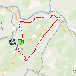
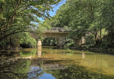
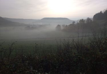
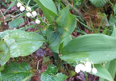
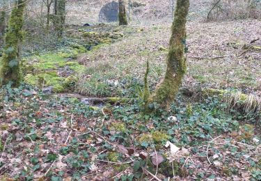
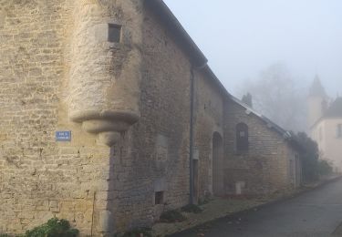
Trail Walking of 6.7 km to be discovered at Bourgogne-Franche-Comté, Doubs, Lizine. This trail is proposed by tracegps.
Description
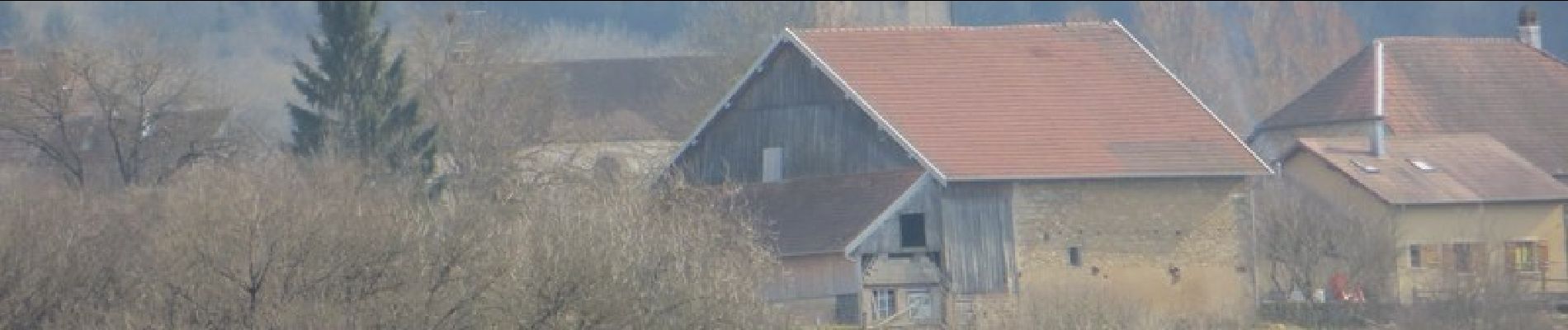
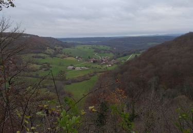
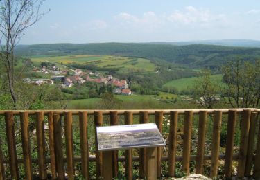
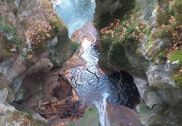
Départ du circuit vers le point info situé derrière l’église de Lizine. Itinéraire pédestre sans difficulté qui permet de visiter trois belvédères avec respectivement vue sur le ruisseau de Malans et la Loue pour le premier, vue sur la vallée de la Loue pour le second et vue sur la vallée du Lison pour le troisième. Le long du parcours, le sentier traverse des "lapiaz", roches calcaires creusées et modelées par les eaux de ruissellement et est bordé d’une végétation de type méditerranéen, ce qui est inhabituel pour la région.
Positioning
Comments
Trails nearby
![Trail Walking Échay - echay et ses belvédères - Photo](https://media.geolcdn.com/t/375/260/e9128b6b-1c37-4aeb-a422-222156e2fff2.jpg&format=jpg&maxdim=2)
![Walking Walking](https://static1.geolcdn.com/sitytour/trail-icons/101.png)
Walking
![](/images/other/stat-length.png)
![](https://static1.geolcdn.com/siteimages/upload/files/16400158638029165_repeat_loop_refresh_sync_direction_icon.png)
![Trail Walking Cussey-sur-Lison - Les Belvédères du Lison - Doubs - Photo](https://media.geolcdn.com/t/375/260/ext.jpg?maxdim=2&url=https%3A%2F%2Fservices.sitytrail.com%2FGeolivesWS%2FDownloadMedia.ashx%3FTrailID%3D108921%26Media%3D2612_1.jpg)
![Walking Walking](https://static1.geolcdn.com/sitytour/trail-icons/101.png)
Walking
![](/images/other/stat-length.png)
![](https://static1.geolcdn.com/siteimages/upload/files/16400158638029165_repeat_loop_refresh_sync_direction_icon.png)
![Trail Walking Cléron - Cléron et 2 de ses ravins - Photo](https://media.geolcdn.com/t/375/260/ext.jpg?maxdim=2&url=https%3A%2F%2Fstatic1.geolcdn.com%2Fsiteimages%2Fupload%2Ffiles%2F1553511878bg_sport_marche.png)
![Walking Walking](https://static1.geolcdn.com/sitytour/trail-icons/101.png)
Walking
![](/images/other/stat-length.png)
![](https://static1.geolcdn.com/siteimages/upload/files/16400158638029165_repeat_loop_refresh_sync_direction_icon.png)
![Trail On foot Éternoz - Tour du Monniot - Photo](https://media.geolcdn.com/t/375/260/4f40bb2a-64fb-41b5-a821-5ab6a4ea7106.jpeg&format=jpg&maxdim=2)
![On foot On foot](https://static1.geolcdn.com/sitytour/trail-icons/100.png)
On foot
![](/images/other/stat-length.png)
![](https://static1.geolcdn.com/siteimages/upload/files/16400158638029165_repeat_loop_refresh_sync_direction_icon.png)
![Trail Walking Malans - bon an Malans - Photo](https://media.geolcdn.com/t/375/260/c8493cd4-41d2-4726-8c11-d8d25395d3a6.jpg&format=jpg&maxdim=2)
![Walking Walking](https://static1.geolcdn.com/sitytour/trail-icons/101.png)
Walking
![](/images/other/stat-length.png)
![](https://static1.geolcdn.com/siteimages/upload/files/16400158638029165_repeat_loop_refresh_sync_direction_icon.png)
![Trail Walking Lizine - lizine croix et lison - Photo](https://media.geolcdn.com/t/375/260/89ebaf4b-099d-4372-ae6f-6f2d43eb6248.jpg&format=jpg&maxdim=2)
![Walking Walking](https://static1.geolcdn.com/sitytour/trail-icons/101.png)
Walking
![](/images/other/stat-length.png)
![](https://static1.geolcdn.com/siteimages/upload/files/16400158638029165_repeat_loop_refresh_sync_direction_icon.png)
![Trail Walking Myon - myon les lunettes à Stéphane - Photo](https://media.geolcdn.com/t/375/260/25acafcd-fd37-4522-a9e0-f3895665c873.jpg&format=jpg&maxdim=2)
![Walking Walking](https://static1.geolcdn.com/sitytour/trail-icons/101.png)
Walking
![](/images/other/stat-length.png)
![](https://static1.geolcdn.com/siteimages/upload/files/16400158638029165_repeat_loop_refresh_sync_direction_icon.png)
![Trail Walking Amondans - Amondans - Photo](https://media.geolcdn.com/t/375/260/4d00c8d3-fdc4-49de-aa75-bde7a160856b.jpg&format=jpg&maxdim=2)
![Walking Walking](https://static1.geolcdn.com/sitytour/trail-icons/101.png)
Walking
![](/images/other/stat-length.png)
![](https://static1.geolcdn.com/siteimages/upload/files/16400158638029165_repeat_loop_refresh_sync_direction_icon.png)
![Trail Walking Myon - Myon le gour de conche - Photo](https://media.geolcdn.com/t/375/260/828466b3-4a5a-411c-b191-55f6e34400fe.jpg&format=jpg&maxdim=2)
![Walking Walking](https://static1.geolcdn.com/sitytour/trail-icons/101.png)
Walking
![](/images/other/stat-length.png)
![](https://static1.geolcdn.com/siteimages/upload/files/16400158638029165_repeat_loop_refresh_sync_direction_icon.png)