![](/images/other/stat-length.png)
![Trail Snowshoes Haut Valromey - Plan d'Hotonnes - GTJ - Photo](https://media.geolcdn.com/t/1900/400/ext.pjpeg?maxdim=2&url=https%3A%2F%2Fservices.sitytrail.com%2FGeolivesWS%2FDownloadMedia.ashx%3FTrailID%3D317659%26Media%3D16945_4.jpg)
Plan d'Hotonnes - GTJ
tracegps
User
![Length](/images/other/stat-length.png)
![Max alt](https://static1.geolcdn.com/siteimages/upload/files/1508320355ic_sort_altitude_max_24dp.png)
![Uphill gradient](https://static1.geolcdn.com/siteimages/upload/files/1508320355ic_sort_den_pos_24dp.png)
![Km-Effort](/images/other/stat-length.png)
![Min alt](https://static1.geolcdn.com/siteimages/upload/files/1508320355ic_sort_altitude_min_24dp.png)
![Downhill gradient](https://static1.geolcdn.com/siteimages/upload/files/1508320355ic_sort_den_neg_24dp.png)
![Boucle](https://static1.geolcdn.com/siteimages/upload/files/16400158638029165_repeat_loop_refresh_sync_direction_icon.png)
![Snowshoes](https://static1.geolcdn.com/sitytour/trail-icons/504.png)
4h00
Difficulty : Medium
![Scan this QR Code to open this trail in the SityTrail application](https://capi.geolives.com/qq0zvz2zws4bq2lad0pu/sitytour/trails/317659/qr.png?size=200)
FREE GPS app for hiking
About
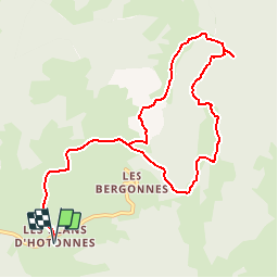
Trail Snowshoes of 10.7 km to be discovered at Auvergne-Rhône-Alpes, Ain, Haut Valromey. This trail is proposed by tracegps.
Description
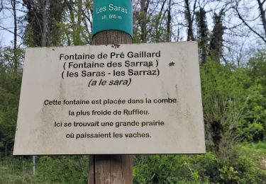
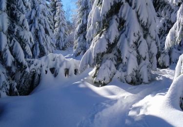
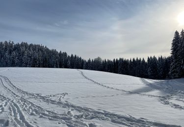
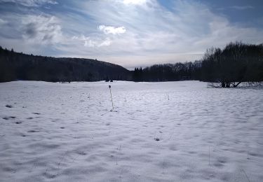
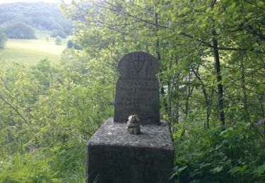
On commence ici par le circuit R4, pour rejoindre par la GTJ (Grande Traversée du Jura), le point de vue Beauregard, où la vue est imprenable sur le Mont Blanc. Attention, le balisage est parfois étrange, les 3 semblent par moment avoir remplacé les 4!! Le circuit 4 finit normalement ici, avec une petite boucle. Nous avons poursuivi jusqu'au Crêt du Nü, en passant l'Angoulot. Ce parcours suit en fait la GTJ. De là, ce tracé coupe à travers champ, pour rejoindre le circuit 5, en noir sur le plan de la station. Balade assez simple, pas de grand dénivelé, pas de grosse côte. Crédit photos : Wombatkio.
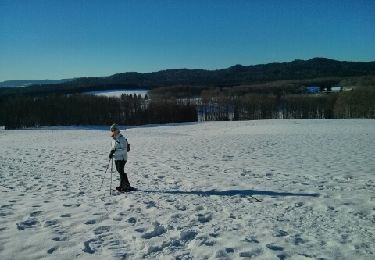
Positioning
Comments
Trails nearby
![Trail Snowshoes Haut Valromey - Raquette Lachat - Photo](https://media.geolcdn.com/t/375/260/ext.jpg?maxdim=2&url=https%3A%2F%2Fservices.sitytrail.com%2FGeolivesWS%2FDownloadMedia.ashx%3FTrailID%3D236206%26Media%3Dfix__20131207144617.jpg)
![Snowshoes Snowshoes](https://static1.geolcdn.com/sitytour/trail-icons/504.png)
Snowshoes
![](/images/other/stat-length.png)
![](https://static1.geolcdn.com/siteimages/upload/files/16400158638029165_repeat_loop_refresh_sync_direction_icon.png)
![Trail Mountain bike Haut Valromey - Espace VTT FFC du Bugey - Circuit n° 16 - Les Plans d'Hotonnes - Photo](https://media.geolcdn.com/t/375/260/ext.jpg?maxdim=2&url=https%3A%2F%2Fservices.sitytrail.com%2FGeolivesWS%2FDownloadMedia.ashx%3FTrailID%3D104583%26Media%3D7976_2.jpg)
![Mountain bike Mountain bike](https://static1.geolcdn.com/sitytour/trail-icons/202.png)
Mountain bike
![](/images/other/stat-length.png)
![](https://static1.geolcdn.com/siteimages/upload/files/16400158638029165_repeat_loop_refresh_sync_direction_icon.png)
![Trail Mountain bike Haut Valromey - Espace VTT FFC du Bugey - Circuit n° 15 - Les Plans d'Hotonnes - Photo](https://media.geolcdn.com/t/375/260/ext.jpg?maxdim=2&url=https%3A%2F%2Fservices.sitytrail.com%2FGeolivesWS%2FDownloadMedia.ashx%3FTrailID%3D104582%26Media%3D7975_2.jpg)
![Mountain bike Mountain bike](https://static1.geolcdn.com/sitytour/trail-icons/202.png)
Mountain bike
![](/images/other/stat-length.png)
![](https://static1.geolcdn.com/siteimages/upload/files/16400158638029165_repeat_loop_refresh_sync_direction_icon.png)
![Trail Walking Haut Valromey - ruffieu rando des bacs quinzaine - Photo](https://media.geolcdn.com/t/375/260/93f72b2e-107d-4804-b247-5a039ed04bc7.jpg&format=jpg&maxdim=2)
![Walking Walking](https://static1.geolcdn.com/sitytour/trail-icons/101.png)
Walking
![](/images/other/stat-length.png)
![](https://static1.geolcdn.com/siteimages/upload/files/16400158638029165_repeat_loop_refresh_sync_direction_icon.png)
![Trail Walking Haut Valromey - ruffieu - Photo](https://media.geolcdn.com/t/375/260/4aa3215c-fce5-444e-bf0f-05a1c758a68b.jpg&format=jpg&maxdim=2)
![Walking Walking](https://static1.geolcdn.com/sitytour/trail-icons/101.png)
Walking
![](/images/other/stat-length.png)
![](https://static1.geolcdn.com/siteimages/upload/files/16400158638029165_repeat_loop_refresh_sync_direction_icon.png)
![Trail Walking Haut Valromey - les bergonnes - Photo](https://media.geolcdn.com/t/375/260/30ef9d6e-c676-4c75-85f1-229cde789ed6.jpg&format=jpg&maxdim=2)
![Walking Walking](https://static1.geolcdn.com/sitytour/trail-icons/101.png)
Walking
![](/images/other/stat-length.png)
![](https://static1.geolcdn.com/siteimages/upload/files/16400158638029165_repeat_loop_refresh_sync_direction_icon.png)
![Trail Walking Haut Valromey - Lachat - Photo](https://media.geolcdn.com/t/375/260/2f2ca98f-bf84-48d1-89c1-5c200f3b27a3.jpg&format=jpg&maxdim=2)
![Walking Walking](https://static1.geolcdn.com/sitytour/trail-icons/101.png)
Walking
![](/images/other/stat-length.png)
![](https://static1.geolcdn.com/siteimages/upload/files/16400158638029165_repeat_loop_refresh_sync_direction_icon.png)
![Trail Walking Haut Valromey - les plans d automne - Photo](https://media.geolcdn.com/t/375/260/1ebfbaec-6f18-4c15-8873-bb95cf2a4c5d.jpg&format=jpg&maxdim=2)
![Walking Walking](https://static1.geolcdn.com/sitytour/trail-icons/101.png)
Walking
![](/images/other/stat-length.png)
![](https://static1.geolcdn.com/siteimages/upload/files/16400158638029165_repeat_loop_refresh_sync_direction_icon.png)
![Trail Walking Chanay - Le Colombier - Photo](https://media.geolcdn.com/t/375/260/ext.jpg?maxdim=2&url=https%3A%2F%2Fservices.sitytrail.com%2FGeolivesWS%2FDownloadMedia.ashx%3FTrailID%3D308118%26Media%3Dfix__20140601172716.jpg)
![Walking Walking](https://static1.geolcdn.com/sitytour/trail-icons/101.png)
Walking
![](/images/other/stat-length.png)
![](https://static1.geolcdn.com/siteimages/upload/files/16400158638029165_repeat_loop_refresh_sync_direction_icon.png)