![](/images/other/stat-length.png)
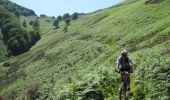
![Trail Mountain bike Urepel - Le Sentier des Contrebandiers en VTT - De Urepel à St Etienne de Baïgorry - Photo](https://media.geolcdn.com/t/1900/400/ext.pjpeg?maxdim=2&url=https%3A%2F%2Fservices.sitytrail.com%2FGeolivesWS%2FDownloadMedia.ashx%3FTrailID%3D317579%26Media%3D16839_1.jpg)
Le Sentier des Contrebandiers en VTT - De Urepel à St Etienne de Baïgorry
tracegps
User
![Length](/images/other/stat-length.png)
![Max alt](https://static1.geolcdn.com/siteimages/upload/files/1508320355ic_sort_altitude_max_24dp.png)
![Uphill gradient](https://static1.geolcdn.com/siteimages/upload/files/1508320355ic_sort_den_pos_24dp.png)
![Km-Effort](/images/other/stat-length.png)
![Min alt](https://static1.geolcdn.com/siteimages/upload/files/1508320355ic_sort_altitude_min_24dp.png)
![Downhill gradient](https://static1.geolcdn.com/siteimages/upload/files/1508320355ic_sort_den_neg_24dp.png)
![Boucle](https://static1.geolcdn.com/siteimages/upload/files/16400158638029165_repeat_loop_refresh_sync_direction_icon.png)
![Mountain bike](https://static1.geolcdn.com/sitytour/trail-icons/202.png)
6h00
Difficulty : Difficult
![Scan this QR Code to open this trail in the SityTrail application](https://capi.geolives.com/qq0zvz2zws4bq2lad0pu/sitytour/trails/317579/qr.png?size=200)
FREE GPS app for hiking
About
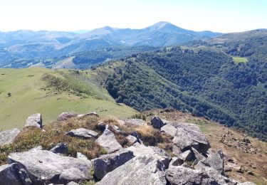
Trail Mountain bike of 34 km to be discovered at New Aquitaine, Pyrénées-Atlantiques, Urepel. This trail is proposed by tracegps.
Description
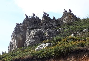
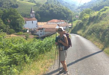
Parcours de grande envergure, composé de deux itinéraires très intéressants pour le VTT et un passage de liaison entre les deux, frustrant, car après de rudes montées et quelques beaux passages cependant, on s’attend à une belle descente, mais non, c’est le goudron ! Du col d’Elhorrieta, une petite descente emmène au pied d’un sentier où la poussée du vélo est nécessaire. Après un petit collet, très beau VTT, mais attention quand même, parfois, mieux vaut ne pas tomber. Enfin, depuis le col d Ispegi, le monotrace est fantastique, mais à ne pas mettre en toutes les mains car certains passages sont assez expos. Plus de détail sur le Sentier des Contrebandiers en VTT .
Positioning
Comments
Trails nearby
![Trail Walking Erro - ARGINTZU - KINTOA BORDA DEPUIS URKIAGA - Photo](https://media.geolcdn.com/t/375/260/f32fccbe-17d6-4372-ae93-4e8154972100.jpg&format=jpg&maxdim=2)
![Walking Walking](https://static1.geolcdn.com/sitytour/trail-icons/101.png)
Walking
![](/images/other/stat-length.png)
![](https://static1.geolcdn.com/siteimages/upload/files/16400158638029165_repeat_loop_refresh_sync_direction_icon.png)
![Trail On foot Urepel - Urepelbide zaharra / Antiguo Camino Urepel - Photo](https://media.geolcdn.com/t/375/260/7d38e3e5-c509-40d9-8bd5-3cb071032eed.jpeg&format=jpg&maxdim=2)
![On foot On foot](https://static1.geolcdn.com/sitytour/trail-icons/100.png)
On foot
![](/images/other/stat-length.png)
![](https://static1.geolcdn.com/siteimages/upload/files/16400158638029165_repeat_loop_refresh_sync_direction_icon.png)
![Trail Walking Urepel - urepel - Photo](https://media.geolcdn.com/t/375/260/34f4b20f-4218-4dc9-93c7-30b06ac568ca.jpg&format=jpg&maxdim=2)
![Walking Walking](https://static1.geolcdn.com/sitytour/trail-icons/101.png)
Walking
![](/images/other/stat-length.png)
![](https://static1.geolcdn.com/siteimages/upload/files/16400158638029165_repeat_loop_refresh_sync_direction_icon.png)
![Trail Walking Aldudes - Aldudes-Argibel - Photo](https://media.geolcdn.com/t/375/260/4f9773da-8c83-45eb-8f57-44f7bebf7df6.jpg&format=jpg&maxdim=2)
![Walking Walking](https://static1.geolcdn.com/sitytour/trail-icons/101.png)
Walking
![](/images/other/stat-length.png)
![](https://static1.geolcdn.com/siteimages/upload/files/16400158638029165_repeat_loop_refresh_sync_direction_icon.png)
![Trail Walking Urepel - Les aldudes urepel - Photo](https://media.geolcdn.com/t/375/260/bcaea539-9d72-42d9-b38f-2917d47505c5.jpg&format=jpg&maxdim=2)
![Walking Walking](https://static1.geolcdn.com/sitytour/trail-icons/101.png)
Walking
![](/images/other/stat-length.png)
![](https://static1.geolcdn.com/siteimages/upload/files/16400158638029165_repeat_loop_refresh_sync_direction_icon.png)
![Trail Walking Aldudes - les Aldudes sentier des crêtes - Photo](https://media.geolcdn.com/t/375/260/38805aca-4424-480e-aee8-63b621fd698a.jpg&format=jpg&maxdim=2)
![Walking Walking](https://static1.geolcdn.com/sitytour/trail-icons/101.png)
Walking
![](/images/other/stat-length.png)
![](https://static1.geolcdn.com/siteimages/upload/files/16400158638029165_repeat_loop_refresh_sync_direction_icon.png)
![Walking Walking](https://static1.geolcdn.com/sitytour/trail-icons/101.png)
Walking
![](/images/other/stat-length.png)
![](https://static1.geolcdn.com/siteimages/upload/files/16400158638029165_repeat_loop_refresh_sync_direction_icon.png)
![Trail Equestrian Urepel - Sentier des Contrebandiers - de Urepel au col d'Elhorrieta au Pays Basque - Photo](https://media.geolcdn.com/t/375/260/ext.jpg?maxdim=2&url=https%3A%2F%2Fservices.sitytrail.com%2FGeolivesWS%2FDownloadMedia.ashx%3FTrailID%3D317110%26Media%3D16263_2.jpg)
![Equestrian Equestrian](https://static1.geolcdn.com/sitytour/trail-icons/300.png)
Equestrian
![](/images/other/stat-length.png)
![](https://static1.geolcdn.com/siteimages/upload/files/16400158638029165_repeat_loop_refresh_sync_direction_icon.png)
![Trail Mountain bike Aldudes - Traversée Pyrénées 2005 Etape 2 - Photo](https://media.geolcdn.com/t/375/260/ext.jpg?maxdim=2&url=https%3A%2F%2Fservices.sitytrail.com%2FGeolivesWS%2FDownloadMedia.ashx%3FTrailID%3D101314%26Media%3D809_2.jpg)
![Mountain bike Mountain bike](https://static1.geolcdn.com/sitytour/trail-icons/202.png)
Mountain bike
![](/images/other/stat-length.png)
![](https://static1.geolcdn.com/siteimages/upload/files/16400158638029165_repeat_loop_refresh_sync_direction_icon.png)