


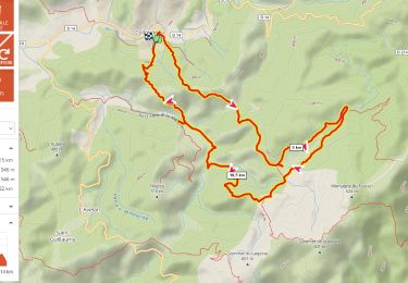
14.4 km | 21 km-effort

User


FREE GPS app for hiking
 SityTrail
IGN / Geographical institutes
SityTrail World
The world is yours!
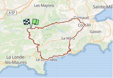
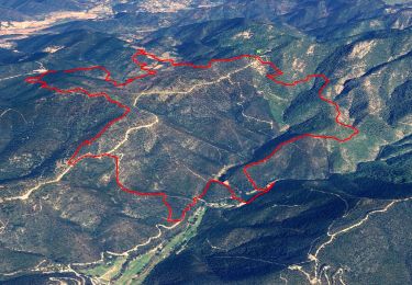
Trail Cycle of 80 km to be discovered at Provence-Alpes-Côte d'Azur, Var, Collobrières. This trail is proposed by tracegps.
Une jolie boucle pour découvrir les Maures et le littoral varois. A faire au printemps ou en automne, avec 1200 m de dénivelé total sur plusieurs ascensions. Routes assez tranquilles dans l'ensemble avec peu de voitures.


Walking
Walking

Walking

Mountain bike
Walking
Walking
Walking
Walking
Walking