![](/images/other/stat-length.png)
![Trail Other activity Gueutteville-les-Grès - Pays du grés - Gueutteville les Grès - Photo](https://media.geolcdn.com/t/1900/400/ext.pjpeg?maxdim=2&url=https%3A%2F%2Fservices.sitytrail.com%2FGeolivesWS%2FDownloadMedia.ashx%3FTrailID%3D317360%26Media%3D16579_3.jpg)
Pays du grés - Gueutteville les Grès
tracegps
User
![Length](/images/other/stat-length.png)
Length
12.4 km
![Max alt](https://static1.geolcdn.com/siteimages/upload/files/1508320355ic_sort_altitude_max_24dp.png)
Max alt
87 m
![Uphill gradient](https://static1.geolcdn.com/siteimages/upload/files/1508320355ic_sort_den_pos_24dp.png)
Uphill gradient
100 m
![Km-Effort](/images/other/stat-length.png)
Km-Effort
13.7 km
![Min alt](https://static1.geolcdn.com/siteimages/upload/files/1508320355ic_sort_altitude_min_24dp.png)
Min alt
46 m
![Downhill gradient](https://static1.geolcdn.com/siteimages/upload/files/1508320355ic_sort_den_neg_24dp.png)
Downhill gradient
98 m
![Boucle](https://static1.geolcdn.com/siteimages/upload/files/16400158638029165_repeat_loop_refresh_sync_direction_icon.png)
Boucle
Yes
Creation date :
2014-12-10 00:00:00.0
Updated on :
2014-12-10 00:00:00.0
![Other activity](https://static1.geolcdn.com/sitytour/trail-icons/900.png)
1h30
Difficulty : Difficult
![Scan this QR Code to open this trail in the SityTrail application](https://capi.geolives.com/qq0zvz2zws4bq2lad0pu/sitytour/trails/317360/qr.png?size=200)
FREE GPS app for hiking
About
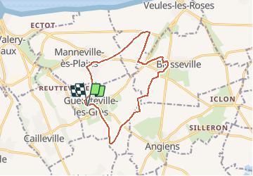
Trail Other activity of 12.4 km to be discovered at Normandy, Seine-Maritime, Gueutteville-les-Grès. This trail is proposed by tracegps.
Description
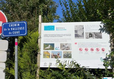
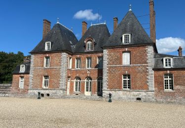
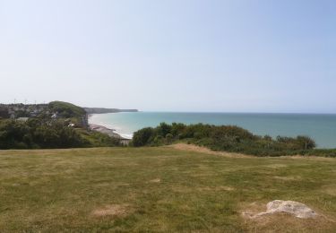
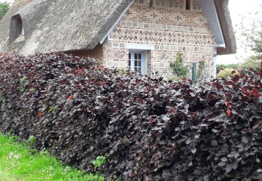
Pittoresques villages cauchois où le grès domine dans les constructions. Paysages de plateaux. Le circuit, au départ de l'église, n'offre pas de difficultés, se méfier du balisage.
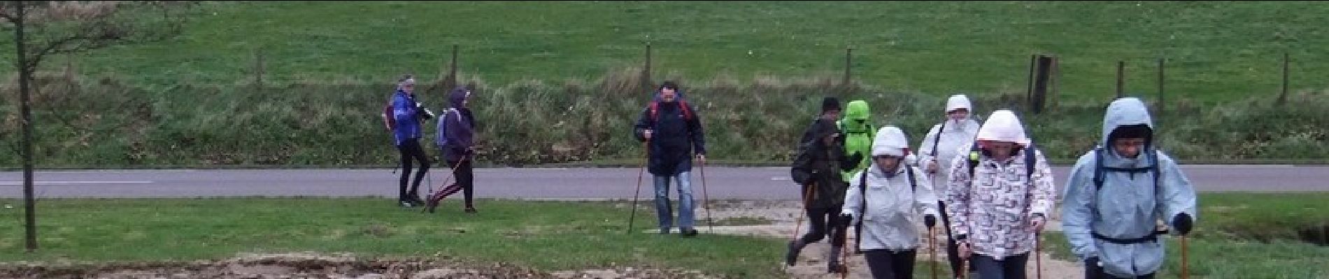
Positioning
Country:
France
Region :
Normandy
Department/Province :
Seine-Maritime
Municipality :
Gueutteville-les-Grès
Location:
Unknown
Start:(Dec)
Start:(UTM)
338553 ; 5523311 (31U) N.
Comments
Trails nearby
![Trail Walking Veules-les-Roses - Circuit du plus petit Fleuve de France - Veules Les Roses - Photo](https://media.geolcdn.com/t/375/260/ext.jpg?maxdim=2&url=https%3A%2F%2Fservices.sitytrail.com%2FGeolivesWS%2FDownloadMedia.ashx%3FTrailID%3D172676%26Media%3D14059_2.jpg)
![Walking Walking](https://static1.geolcdn.com/sitytour/trail-icons/101.png)
Circuit du plus petit Fleuve de France - Veules Les Roses
Walking
Easy
(4)
Veules-les-Roses,
Normandy,
Seine-Maritime,
France
![](/images/other/stat-length.png)
4 km | 5.3 km-effort
1h 30min
![](https://static1.geolcdn.com/siteimages/upload/files/16400158638029165_repeat_loop_refresh_sync_direction_icon.png)
Yes
![Trail Walking Veules-les-Roses - Circuit du plus petit Fleuve de France – Veules Les Roses - Photo](https://media.geolcdn.com/t/375/260/ext.jpg?maxdim=2&url=https%3A%2F%2Fservices.sitytrail.com%2FGeolivesWS%2FDownloadMedia.ashx%3FTrailID%3D155303%26Media%3D4c344425-a5c2-4255-8220-3432dbd8805b.JPG)
![Walking Walking](https://static1.geolcdn.com/sitytour/trail-icons/101.png)
Circuit du plus petit Fleuve de France – Veules Les Roses
Walking
Very easy
(2)
Veules-les-Roses,
Normandy,
Seine-Maritime,
France
![](/images/other/stat-length.png)
4 km | 5.3 km-effort
1h 30min
![](https://static1.geolcdn.com/siteimages/upload/files/16400158638029165_repeat_loop_refresh_sync_direction_icon.png)
Yes
![Trail Road bike Saint-Valery-en-Caux - Sainte Marie La Flotte retour - Photo](https://media.geolcdn.com/t/375/260/c953ac11-fd11-47b9-9f84-6149c27e4f08.jpg&format=jpg&maxdim=2)
![Road bike Road bike](https://static1.geolcdn.com/sitytour/trail-icons/201.png)
Sainte Marie La Flotte retour
Road bike
Easy
Saint-Valery-en-Caux,
Normandy,
Seine-Maritime,
France
![](/images/other/stat-length.png)
554 km | 638 km-effort
2h 38min
![](https://static1.geolcdn.com/siteimages/upload/files/16400158638029165_repeat_loop_refresh_sync_direction_icon.png)
No
![Trail Road bike Ocqueville - Les grandes dalles - Photo](https://media.geolcdn.com/t/375/260/ef7ef045-acb3-4d2f-85c0-a2e87799d551.jpg&format=jpg&maxdim=2)
![Road bike Road bike](https://static1.geolcdn.com/sitytour/trail-icons/201.png)
Les grandes dalles
Road bike
Medium
Ocqueville,
Normandy,
Seine-Maritime,
France
![](/images/other/stat-length.png)
63 km | 70 km-effort
4h 16min
![](https://static1.geolcdn.com/siteimages/upload/files/16400158638029165_repeat_loop_refresh_sync_direction_icon.png)
Yes
![Trail Walking Saint-Valery-en-Caux - boucle de st valery en cause à veules et retour par la plage - Photo](https://media.geolcdn.com/t/375/260/1b47ad71-45e2-413b-af01-56a4ea59949a.jpg&format=jpg&maxdim=2)
![Walking Walking](https://static1.geolcdn.com/sitytour/trail-icons/101.png)
boucle de st valery en cause à veules et retour par la plage
Walking
Very difficult
Saint-Valery-en-Caux,
Normandy,
Seine-Maritime,
France
![](/images/other/stat-length.png)
18.4 km | 21 km-effort
4h 40min
![](https://static1.geolcdn.com/siteimages/upload/files/16400158638029165_repeat_loop_refresh_sync_direction_icon.png)
No
![Trail Walking Ermenouville - Ermenouvillle - Le Mesnil Geoffroy - Photo](https://media.geolcdn.com/t/375/260/5bb1fe76-5828-4c00-8543-c120e4c71a2a.jpg&format=jpg&maxdim=2)
![Walking Walking](https://static1.geolcdn.com/sitytour/trail-icons/101.png)
Ermenouvillle - Le Mesnil Geoffroy
Walking
Very easy
Ermenouville,
Normandy,
Seine-Maritime,
France
![](/images/other/stat-length.png)
15.3 km | 17.2 km-effort
5h 26min
![](https://static1.geolcdn.com/siteimages/upload/files/16400158638029165_repeat_loop_refresh_sync_direction_icon.png)
Yes
![Trail Walking Veules-les-Roses - Balade à Veules les Roses - Photo](https://media.geolcdn.com/t/375/260/1920cf90-1057-4f37-90a3-d3e91d6cd23d.jpg&format=jpg&maxdim=2)
![Walking Walking](https://static1.geolcdn.com/sitytour/trail-icons/101.png)
Balade à Veules les Roses
Walking
Very easy
Veules-les-Roses,
Normandy,
Seine-Maritime,
France
![](/images/other/stat-length.png)
3.8 km | 4.9 km-effort
1h 56min
![](https://static1.geolcdn.com/siteimages/upload/files/16400158638029165_repeat_loop_refresh_sync_direction_icon.png)
Yes
![Trail Walking Ermenouville - Ermenouville . Château de Mesnil-Geoffroy - Photo](https://media.geolcdn.com/t/375/260/7a0d7ca8-1cee-4dbe-ad74-2fd526e4e0b8.jpg&format=jpg&maxdim=2)
![Walking Walking](https://static1.geolcdn.com/sitytour/trail-icons/101.png)
Ermenouville . Château de Mesnil-Geoffroy
Walking
Very easy
Ermenouville,
Normandy,
Seine-Maritime,
France
![](/images/other/stat-length.png)
13.4 km | 0 m-effort
3h 56min
![](https://static1.geolcdn.com/siteimages/upload/files/16400158638029165_repeat_loop_refresh_sync_direction_icon.png)
No
![Trail Other activity Le Mesnil-Durdent - Les Amouhoques - Le Mesmil-Durdent - Photo](https://media.geolcdn.com/t/375/260/ext.jpg?maxdim=2&url=https%3A%2F%2Fservices.sitytrail.com%2FGeolivesWS%2FDownloadMedia.ashx%3FTrailID%3D317494%26Media%3D16728_5.jpg)
![Other activity Other activity](https://static1.geolcdn.com/sitytour/trail-icons/900.png)
Les Amouhoques - Le Mesmil-Durdent
Other activity
Difficult
Le Mesnil-Durdent,
Normandy,
Seine-Maritime,
France
![](/images/other/stat-length.png)
18.9 km | 22 km-effort
2h 0min
![](https://static1.geolcdn.com/siteimages/upload/files/16400158638029165_repeat_loop_refresh_sync_direction_icon.png)
Yes