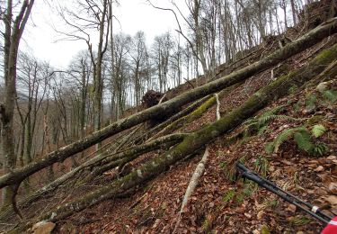
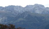
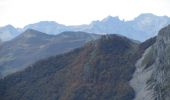
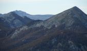
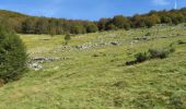
Trail Walking Asson - Le Pic du Monbula - Arthez d'Asson - Photo

Le Pic du Monbula - Arthez d'Asson

 tracegps
tracegps

User

© OpenStreetMap contributors
Length
Length
11.3 km
Max alt
Max alt
1583 m
Uphill gradient
Uphill gradient
1129 m
Km-Effort
Km-Effort  
26 km
Min alt
Min alt
461 m
Downhill gradient
Downhill gradient
1129 m
Boucle
Boucle
Yes
Creation date :
2014-12-10 00:00:00.0
Updated on :
2014-12-10 00:00:00.0

(0 Reviews)

Walking
Walking
6h30
Difficulty : Difficult

Scan this QR Code to open this trail in the SityTrail application

FREE GPS app for hiking

Logo SityTrail SityTrail
IGN / Geographical institutes

Download SityTrail from the App Store Download SityTrail from Google Play

Logo SityTrail SityTrail World

The world is yours!

Download SityTrail from the App Store Download SityTrail from Google Play Download SityTrail on Huawei AppGallery

About

Trail Walking of 11.3 km to be discovered at New Aquitaine, Pyrénées-Atlantiques, Asson. This trail is proposed by tracegps.

Description

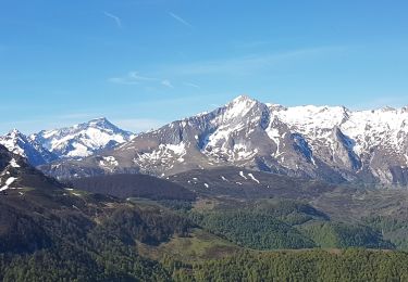
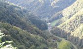
Départ sur la D126, 6km après Arthez-d'Asson en direction de Ferrières. Cela monte d'entrée pour aboutir dans un premier temps au Col d'Arangou. Puis on bifurque plein Est vers le plateau du Monbula pour attaquer ensuite la montée finale vers le Pic d'où le panorama est assez époustouflant. Descente par une variante jusqu'au plateau puis suivre le chemin de la montée et retrouver le parking.

Elevation profile

Photos

Positioning

Country:
France
Region :
New Aquitaine
Department/Province :
Pyrénées-Atlantiques
Municipality :
Asson
Location:
Unknown
Start:(UTM)
723192 ; 4768782 (30T) N.

Trails nearby

Trail On foot Arbéost - SityTrail - Arbeost le tour des quartiers d'Arbeost fait - Photo
On foot
GUIDE
marmotte65

On foot

Easy
(1)
Arbéost, Occitania, Hautespyrenees, France
6.7 km | 12.3 km-effort
Unknown
Yes
Trail Walking Arbéost - Ferrière  - Photo
Walking
pffrench

Walking

Very easy
Arbéost, Occitania, Hautespyrenees, France
3.4 km | 5.7 km-effort
2h 1min
Yes
Trail Walking Arbéost - G3arbeost le tour fait 2022 - Photo
Walking
LouisROGER

Walking

Very difficult
Arbéost, Occitania, Hautespyrenees, France
7.1 km | 12.5 km-effort
4h 48min
Yes
Trail Walking Ferrières - FERRIERES  la mine de Baburet   295 0542 - Photo
Walking
GUIDE
marmotte65

Walking

Easy
Ferrières, Occitania, Hautespyrenees, France
2.8 km | 4.8 km-effort
1h 2min
Yes
Trail Walking Louvie-Juzon - Pic du Pas de Broc (1371m) et pic du Merdanson (1540m) - Photo
Walking
eric.mignot

Walking

Very difficult
Louvie-Juzon, New Aquitaine, Pyrénées-Atlantiques, France
13.6 km | 28 km-effort
6h 16min
Yes
Trail Walking Aucun - pic d'estibet  - Photo
Walking
Patlac3

Walking

Difficult
Aucun, Occitania, Hautespyrenees, France
6.4 km | 13.3 km-effort
3h 35min
Yes
Trail On foot Ferrières - Circuit des mines de Baburet modifié - Photo
On foot
GUIDE
marmotte65

On foot

Medium
Ferrières, Occitania, Hautespyrenees, France
2.9 km | 4.9 km-effort
Unknown
Yes
Trail Walking Ferrières - granquet - Photo
Walking
dakar_88

Walking

Very easy
Ferrières, Occitania, Hautespyrenees, France
9.1 km | 17.9 km-effort
6h 20min
Yes
Trail Walking Arbéost - Arbeost le tour des quartiers d'Arbeost fait - Photo
Walking

Walking

Easy
Arbéost, Occitania, Hautespyrenees, France
7.5 km | 13.3 km-effort
3h 19min
Yes


Close
My subscriptions