![](/images/other/stat-length.png)
![Trail Equestrian Ostabat-Asme - Sentier des Contrebandiers - de Ostabat à Lasse au Pays Basque - Photo](https://media.geolcdn.com/t/1900/400/ext.pjpeg?maxdim=2&url=https%3A%2F%2Fservices.sitytrail.com%2FGeolivesWS%2FDownloadMedia.ashx%3FTrailID%3D317107%26Media%3D16257_2.jpg)
Sentier des Contrebandiers - de Ostabat à Lasse au Pays Basque
tracegps
User
![Length](/images/other/stat-length.png)
![Max alt](https://static1.geolcdn.com/siteimages/upload/files/1508320355ic_sort_altitude_max_24dp.png)
![Uphill gradient](https://static1.geolcdn.com/siteimages/upload/files/1508320355ic_sort_den_pos_24dp.png)
![Km-Effort](/images/other/stat-length.png)
![Min alt](https://static1.geolcdn.com/siteimages/upload/files/1508320355ic_sort_altitude_min_24dp.png)
![Downhill gradient](https://static1.geolcdn.com/siteimages/upload/files/1508320355ic_sort_den_neg_24dp.png)
![Boucle](https://static1.geolcdn.com/siteimages/upload/files/16400158638029165_repeat_loop_refresh_sync_direction_icon.png)
![Equestrian](https://static1.geolcdn.com/sitytour/trail-icons/300.png)
7h00
Difficulty : Difficult
![Scan this QR Code to open this trail in the SityTrail application](https://capi.geolives.com/qq0zvz2zws4bq2lad0pu/sitytour/trails/317107/qr.png?size=200)
FREE GPS app for hiking
About
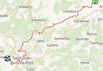
Trail Equestrian of 32 km to be discovered at New Aquitaine, Pyrénées-Atlantiques, Ostabat-Asme. This trail is proposed by tracegps.
Description
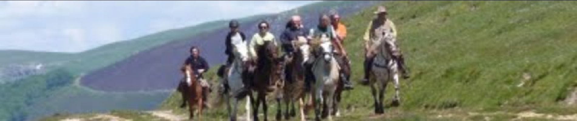
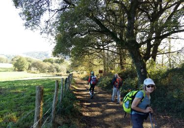
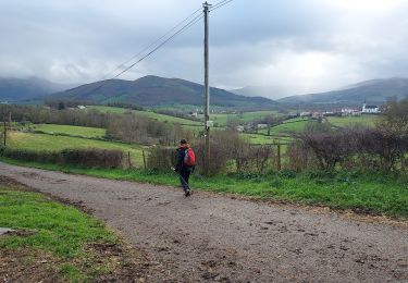
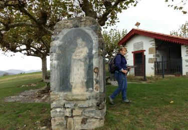
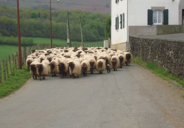
Trotter et galoper sur les flancs des monts dans les fougères, puis flâner sous les arbres au dessus de St Jean Pied de Port qu’il faudra traverser (circulation dense). Les chevaux avanceront assez vite sur cette étape... Imaginé il y a quelques années par plusieurs passionnés de l'ACTE (A Cheval Tous Ensemble), le sentier des contrebandiers est maintenant un itinéraire dont l'aménagement et le balisage sont assurés par le Conseil Général des Pyrénées-Atlantiques. 220 km d'aventures entre Saint-Palais et Biriatou (Hendaye) à travers la montagne basque, un itinéraire sauvage, réservé à des pratiquants chevronnés et entrainés, avec une cavalerie habituée à évoluer en montagne. En cas de doute sur votre niveau, l'idéal est de se mettre en relation avec le CDTE et l'ACTE afin de vous évaluer ! Des hébergements labellisés Cheval 64 vous accueillent à chaque étape afin d'assurer notamment l'accueil des chevaux dans de bonnes conditions. Crédits photos: ©CDT64
Positioning
Comments
Trails nearby
![Trail Walking Arhansus - Balade autour d'Arhansus - Photo](https://media.geolcdn.com/t/375/260/ext.jpg?maxdim=2&url=https%3A%2F%2Fservices.sitytrail.com%2FGeolivesWS%2FDownloadMedia.ashx%3FTrailID%3D111306%26Media%3D6955_1.jpg)
![Walking Walking](https://static1.geolcdn.com/sitytour/trail-icons/101.png)
Walking
![](/images/other/stat-length.png)
![](https://static1.geolcdn.com/siteimages/upload/files/16400158638029165_repeat_loop_refresh_sync_direction_icon.png)
![Trail Walking Uhart-Mixe - UHART MIXE journée présidents et animateurs](https://media.geolcdn.com/t/375/260/2708b30b-c90c-4afe-a2c3-fc4432d8dcc2.jpg&format=jpg&maxdim=2)
![Walking Walking](https://static1.geolcdn.com/sitytour/trail-icons/101.png)
Walking
![](/images/other/stat-length.png)
![](https://static1.geolcdn.com/siteimages/upload/files/16400158638029165_repeat_loop_refresh_sync_direction_icon.png)
![Trail Walking Ostabat-Asme - OSTABAT-ASME St Nicolas-Soyarze-Fntaine de la vierge G3](https://media.geolcdn.com/t/375/260/3d549841-31ce-4f5c-a0c8-5f78c7f7af4e.jpg&format=jpg&maxdim=2)
![Walking Walking](https://static1.geolcdn.com/sitytour/trail-icons/101.png)
Walking
![](/images/other/stat-length.png)
![](https://static1.geolcdn.com/siteimages/upload/files/16400158638029165_repeat_loop_refresh_sync_direction_icon.png)
![Trail Walking Uhart-Mixe - UHART-MIXE journée Presidents / animateurs](https://media.geolcdn.com/t/375/260/177f0667-f458-47f3-85ca-ac4813df1948.jpg&format=jpg&maxdim=2)
![Walking Walking](https://static1.geolcdn.com/sitytour/trail-icons/101.png)
Walking
![](/images/other/stat-length.png)
![](https://static1.geolcdn.com/siteimages/upload/files/16400158638029165_repeat_loop_refresh_sync_direction_icon.png)
![Trail Walking Uhart-Mixe - UHART MIXE reco Circuit Urbeltz journee](https://media.geolcdn.com/t/375/260/45c7355a-71af-4b7d-aa45-c050d457011b.jpg&format=jpg&maxdim=2)
![Walking Walking](https://static1.geolcdn.com/sitytour/trail-icons/101.png)
Walking
![](/images/other/stat-length.png)
![](https://static1.geolcdn.com/siteimages/upload/files/16400158638029165_repeat_loop_refresh_sync_direction_icon.png)
![Trail Walking Ostabat-Asme - G3 Ostabat 2023 - Photo](https://media.geolcdn.com/t/375/260/755261ed-3819-48f8-8d80-85c5c292cf75.jpg&format=jpg&maxdim=2)
![Walking Walking](https://static1.geolcdn.com/sitytour/trail-icons/101.png)
Walking
![](/images/other/stat-length.png)
![](https://static1.geolcdn.com/siteimages/upload/files/16400158638029165_repeat_loop_refresh_sync_direction_icon.png)
![Trail Walking Ostabat-Asme - OSTABAT G3 Chapelles St Nicolas et Soyarze reco](https://media.geolcdn.com/t/375/260/40cc9732-ad92-4c39-b129-bbdc47d5625e.jpg&format=jpg&maxdim=2)
![Walking Walking](https://static1.geolcdn.com/sitytour/trail-icons/101.png)
Walking
![](/images/other/stat-length.png)
![](https://static1.geolcdn.com/siteimages/upload/files/16400158638029165_repeat_loop_refresh_sync_direction_icon.png)
![Walking Walking](https://static1.geolcdn.com/sitytour/trail-icons/101.png)
Walking
![](/images/other/stat-length.png)
![](https://static1.geolcdn.com/siteimages/upload/files/16400158638029165_repeat_loop_refresh_sync_direction_icon.png)
![Trail Walking Ostabat-Asme - Ostabat et Haranbeltz - Photo](https://media.geolcdn.com/t/375/260/ext.jpg?maxdim=2&url=https%3A%2F%2Fservices.sitytrail.com%2FGeolivesWS%2FDownloadMedia.ashx%3FTrailID%3D333764%26Media%3D20140812113525.jpg)
![Walking Walking](https://static1.geolcdn.com/sitytour/trail-icons/101.png)
Walking
![](/images/other/stat-length.png)
![](https://static1.geolcdn.com/siteimages/upload/files/16400158638029165_repeat_loop_refresh_sync_direction_icon.png)