![](/images/other/stat-length.png)
![Trail Walking Feigneux - Vez en Automne - Feigneux - Photo](https://media.geolcdn.com/t/1900/400/ext.pjpeg?maxdim=2&url=https%3A%2F%2Fservices.sitytrail.com%2FGeolivesWS%2FDownloadMedia.ashx%3FTrailID%3D317010%26Media%3D16150_5.jpg)
Vez en Automne - Feigneux
tracegps
User
![Length](/images/other/stat-length.png)
Length
26 km
![Max alt](https://static1.geolcdn.com/siteimages/upload/files/1508320355ic_sort_altitude_max_24dp.png)
Max alt
176 m
![Uphill gradient](https://static1.geolcdn.com/siteimages/upload/files/1508320355ic_sort_den_pos_24dp.png)
Uphill gradient
459 m
![Km-Effort](/images/other/stat-length.png)
Km-Effort
32 km
![Min alt](https://static1.geolcdn.com/siteimages/upload/files/1508320355ic_sort_altitude_min_24dp.png)
Min alt
59 m
![Downhill gradient](https://static1.geolcdn.com/siteimages/upload/files/1508320355ic_sort_den_neg_24dp.png)
Downhill gradient
459 m
![Boucle](https://static1.geolcdn.com/siteimages/upload/files/16400158638029165_repeat_loop_refresh_sync_direction_icon.png)
Boucle
Yes
Creation date :
2014-12-10 00:00:00.0
Updated on :
2014-12-10 00:00:00.0
![Walking](https://static1.geolcdn.com/sitytour/trail-icons/101.png)
5h30
Difficulty : Difficult
![Scan this QR Code to open this trail in the SityTrail application](https://capi.geolives.com/qq0zvz2zws4bq2lad0pu/sitytour/trails/317010/qr.png?size=200)
FREE GPS app for hiking
About
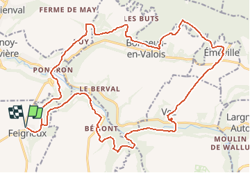
Trail Walking of 26 km to be discovered at Hauts-de-France, Oise, Feigneux. This trail is proposed by tracegps.
Description
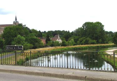
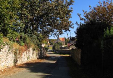
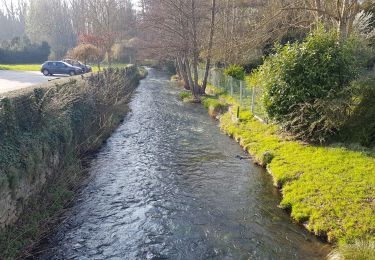
Départ de la mairie de Feigneux. Randonnée en zone souvent boisée, parfois humide le long des vallées. Les chemins sont très praticables. Le village de Vez mérite un détour. La partie sud du circuit se tient sur le GR11 et GR11B.
Positioning
Country:
France
Region :
Hauts-de-France
Department/Province :
Oise
Municipality :
Feigneux
Location:
Unknown
Start:(Dec)
Start:(UTM)
494972 ; 5456298 (31U) N.
Comments
Trails nearby
![Trail On foot Crépy-en-Valois - Boucle 24 km Crépy en Valois - Duvy - Trumily - Rocquemont - Photo](https://media.geolcdn.com/t/375/260/280ca2ce-af52-47b9-81c4-4fc64d53f4f3.jpg&format=jpg&maxdim=2)
![On foot On foot](https://static1.geolcdn.com/sitytour/trail-icons/100.png)
Boucle 24 km Crépy en Valois - Duvy - Trumily - Rocquemont
On foot
Medium
Crépy-en-Valois,
Hauts-de-France,
Oise,
France
![](/images/other/stat-length.png)
24 km | 27 km-effort
6h 14min
![](https://static1.geolcdn.com/siteimages/upload/files/16400158638029165_repeat_loop_refresh_sync_direction_icon.png)
Yes
![Trail On foot Morienval - Morienval- Crepy en Valois par la vallée de l'Automne - Photo](https://media.geolcdn.com/t/375/260/535655d5-fe74-49b4-b09d-122bf59c29ec.jpg&format=jpg&maxdim=2)
![On foot On foot](https://static1.geolcdn.com/sitytour/trail-icons/100.png)
Morienval- Crepy en Valois par la vallée de l'Automne
On foot
Difficult
Morienval,
Hauts-de-France,
Oise,
France
![](/images/other/stat-length.png)
28 km | 35 km-effort
7h 56min
![](https://static1.geolcdn.com/siteimages/upload/files/16400158638029165_repeat_loop_refresh_sync_direction_icon.png)
No
![On foot On foot](https://static1.geolcdn.com/sitytour/trail-icons/100.png)
le GR11 dans la Forêt de Retz et sur les bords du canal de l'Ourcq
On foot
Very difficult
Crépy-en-Valois,
Hauts-de-France,
Oise,
France
![](/images/other/stat-length.png)
42 km | 51 km-effort
Unknown
![](https://static1.geolcdn.com/siteimages/upload/files/16400158638029165_repeat_loop_refresh_sync_direction_icon.png)
No
![Trail Walking Vauciennes - en forêt de Retz_71_Chavres_carrefour de la Chapelle de Montigny_AR - Photo](https://media.geolcdn.com/t/375/260/ext.jpg?maxdim=2&url=https%3A%2F%2Fservices.sitytrail.com%2FGeolivesWS%2FDownloadMedia.ashx%3FTrailID%3D1051658%26Media%3Db1fc04b4-d99a-4134-8103-c8656945a89e.JPG)
![Walking Walking](https://static1.geolcdn.com/sitytour/trail-icons/101.png)
en forêt de Retz_71_Chavres_carrefour de la Chapelle de Montigny_AR
Walking
Difficult
Vauciennes,
Hauts-de-France,
Oise,
France
![](/images/other/stat-length.png)
18.6 km | 22 km-effort
6h 10min
![](https://static1.geolcdn.com/siteimages/upload/files/16400158638029165_repeat_loop_refresh_sync_direction_icon.png)
Yes
![Trail Walking Coyolles - en foret de Retz_ 40_Vaumoise_les bruyères de Gondreville_Chavres_AR - Photo](https://media.geolcdn.com/t/375/260/ext.jpg?maxdim=2&url=https%3A%2F%2Fservices.sitytrail.com%2FGeolivesWS%2FDownloadMedia.ashx%3FTrailID%3D486247%26Media%3D0b6e2815-570a-4c2b-b4bd-477ad8a94849.JPG)
![Walking Walking](https://static1.geolcdn.com/sitytour/trail-icons/101.png)
en foret de Retz_ 40_Vaumoise_les bruyères de Gondreville_Chavres_AR
Walking
Difficult
Coyolles,
Hauts-de-France,
Aisne,
France
![](/images/other/stat-length.png)
21 km | 24 km-effort
5h 6min
![](https://static1.geolcdn.com/siteimages/upload/files/16400158638029165_repeat_loop_refresh_sync_direction_icon.png)
Yes
![Trail Mountain bike Fresnoy-la-Rivière - Clochers en Vallée de l'Automne (version courte) - Fresnoy-la-Rivière - Photo](https://media.geolcdn.com/t/375/260/ext.jpg?maxdim=2&url=https%3A%2F%2Fservices.sitytrail.com%2FGeolivesWS%2FDownloadMedia.ashx%3FTrailID%3D111167%26Media%3D6606_4.jpg)
![Mountain bike Mountain bike](https://static1.geolcdn.com/sitytour/trail-icons/202.png)
Clochers en Vallée de l'Automne (version courte) - Fresnoy-la-Rivière
Mountain bike
Easy
Fresnoy-la-Rivière,
Hauts-de-France,
Oise,
France
![](/images/other/stat-length.png)
9 km | 11.7 km-effort
1h 0min
![](https://static1.geolcdn.com/siteimages/upload/files/16400158638029165_repeat_loop_refresh_sync_direction_icon.png)
Yes
![Trail Walking Fresnoy-la-Rivière - Clochers en Vallée de l'Automne (version courte) - Fresnoy-la-Rivière - Photo](https://media.geolcdn.com/t/375/260/ext.jpg?maxdim=2&url=https%3A%2F%2Fservices.sitytrail.com%2FGeolivesWS%2FDownloadMedia.ashx%3FTrailID%3D111166%26Media%3D6606_4.jpg)
![Walking Walking](https://static1.geolcdn.com/sitytour/trail-icons/101.png)
Clochers en Vallée de l'Automne (version courte) - Fresnoy-la-Rivière
Walking
Medium
(1)
Fresnoy-la-Rivière,
Hauts-de-France,
Oise,
France
![](/images/other/stat-length.png)
9 km | 11.7 km-effort
2h 15min
![](https://static1.geolcdn.com/siteimages/upload/files/16400158638029165_repeat_loop_refresh_sync_direction_icon.png)
Yes
![Trail Motor Crépy-en-Valois - Randoguide - Photo](https://media.geolcdn.com/t/375/260/ext.jpg?maxdim=2&url=https%3A%2F%2Fstatic1.geolcdn.com%2Fsiteimages%2Fupload%2Ffiles%2F15247431544x4.jpg)
![Motor Motor](https://static1.geolcdn.com/sitytour/trail-icons/400.png)
Randoguide
Motor
Medium
(1)
Crépy-en-Valois,
Hauts-de-France,
Oise,
France
![](/images/other/stat-length.png)
64 km | 78 km-effort
5h 26min
![](https://static1.geolcdn.com/siteimages/upload/files/16400158638029165_repeat_loop_refresh_sync_direction_icon.png)
No
![Trail Walking Fresnoy-la-Rivière - Fresnoy-la-Rivière - Photo](https://media.geolcdn.com/t/375/260/5da58e15-7bb1-4b85-b1bf-12a84cc1a557.jpg&format=jpg&maxdim=2)
![Walking Walking](https://static1.geolcdn.com/sitytour/trail-icons/101.png)
Fresnoy-la-Rivière
Walking
Medium
Fresnoy-la-Rivière,
Hauts-de-France,
Oise,
France
![](/images/other/stat-length.png)
10.4 km | 12.1 km-effort
2h 16min
![](https://static1.geolcdn.com/siteimages/upload/files/16400158638029165_repeat_loop_refresh_sync_direction_icon.png)
Yes