![](/images/other/stat-length.png)
![Trail Walking Chalencon - Les trois V - Le Pont de Chervil - Photo](https://media.geolcdn.com/t/1900/400/ext.pjpeg?maxdim=2&url=https%3A%2F%2Fservices.sitytrail.com%2FGeolivesWS%2FDownloadMedia.ashx%3FTrailID%3D316984%26Media%3D16110_6.jpg)
Les trois V - Le Pont de Chervil
tracegps
User
![Length](/images/other/stat-length.png)
![Max alt](https://static1.geolcdn.com/siteimages/upload/files/1508320355ic_sort_altitude_max_24dp.png)
![Uphill gradient](https://static1.geolcdn.com/siteimages/upload/files/1508320355ic_sort_den_pos_24dp.png)
![Km-Effort](/images/other/stat-length.png)
![Min alt](https://static1.geolcdn.com/siteimages/upload/files/1508320355ic_sort_altitude_min_24dp.png)
![Downhill gradient](https://static1.geolcdn.com/siteimages/upload/files/1508320355ic_sort_den_neg_24dp.png)
![Boucle](https://static1.geolcdn.com/siteimages/upload/files/16400158638029165_repeat_loop_refresh_sync_direction_icon.png)
![Walking](https://static1.geolcdn.com/sitytour/trail-icons/101.png)
2h30
Difficulty : Difficult
![Scan this QR Code to open this trail in the SityTrail application](https://capi.geolives.com/qq0zvz2zws4bq2lad0pu/sitytour/trails/316984/qr.png?size=200)
FREE GPS app for hiking
About
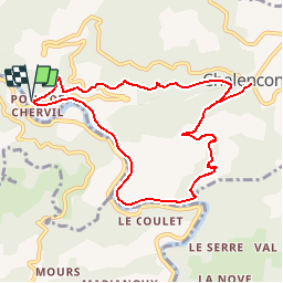
Trail Walking of 9.6 km to be discovered at Auvergne-Rhône-Alpes, Ardèche, Chalencon. This trail is proposed by tracegps.
Description
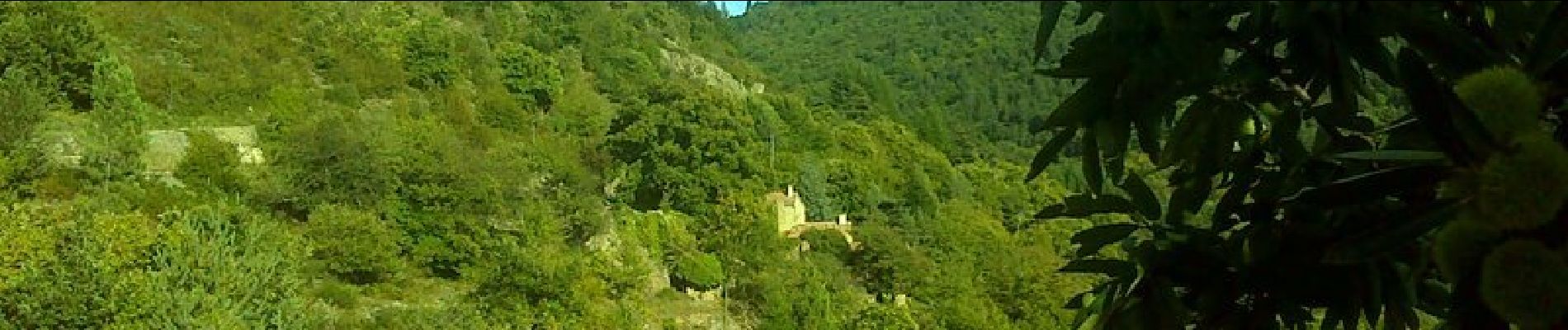
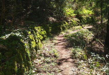
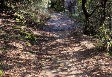
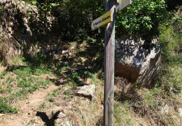
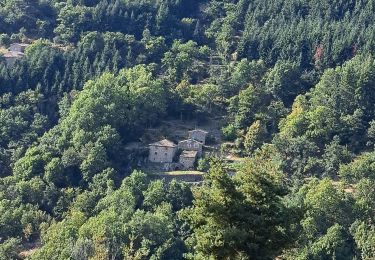
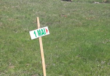
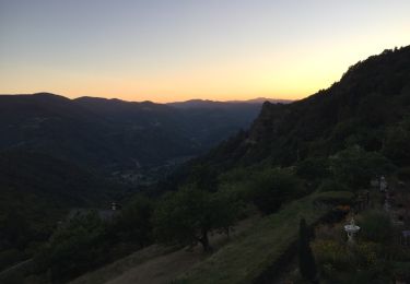
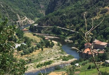
Balade au départ du Pont de Chervil sur l'ancienne voie ferrée des la vallée de l'Eyrieux. On descend cette voie verte sur quelques kilomètres avant de grimper par un beau sentier en direction de Chalencon, au milieu d'une végétation dense. Le Vignal, le Vigneron, les Vignes, on y cultivait autrefois les ceps de Bacchus sur les "Echamps" construits à force de labeur. La descente après une visite au village de Chalencon, but d'une autre promenade, est plus facile au milieu des châtaigniers.
Positioning
Comments
Trails nearby
![Trail Walking Saint-Michel-de-Chabrillanoux - 07 st Michel de chabrillanoux 19.05.24 - Photo](https://media.geolcdn.com/t/375/260/9f01ef04-ea67-4f25-9a7e-6220ab4ae4e0.jpg&format=jpg&maxdim=2)
![Walking Walking](https://static1.geolcdn.com/sitytour/trail-icons/101.png)
Walking
![](/images/other/stat-length.png)
![](https://static1.geolcdn.com/siteimages/upload/files/16400158638029165_repeat_loop_refresh_sync_direction_icon.png)
![Trail Walking Saint-Maurice-en-Chalencon - 07 gliuras n2 suite - Photo](https://media.geolcdn.com/t/375/260/4e001e65-168a-4ab8-956f-e7607f24ba30.jpg&format=jpg&maxdim=2)
![Walking Walking](https://static1.geolcdn.com/sitytour/trail-icons/101.png)
Walking
![](/images/other/stat-length.png)
![](https://static1.geolcdn.com/siteimages/upload/files/16400158638029165_repeat_loop_refresh_sync_direction_icon.png)
![Trail Walking Saint-Maurice-en-Chalencon - 07 gliuras n1 - Photo](https://media.geolcdn.com/t/375/260/89d96e21-3521-4570-85bc-f20549dde965.jpg&format=jpg&maxdim=2)
![Walking Walking](https://static1.geolcdn.com/sitytour/trail-icons/101.png)
Walking
![](/images/other/stat-length.png)
![](https://static1.geolcdn.com/siteimages/upload/files/16400158638029165_repeat_loop_refresh_sync_direction_icon.png)
![Trail Walking Saint-Jean-Chambre - Boucle Chalencon Pont de Chervil - Photo](https://media.geolcdn.com/t/375/260/25b89ba2-0bca-4c8c-a18d-9e8f4c8cd813.jpg&format=jpg&maxdim=2)
![Walking Walking](https://static1.geolcdn.com/sitytour/trail-icons/101.png)
Walking
![](/images/other/stat-length.png)
![](https://static1.geolcdn.com/siteimages/upload/files/16400158638029165_repeat_loop_refresh_sync_direction_icon.png)
![Trail Walking Belsentes - Saint-julien-labrousse 1er mai la rando des chanteurs de mai - Photo](https://media.geolcdn.com/t/375/260/dbd45dbc-9529-4e5d-9148-ee37437ae5f2.jpg&format=jpg&maxdim=2)
![Walking Walking](https://static1.geolcdn.com/sitytour/trail-icons/101.png)
Walking
![](/images/other/stat-length.png)
![](https://static1.geolcdn.com/siteimages/upload/files/16400158638029165_repeat_loop_refresh_sync_direction_icon.png)
![Trail Walking Chalencon - Circuit 2 Chalencon - Photo](https://media.geolcdn.com/t/375/260/ext.jpg?maxdim=2&url=https%3A%2F%2Fservices.sitytrail.com%2FGeolivesWS%2FDownloadMedia.ashx%3FTrailID%3D1002918%26Media%3D20180709211950.jpg)
![Walking Walking](https://static1.geolcdn.com/sitytour/trail-icons/101.png)
Walking
![](/images/other/stat-length.png)
![](https://static1.geolcdn.com/siteimages/upload/files/16400158638029165_repeat_loop_refresh_sync_direction_icon.png)
![Trail Walking Chalencon - Chalencon Circuit 2 - Photo](https://media.geolcdn.com/t/375/260/ext.jpg?maxdim=2&url=https%3A%2F%2Fservices.sitytrail.com%2FGeolivesWS%2FDownloadMedia.ashx%3FTrailID%3D1001624%26Media%3D20180709211950.jpg)
![Walking Walking](https://static1.geolcdn.com/sitytour/trail-icons/101.png)
Walking
![](/images/other/stat-length.png)
![](https://static1.geolcdn.com/siteimages/upload/files/16400158638029165_repeat_loop_refresh_sync_direction_icon.png)
![Trail Walking Chalencon - Chalencon circuit 1 - Photo](https://media.geolcdn.com/t/375/260/ext.jpg?maxdim=2&url=https%3A%2F%2Fservices.sitytrail.com%2FGeolivesWS%2FDownloadMedia.ashx%3FTrailID%3D1000808%26Media%3D20180708151204.jpg)
![Walking Walking](https://static1.geolcdn.com/sitytour/trail-icons/101.png)
Walking
![](/images/other/stat-length.png)
![](https://static1.geolcdn.com/siteimages/upload/files/16400158638029165_repeat_loop_refresh_sync_direction_icon.png)
![Trail Mountain bike Belsentes - St Julien Boutières - La Gare- Le Cheylard - Photo](https://media.geolcdn.com/t/375/260/ext.jpg?maxdim=2&url=https%3A%2F%2Fservices.sitytrail.com%2FGeolivesWS%2FDownloadMedia.ashx%3FTrailID%3D129915%26Media%3D13467_4.jpg)
![Mountain bike Mountain bike](https://static1.geolcdn.com/sitytour/trail-icons/202.png)
Mountain bike
![](/images/other/stat-length.png)
![](https://static1.geolcdn.com/siteimages/upload/files/16400158638029165_repeat_loop_refresh_sync_direction_icon.png)