![](/images/other/stat-length.png)
![Trail Horseback riding Hargnies - Landrichant 06 SEPT 2020 09_42 - Photo](https://media.geolcdn.com/t/1900/400/96592ff8-dc8a-48d7-b0d7-7a982426ee88.jpg&format=pjpeg&maxdim=2)
Landrichant 06 SEPT 2020 09_42
eddyvermeulen1
User
![Length](/images/other/stat-length.png)
Length
13.9 km
![Max alt](https://static1.geolcdn.com/siteimages/upload/files/1508320355ic_sort_altitude_max_24dp.png)
Max alt
361 m
![Uphill gradient](https://static1.geolcdn.com/siteimages/upload/files/1508320355ic_sort_den_pos_24dp.png)
Uphill gradient
364 m
![Km-Effort](/images/other/stat-length.png)
Km-Effort
18.7 km
![Min alt](https://static1.geolcdn.com/siteimages/upload/files/1508320355ic_sort_altitude_min_24dp.png)
Min alt
142 m
![Downhill gradient](https://static1.geolcdn.com/siteimages/upload/files/1508320355ic_sort_den_neg_24dp.png)
Downhill gradient
363 m
![Boucle](https://static1.geolcdn.com/siteimages/upload/files/16400158638029165_repeat_loop_refresh_sync_direction_icon.png)
Boucle
Yes
Creation date :
2021-04-29 04:52:16.0
Updated on :
2023-04-01 15:47:58.084
![Horseback riding](https://static1.geolcdn.com/sitytour/trail-icons/301.png)
2h27
Difficulty : Difficult
![Scan this QR Code to open this trail in the SityTrail application](https://capi.geolives.com/qq0zvz2zws4bq2lad0pu/sitytour/trails/3169633/qr.png?size=200)
FREE GPS app for hiking
About
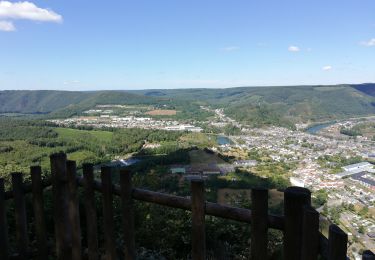
Trail Horseback riding of 13.9 km to be discovered at Grand Est, Ardennes, Hargnies. This trail is proposed by eddyvermeulen1.
Description
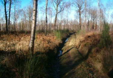
Gedaan in zeeeer nat weer
Nogal wat stenen
Mooie bossen en mooie galoppen
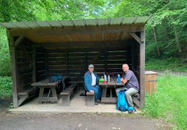
maar, een beetje "Marche"-gevoel.
Eventueel in te korten door aan dezelfde kant van de grote baan te blijven.
Grote startparking
Positioning
Country:
France
Region :
Grand Est
Department/Province :
Ardennes
Municipality :
Hargnies
Location:
Unknown
Start:(Dec)
Start:(UTM)
627357 ; 5545538 (31U) N.
Comments
Trails nearby
![Trail Walking Vireux-Molhain - Balade Franco-Belge - De Vireux-Molhain à Mazée - Photo](https://media.geolcdn.com/t/375/260/ext.jpg?maxdim=2&url=https%3A%2F%2Fservices.sitytrail.com%2FGeolivesWS%2FDownloadMedia.ashx%3FTrailID%3D191490%26Media%3D15083_5.jpg)
![Walking Walking](https://static1.geolcdn.com/sitytour/trail-icons/101.png)
Balade Franco-Belge - De Vireux-Molhain à Mazée
Walking
Medium
(1)
Vireux-Molhain,
Grand Est,
Ardennes,
France
![](/images/other/stat-length.png)
14.4 km | 19.2 km-effort
3h 30min
![](https://static1.geolcdn.com/siteimages/upload/files/16400158638029165_repeat_loop_refresh_sync_direction_icon.png)
Yes
![Trail Walking Vireux-Molhain - Du Mont Vireux au château de Hierges - Photo](https://media.geolcdn.com/t/375/260/ext.jpg?maxdim=2&url=https%3A%2F%2Fservices.sitytrail.com%2FGeolivesWS%2FDownloadMedia.ashx%3FTrailID%3D108904%26Media%3D2563_6.jpg)
![Walking Walking](https://static1.geolcdn.com/sitytour/trail-icons/101.png)
Du Mont Vireux au château de Hierges
Walking
Difficult
(1)
Vireux-Molhain,
Grand Est,
Ardennes,
France
![](/images/other/stat-length.png)
12.3 km | 16.8 km-effort
4h 0min
![](https://static1.geolcdn.com/siteimages/upload/files/16400158638029165_repeat_loop_refresh_sync_direction_icon.png)
Yes
![Trail Walking Hargnies - De Hargnies au Point de vue de la Roche à Fépin par la vallée du Risdoux - Photo](https://media.geolcdn.com/t/375/260/ext.jpg?maxdim=2&url=https%3A%2F%2Fservices.sitytrail.com%2FGeolivesWS%2FDownloadMedia.ashx%3FTrailID%3D108901%26Media%3D2491_6.jpg)
![Walking Walking](https://static1.geolcdn.com/sitytour/trail-icons/101.png)
De Hargnies au Point de vue de la Roche à Fépin par la vallée du Risdoux
Walking
Difficult
(1)
Hargnies,
Grand Est,
Ardennes,
France
![](/images/other/stat-length.png)
13.9 km | 18 km-effort
4h 0min
![](https://static1.geolcdn.com/siteimages/upload/files/16400158638029165_repeat_loop_refresh_sync_direction_icon.png)
Yes
![Trail Walking Hargnies - De Hargnies au Point de vue de la Roche à Fépin par la vallée du Risdoux - Photo](https://media.geolcdn.com/t/375/260/ext.jpg?maxdim=2&url=https%3A%2F%2Fstatic1.geolcdn.com%2Fsiteimages%2Fupload%2Ffiles%2F1553511878bg_sport_marche.png)
![Walking Walking](https://static1.geolcdn.com/sitytour/trail-icons/101.png)
De Hargnies au Point de vue de la Roche à Fépin par la vallée du Risdoux
Walking
Medium
(1)
Hargnies,
Grand Est,
Ardennes,
France
![](/images/other/stat-length.png)
13.9 km | 18 km-effort
3h 20min
![](https://static1.geolcdn.com/siteimages/upload/files/16400158638029165_repeat_loop_refresh_sync_direction_icon.png)
Yes
![Trail Walking Vireux-Molhain - Du Mont Vireux au château de Hierges - Photo](https://media.geolcdn.com/t/375/260/ext.jpg?maxdim=2&url=https%3A%2F%2Fstatic1.geolcdn.com%2Fsiteimages%2Fupload%2Ffiles%2F1553511878bg_sport_marche.png)
![Walking Walking](https://static1.geolcdn.com/sitytour/trail-icons/101.png)
Du Mont Vireux au château de Hierges
Walking
Easy
(1)
Vireux-Molhain,
Grand Est,
Ardennes,
France
![](/images/other/stat-length.png)
12.3 km | 16.8 km-effort
3h 0min
![](https://static1.geolcdn.com/siteimages/upload/files/16400158638029165_repeat_loop_refresh_sync_direction_icon.png)
Yes
![Trail Walking Beauraing - Balade à Felenne - Photo](https://media.geolcdn.com/t/375/260/bf427321-99ec-45e0-a570-b7aca0f64053.jpeg&format=jpg&maxdim=2)
![Walking Walking](https://static1.geolcdn.com/sitytour/trail-icons/101.png)
Balade à Felenne
Walking
Difficult
Beauraing,
Wallonia,
Namur,
Belgium
![](/images/other/stat-length.png)
11.5 km | 15.3 km-effort
3h 28min
![](https://static1.geolcdn.com/siteimages/upload/files/16400158638029165_repeat_loop_refresh_sync_direction_icon.png)
Yes
![Trail On foot Haybes - Les Sentiers des Crêtes - Photo](https://media.geolcdn.com/t/375/260/6b94c5c3-dc13-4c48-9664-900aed09082a.jpeg&format=jpg&maxdim=2)
![On foot On foot](https://static1.geolcdn.com/sitytour/trail-icons/100.png)
Les Sentiers des Crêtes
On foot
Easy
Haybes,
Grand Est,
Ardennes,
France
![](/images/other/stat-length.png)
14.1 km | 19.5 km-effort
4h 25min
![](https://static1.geolcdn.com/siteimages/upload/files/16400158638029165_repeat_loop_refresh_sync_direction_icon.png)
No
![Trail On foot Haybes - La Roche de Madame de Cormont - Photo](https://media.geolcdn.com/t/375/260/84d10620-5baa-43f3-9d62-58a472020b42.jpeg&format=jpg&maxdim=2)
![On foot On foot](https://static1.geolcdn.com/sitytour/trail-icons/100.png)
La Roche de Madame de Cormont
On foot
Easy
Haybes,
Grand Est,
Ardennes,
France
![](/images/other/stat-length.png)
8.4 km | 11.8 km-effort
2h 41min
![](https://static1.geolcdn.com/siteimages/upload/files/16400158638029165_repeat_loop_refresh_sync_direction_icon.png)
Yes
![Trail Walking Haybes - Fumay - Photo](https://media.geolcdn.com/t/375/260/a9d23473-6fa3-4f4b-9c8d-944146d33ab8.jpg&format=jpg&maxdim=2)
![Walking Walking](https://static1.geolcdn.com/sitytour/trail-icons/101.png)
Fumay
Walking
Very easy
(1)
Haybes,
Grand Est,
Ardennes,
France
![](/images/other/stat-length.png)
12.3 km | 17.4 km-effort
3h 15min
![](https://static1.geolcdn.com/siteimages/upload/files/16400158638029165_repeat_loop_refresh_sync_direction_icon.png)
Yes