![](/images/other/stat-length.png)
![Trail Mountain bike Feurs - Du Barrage de Villerest au Barrage de Grangent en 10 boucles / Boucle N° 05 : Pont de Feurs - Pont de Montrond-les-Bains - Photo](https://media.geolcdn.com/t/1900/400/ext.pjpeg?maxdim=2&url=https%3A%2F%2Fservices.sitytrail.com%2FGeolivesWS%2FDownloadMedia.ashx%3FTrailID%3D316882%26Media%3D15966_6.jpg)
Du Barrage de Villerest au Barrage de Grangent en 10 boucles / Boucle N° 05 : Pont de Feurs - Pont de Montrond-les-Bains
tracegps
User
![Length](/images/other/stat-length.png)
![Max alt](https://static1.geolcdn.com/siteimages/upload/files/1508320355ic_sort_altitude_max_24dp.png)
![Uphill gradient](https://static1.geolcdn.com/siteimages/upload/files/1508320355ic_sort_den_pos_24dp.png)
![Km-Effort](/images/other/stat-length.png)
![Min alt](https://static1.geolcdn.com/siteimages/upload/files/1508320355ic_sort_altitude_min_24dp.png)
![Downhill gradient](https://static1.geolcdn.com/siteimages/upload/files/1508320355ic_sort_den_neg_24dp.png)
![Boucle](https://static1.geolcdn.com/siteimages/upload/files/16400158638029165_repeat_loop_refresh_sync_direction_icon.png)
![Mountain bike](https://static1.geolcdn.com/sitytour/trail-icons/202.png)
4h15
Difficulty : Medium
![Scan this QR Code to open this trail in the SityTrail application](https://capi.geolives.com/qq0zvz2zws4bq2lad0pu/sitytour/trails/316882/qr.png?size=200)
FREE GPS app for hiking
About
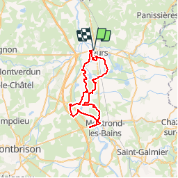
Trail Mountain bike of 47 km to be discovered at Auvergne-Rhône-Alpes, Loire, Feurs. This trail is proposed by tracegps.
Description
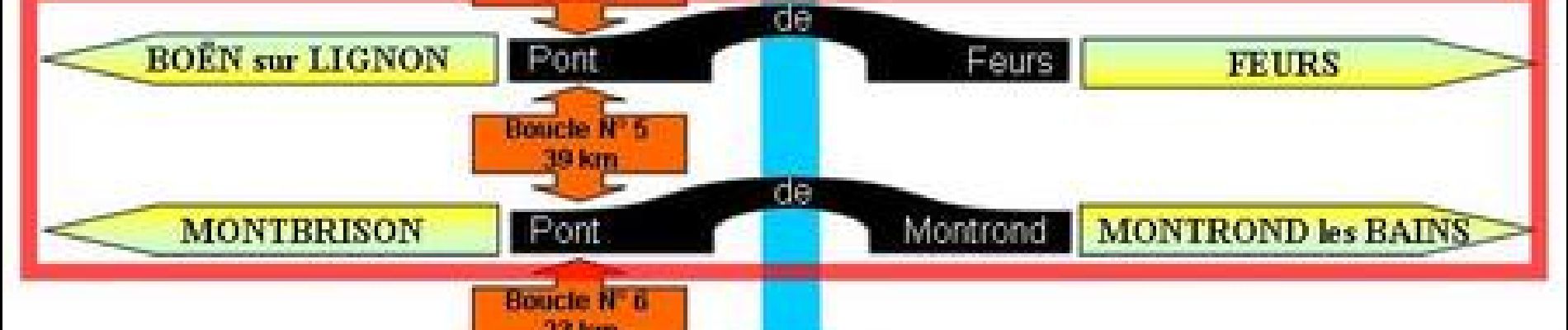
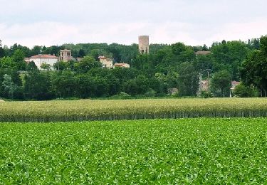
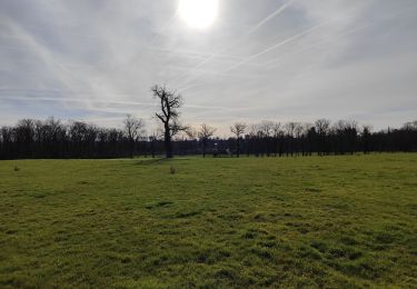
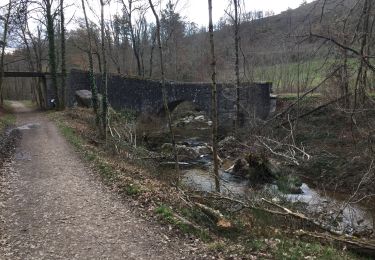
Parking et départ proche du pont de Feurs. Franchissant la Loire par le pont de Feurs et celui de Montrond-les-Bains (voie verte), ce circuit fait découvrir les bords de Loire, l’Ecopôle du Forez avec ses étangs, sa faune et sa flore, le château de Magneux, les cultures céréalières de la plaine du Forez, la voie verte sur l’ancien pont de la voie ferrée à Montrond-les-Bains ainsi qu’une vue sur le château, le village de Saint-Laurent-la-Conche, les quartiers résidentiels de Feurs et le Gourd de Randan. Le parcours est facile et très roulant, il emprunte de nombreux single-tracks ludiques qui serpentent au bord de la Loire tout en traversant de nombreux sous-bois. Cependant le franchissement de quelques obstacles naturels ou artificiels (dépressions, passerelles ou escaliers) nécessitera le portage du VTT.
Positioning
Comments
Trails nearby
![Trail Mountain bike Cleppé - Randonnée de la Tour - Cléppé - Photo](https://media.geolcdn.com/t/375/260/ext.jpg?maxdim=2&url=https%3A%2F%2Fservices.sitytrail.com%2FGeolivesWS%2FDownloadMedia.ashx%3FTrailID%3D172375%26Media%3D13718_6.jpg)
![Mountain bike Mountain bike](https://static1.geolcdn.com/sitytour/trail-icons/202.png)
Mountain bike
![](/images/other/stat-length.png)
![](https://static1.geolcdn.com/siteimages/upload/files/16400158638029165_repeat_loop_refresh_sync_direction_icon.png)
![Trail Walking Feurs - Randonnée au dessus de Feurs - Photo](https://media.geolcdn.com/t/375/260/d2c52346-f2e5-4497-8257-48fbc24ee939.jpg&format=jpg&maxdim=2)
![Walking Walking](https://static1.geolcdn.com/sitytour/trail-icons/101.png)
Walking
![](/images/other/stat-length.png)
![](https://static1.geolcdn.com/siteimages/upload/files/16400158638029165_repeat_loop_refresh_sync_direction_icon.png)
![Trail Walking Salvizinet - Salvizinet, les ponts - Photo](https://media.geolcdn.com/t/375/260/c69d1521-2db8-470f-b0c0-5530cf9080dd.jpg&format=jpg&maxdim=2)
![Walking Walking](https://static1.geolcdn.com/sitytour/trail-icons/101.png)
Walking
![](/images/other/stat-length.png)
![](https://static1.geolcdn.com/siteimages/upload/files/16400158638029165_repeat_loop_refresh_sync_direction_icon.png)
![Trail Walking Poncins - rando autour de Po'cin, pour la cause de Keur d'Afrique - Photo](https://media.geolcdn.com/t/375/260/cee6d893-3319-4124-852c-e6f360b5ea32.jpg&format=jpg&maxdim=2)
![Walking Walking](https://static1.geolcdn.com/sitytour/trail-icons/101.png)
Walking
![](/images/other/stat-length.png)
![](https://static1.geolcdn.com/siteimages/upload/files/16400158638029165_repeat_loop_refresh_sync_direction_icon.png)
![Trail Walking Cleppé - Cleppe - Photo](https://media.geolcdn.com/t/375/260/e763cdde-54ba-49eb-adef-c0398a496538.jpg&format=jpg&maxdim=2)
![Walking Walking](https://static1.geolcdn.com/sitytour/trail-icons/101.png)
Walking
![](/images/other/stat-length.png)
![](https://static1.geolcdn.com/siteimages/upload/files/16400158638029165_repeat_loop_refresh_sync_direction_icon.png)
![Trail Walking Salt-en-Donzy - rando à Salt en Douzy, boucle autour du chemin de monorail - Photo](https://media.geolcdn.com/t/375/260/ee316358-f7a5-4d9c-844b-66185530b4f7.jpg&format=jpg&maxdim=2)
![Walking Walking](https://static1.geolcdn.com/sitytour/trail-icons/101.png)
Walking
![](/images/other/stat-length.png)
![](https://static1.geolcdn.com/siteimages/upload/files/16400158638029165_repeat_loop_refresh_sync_direction_icon.png)
![Trail Walking Salvizinet - Salvizinet et vers monorail - Photo](https://media.geolcdn.com/t/375/260/5a0a9506-2bc1-45db-9a49-992d649dcc32.jpg&format=jpg&maxdim=2)
![Walking Walking](https://static1.geolcdn.com/sitytour/trail-icons/101.png)
Walking
![](/images/other/stat-length.png)
![](https://static1.geolcdn.com/siteimages/upload/files/16400158638029165_repeat_loop_refresh_sync_direction_icon.png)
![Trail Mountain bike Cleppé - Autour des Gorges de la Loire - GR de Pays N° 1 : La Tour de Cléppé - Cleppé - Photo](https://media.geolcdn.com/t/375/260/ext.jpg?maxdim=2&url=https%3A%2F%2Fservices.sitytrail.com%2FGeolivesWS%2FDownloadMedia.ashx%3FTrailID%3D215005%26Media%3D15574_6.jpg)
![Mountain bike Mountain bike](https://static1.geolcdn.com/sitytour/trail-icons/202.png)
Mountain bike
![](/images/other/stat-length.png)
![](https://static1.geolcdn.com/siteimages/upload/files/16400158638029165_repeat_loop_refresh_sync_direction_icon.png)
![Trail Walking Cleppé - Autour des Gorges de la Loire - GR de Pays N° 1 : La Tour de Cléppé - Cleppé - Photo](https://media.geolcdn.com/t/375/260/ext.jpg?maxdim=2&url=https%3A%2F%2Fservices.sitytrail.com%2FGeolivesWS%2FDownloadMedia.ashx%3FTrailID%3D215004%26Media%3D15574_6.jpg)
![Walking Walking](https://static1.geolcdn.com/sitytour/trail-icons/101.png)
Walking
![](/images/other/stat-length.png)
![](https://static1.geolcdn.com/siteimages/upload/files/16400158638029165_repeat_loop_refresh_sync_direction_icon.png)