Trail Walking Obernai - D'Obernai à Barr, via Mont Sainte Odile - Photo

D'Obernai à Barr, via Mont Sainte Odile

 tracegps
tracegps

User

© OpenStreetMap contributors
Length
Length
21 km
Max alt
Max alt
821 m
Uphill gradient
Uphill gradient
743 m
Km-Effort
Km-Effort  
30 km
Min alt
Min alt
179 m
Downhill gradient
Downhill gradient
722 m
Boucle
Boucle
No
Creation date :
2014-12-10 00:00:00.0
Updated on :
2014-12-10 00:00:00.0

(0 Reviews)

Walking
Walking
5h30
Difficulty : Medium

Scan this QR Code to open this trail in the SityTrail application

FREE GPS app for hiking

Logo SityTrail SityTrail

IGN / Geographical institutes

Download SityTrail from the App Store Download SityTrail from Google Play

Logo SityTrail SityTrail World

The world is yours!

Download SityTrail from the App Store Download SityTrail from Google Play Download SityTrail on Huawei AppGallery

About

Trail Walking of 21 km to be discovered at Grand Est, Bas-Rhin, Obernai. This trail is proposed by tracegps.

Description

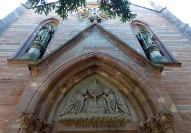
En sortant de la gare d’Obernai, se diriger vers le centre ville, pour boire un café. Ensuite suivre le balisage du Club vosgien rectangle rouge-blanc-rouge, le long de l’Ehn. A partir d’Ottrott suivre la croix jaune, sur le sentier des pèlerins pour monter vers le Mont Sainte Odile. Le chemin passe à proximité de l’ancien prieuré Saint Gorgon, la carrière de Saint Nabor, le mur païen. Après la visite du couvent et le déjeuner à la cafétéria, descendre à la source miraculeuse Sainte Odile et remonter à l’entrée du couvent. Continuer vers Barr en suivant le rectangle rouge jusqu’à la gare, en passant au rocher du Beckenfels, la stèle de l’accident d’avion en 1992 sur la Bloss, le kiosque Jadelot, le château de Landsberg. Continuer la descente vers Barr à travers les vignes. Passer devant l’Hôtel de Ville et la pâtisserie Oster (2 beaux bâtiments) avant de rejoindre la gare.

Elevation profile

Photos

Positioning

Country:
France
Region :
Grand Est
Department/Province :
Bas-Rhin
Municipality :
Obernai
Location:
Unknown
Start:(UTM)
388335 ; 5368827 (32U) N.

Trails nearby

Trail Walking Ottrott - Le Mont Sainte-Odile depuis Otrott - Photo
Walking
VacheKiri67

Walking

Medium
(1)
Ottrott, Grand Est, Bas-Rhin, France
13 km | 20 km-effort
6h 18min
Yes
Trail Walking Obernai - Obernai gare - Mont St Odile - Photo
Walking
tracegps

Walking

Difficult
(2)
Obernai, Grand Est, Bas-Rhin, France
20 km | 29 km-effort
5h 0min
Yes
Trail Mountain bike Ottrott - Sainte-Odile East-Face - Photo
Mountain bike
tracegps

Mountain bike

Difficult
(1)
Ottrott, Grand Est, Bas-Rhin, France
24 km | 39 km-effort
3h 0min
Yes
Trail On foot Rosheim - Circuit du Vignoble - Photo
On foot
GUIDE+

On foot

Easy
Rosheim, Grand Est, Bas-Rhin, France
8.8 km | 11.7 km-effort
2h 38min
Yes
Trail On foot Bischoffsheim - Circuit des Balcons - Photo
On foot
GUIDE+

On foot

Easy
(1)
Bischoffsheim, Grand Est, Bas-Rhin, France
12.4 km | 15.4 km-effort
3h 30min
Yes
Trail Mountain bike Rosheim - schnacker tour le grand 8 circuit magique - Photo
Mountain bike
raphnou

Mountain bike

Difficult
(1)
Rosheim, Grand Est, Bas-Rhin, France
29 km | 39 km-effort
2h 30min
Yes
Trail Walking Rosenwiller - 2015-05-17 Marche Gourmande Rosenwiller - Photo
Walking
GUIDE
holtzv

Walking

Easy
(1)
Rosenwiller, Grand Est, Bas-Rhin, France
8.8 km | 11 km-effort
2h 23min
No
Trail Electric bike Rosheim - Rosheim Grendelbruch  - Photo
Electric bike
apa

Electric bike

Medium
Rosheim, Grand Est, Bas-Rhin, France
49 km | 59 km-effort
3h 13min
Yes
Trail Electric bike Bischoffsheim - un tour dans le vignoble Bischoffsheim  - Photo
Electric bike
apa

Electric bike

Very easy
Bischoffsheim, Grand Est, Bas-Rhin, France
49 km | 57 km-effort
3h 25min
No


Close
My subscriptions