


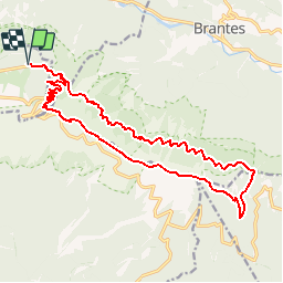

19.1 km | 30 km-effort


User


FREE GPS app for hiking
 SityTrail
IGN / Geographical institutes
SityTrail World
The world is yours!
Trail Walking of 19.9 km to be discovered at Provence-Alpes-Côte d'Azur, Vaucluse, Beaumont-du-Ventoux. This trail is proposed by tracegps.
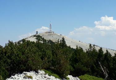
Découvrez en une journée l’intégralité du Mont Ventoux. Le panorama du sommet, la crête lunaire, et les points de vue depuis la corniche boisée du versant nord resteront inoubliables ! Départ Station du Mont Serein.


Walking

Walking

Mountain bike

Mountain bike

Mountain bike

Walking

Walking

Walking
Walking