![](/images/other/stat-length.png)
![Trail Running Sainte-Rose - Boucle Davidon - Photo](https://media.geolcdn.com/t/1900/400/ext.pjpeg?maxdim=2&url=https%3A%2F%2Fservices.sitytrail.com%2FGeolivesWS%2FDownloadMedia.ashx%3FTrailID%3D316716%26Media%3D4542_5.jpg)
Boucle Davidon
tracegps
User
![Length](/images/other/stat-length.png)
![Max alt](https://static1.geolcdn.com/siteimages/upload/files/1508320355ic_sort_altitude_max_24dp.png)
![Uphill gradient](https://static1.geolcdn.com/siteimages/upload/files/1508320355ic_sort_den_pos_24dp.png)
![Km-Effort](/images/other/stat-length.png)
![Min alt](https://static1.geolcdn.com/siteimages/upload/files/1508320355ic_sort_altitude_min_24dp.png)
![Downhill gradient](https://static1.geolcdn.com/siteimages/upload/files/1508320355ic_sort_den_neg_24dp.png)
![Boucle](https://static1.geolcdn.com/siteimages/upload/files/16400158638029165_repeat_loop_refresh_sync_direction_icon.png)
![Running](https://static1.geolcdn.com/sitytour/trail-icons/103.png)
45m
Difficulty : Medium
![Scan this QR Code to open this trail in the SityTrail application](https://capi.geolives.com/qq0zvz2zws4bq2lad0pu/sitytour/trails/316716/qr.png?size=200)
FREE GPS app for hiking
About
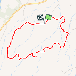
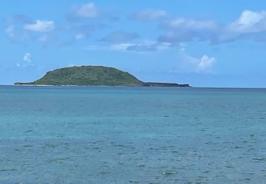
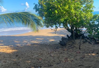
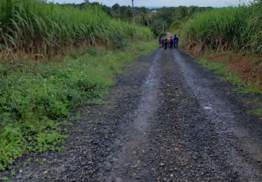
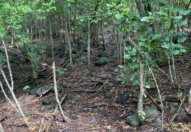
Trail Running of 6.6 km to be discovered at Guadeloupe, Unknown, Sainte-Rose. This trail is proposed by tracegps.
Description
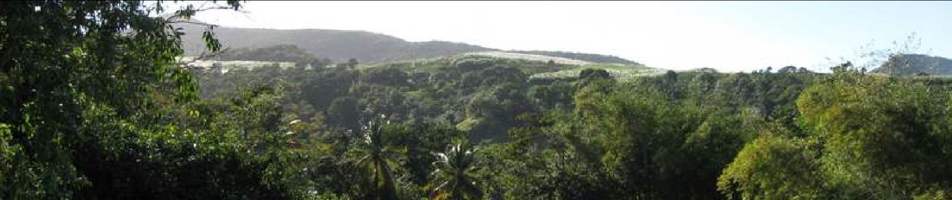
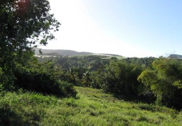
Petite balade dans les champs de canne à sucre, sur les hauteurs de Sainte-Rose, avec une vue superbe sur le Grand Cul de sac marin, et même sur la Grande Terre par temps clair. Parcours très sauvage, varié, non balisé, sur piste en terre en majorité, qui convient parfaitement à la course à pied. Faisable en VTT mais quelques passages aux herbes hautes avec mauvaise trace seront courts mais difficiles à passer sans portage. Jonction possible avec parcours de Solitude au Sud-Ouest.
Positioning
Comments
Trails nearby
![Trail Walking Sainte-Rose - Boucle Davidon - Photo](https://media.geolcdn.com/t/375/260/ext.jpg?maxdim=2&url=https%3A%2F%2Fservices.sitytrail.com%2FGeolivesWS%2FDownloadMedia.ashx%3FTrailID%3D316715%26Media%3D4542_5.jpg)
![Walking Walking](https://static1.geolcdn.com/sitytour/trail-icons/101.png)
Walking
![](/images/other/stat-length.png)
![](https://static1.geolcdn.com/siteimages/upload/files/16400158638029165_repeat_loop_refresh_sync_direction_icon.png)
![Trail Walking Sainte-Rose - Guadeloupe - Littoral Sainte Rose - Photo](https://media.geolcdn.com/t/375/260/cbd470b5-c043-4002-931a-b446dba62633.jpg&format=jpg&maxdim=2)
![Walking Walking](https://static1.geolcdn.com/sitytour/trail-icons/101.png)
Walking
![](/images/other/stat-length.png)
![](https://static1.geolcdn.com/siteimages/upload/files/16400158638029165_repeat_loop_refresh_sync_direction_icon.png)
![Trail On foot Sainte-Rose - Littoral de Sainte Rose - Photo](https://media.geolcdn.com/t/375/260/a253bd8e-c51d-4ab3-ae66-2624aaeebf79.jpeg&format=jpg&maxdim=2)
![On foot On foot](https://static1.geolcdn.com/sitytour/trail-icons/100.png)
On foot
![](/images/other/stat-length.png)
![](https://static1.geolcdn.com/siteimages/upload/files/16400158638029165_repeat_loop_refresh_sync_direction_icon.png)
![Trail Walking Sainte-Rose - Louheac Ravine Calée - Photo](https://media.geolcdn.com/t/375/260/fac6128d-8203-4844-a967-808ab4d68c37.jpg&format=jpg&maxdim=2)
![Walking Walking](https://static1.geolcdn.com/sitytour/trail-icons/101.png)
Walking
![](/images/other/stat-length.png)
![](https://static1.geolcdn.com/siteimages/upload/files/16400158638029165_repeat_loop_refresh_sync_direction_icon.png)
![Trail Walking Deshaies - SityTrail - 2167666 - tillet---les-amandiers (1) - Photo](https://media.geolcdn.com/t/375/260/033d3238-57c1-4454-a212-9faa3391135e.jpg&format=jpg&maxdim=2)
![Walking Walking](https://static1.geolcdn.com/sitytour/trail-icons/101.png)
Walking
![](/images/other/stat-length.png)
![](https://static1.geolcdn.com/siteimages/upload/files/16400158638029165_repeat_loop_refresh_sync_direction_icon.png)
![Trail Trail Sainte-Rose - Co plage Fré Cluny - Photo](https://media.geolcdn.com/t/375/260/e5f99555-eed9-405a-9137-5459161c408c.jpg&format=jpg&maxdim=2)
![Trail Trail](https://static1.geolcdn.com/sitytour/trail-icons/104.png)
Trail
![](/images/other/stat-length.png)
![](https://static1.geolcdn.com/siteimages/upload/files/16400158638029165_repeat_loop_refresh_sync_direction_icon.png)
![Trail Trail Sainte-Rose - Plage cluny - Photo](https://media.geolcdn.com/t/375/260/d5a05c13-8279-4f5c-a8e9-9b2b9c29972e.jpg&format=jpg&maxdim=2)
![Trail Trail](https://static1.geolcdn.com/sitytour/trail-icons/104.png)
![Trail Walking Sainte-Rose - plage manbia - Photo](https://media.geolcdn.com/t/375/260/11212f86-2411-4f07-b841-1823f8ea750e.jpg&format=jpg&maxdim=2)
![Walking Walking](https://static1.geolcdn.com/sitytour/trail-icons/101.png)
Walking
![](/images/other/stat-length.png)
![](https://static1.geolcdn.com/siteimages/upload/files/16400158638029165_repeat_loop_refresh_sync_direction_icon.png)
![Trail Trail Deshaies - Reco morne fort royal - Photo](https://media.geolcdn.com/t/375/260/a36b2213-944d-43a2-aea4-cd91affff845.jpg&format=jpg&maxdim=2)
![Trail Trail](https://static1.geolcdn.com/sitytour/trail-icons/104.png)
Trail
![](/images/other/stat-length.png)
![](https://static1.geolcdn.com/siteimages/upload/files/16400158638029165_repeat_loop_refresh_sync_direction_icon.png)