![](/images/other/stat-length.png)
![Trail Walking Bélesta - La forêt de Bélesta - Photo](https://media.geolcdn.com/t/1900/400/ext.pjpeg?maxdim=2&url=https%3A%2F%2Fservices.sitytrail.com%2FGeolivesWS%2FDownloadMedia.ashx%3FTrailID%3D316704%26Media%3D3917_1.jpg)
La forêt de Bélesta
tracegps
User
![Length](/images/other/stat-length.png)
![Max alt](https://static1.geolcdn.com/siteimages/upload/files/1508320355ic_sort_altitude_max_24dp.png)
![Uphill gradient](https://static1.geolcdn.com/siteimages/upload/files/1508320355ic_sort_den_pos_24dp.png)
![Km-Effort](/images/other/stat-length.png)
![Min alt](https://static1.geolcdn.com/siteimages/upload/files/1508320355ic_sort_altitude_min_24dp.png)
![Downhill gradient](https://static1.geolcdn.com/siteimages/upload/files/1508320355ic_sort_den_neg_24dp.png)
![Boucle](https://static1.geolcdn.com/siteimages/upload/files/16400158638029165_repeat_loop_refresh_sync_direction_icon.png)
![Walking](https://static1.geolcdn.com/sitytour/trail-icons/101.png)
5h00
Difficulty : Difficult
![Scan this QR Code to open this trail in the SityTrail application](https://capi.geolives.com/qq0zvz2zws4bq2lad0pu/sitytour/trails/316704/qr.png?size=200)
FREE GPS app for hiking
About
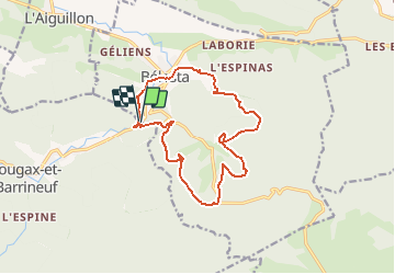
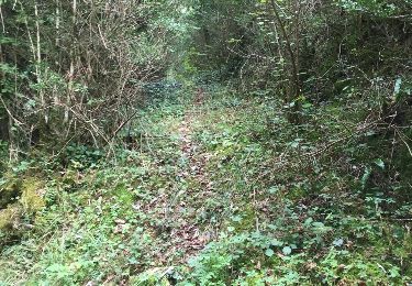
Trail Walking of 15 km to be discovered at Occitania, Ariège, Bélesta. This trail is proposed by tracegps.
Description
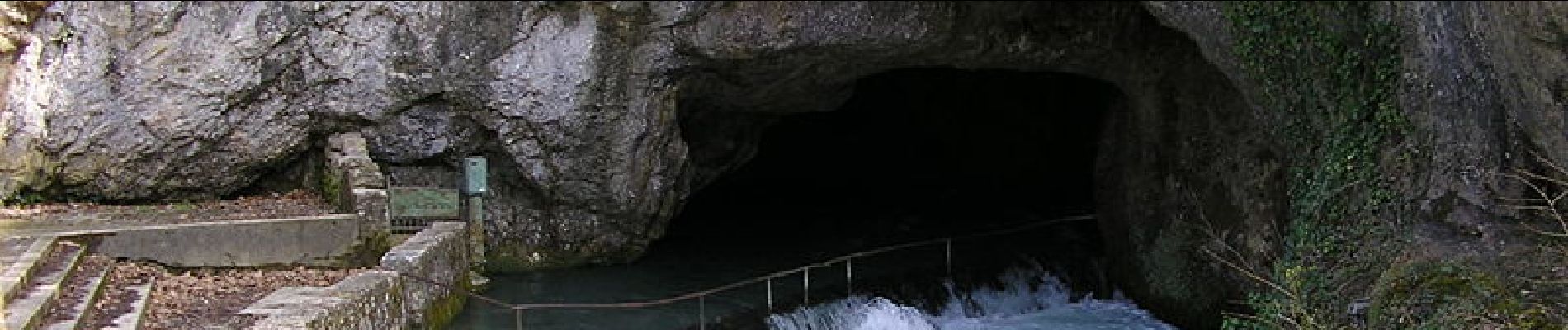
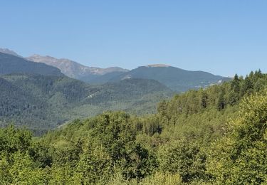
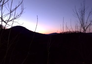
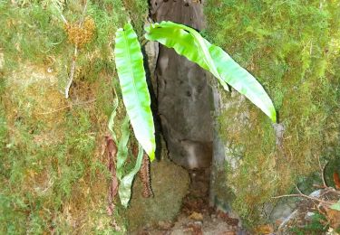
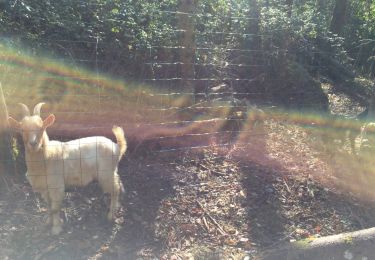
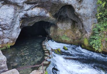
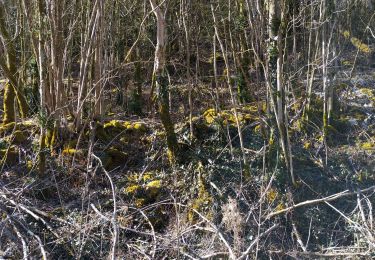
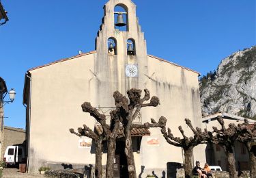
De la douceur du piémont à la fière verticalité pyrénéenne, l'Ariège décline avec bonheur tous les plaisirs de la randonnée. Le département cultive en effet - entre influences atlantique et méditerranéenne - une diversité climatique, géographique et culturelle et abrite de nombreux lieux imprégnés d'histoire, parmi lesquels les grottes ornées (paléolithique supérieur), la cité gallo-romaine de Saint-Lizier, les chapelles romanes, les citadelles cathares (Foix, Montségur, etc.) et, nichées au cœur des montagnes, les anciennes mines de fer du Biros ou du Vicdessos. Rejoignant l’étonnante source intermittente de Fontestorbes, cette longue mais facile balade traverse la plus célèbre forêt d’Ariège (nombreuses espèces forestières) et de charmants petits hameaux isolés.
Positioning
Comments
Trails nearby
![Trail Walking Fougax-et-Barrineuf - cols du figuier et de Ballussou et croix de Morenci depuis Fougax 09 - Photo](https://media.geolcdn.com/t/375/260/49cdc21a-424f-41fd-8f3c-bcebcf821473.jpg&format=jpg&maxdim=2)
![Walking Walking](https://static1.geolcdn.com/sitytour/trail-icons/101.png)
Walking
![](/images/other/stat-length.png)
![](https://static1.geolcdn.com/siteimages/upload/files/16400158638029165_repeat_loop_refresh_sync_direction_icon.png)
![Trail Walking Bélesta - espalisse 00 - Photo](https://media.geolcdn.com/t/375/260/8a4ac953-1aa7-4919-a149-bd60a8d896b5.jpg&format=jpg&maxdim=2)
![Walking Walking](https://static1.geolcdn.com/sitytour/trail-icons/101.png)
Walking
![](/images/other/stat-length.png)
![](https://static1.geolcdn.com/siteimages/upload/files/16400158638029165_repeat_loop_refresh_sync_direction_icon.png)
![Trail Other activity Bélesta - ballade au trou - Photo](https://media.geolcdn.com/t/375/260/d4e18af9-3770-4b8e-911b-3b4d3a895954.jpg&format=jpg&maxdim=2)
![Other activity Other activity](https://static1.geolcdn.com/sitytour/trail-icons/900.png)
Other activity
![](/images/other/stat-length.png)
![](https://static1.geolcdn.com/siteimages/upload/files/16400158638029165_repeat_loop_refresh_sync_direction_icon.png)
![Trail Other activity Bélesta - accès trou de la doline plate - Photo](https://media.geolcdn.com/t/375/260/55e75352-b123-481b-a47f-14e7dcc9cc8e.jpg&format=jpg&maxdim=2)
![Other activity Other activity](https://static1.geolcdn.com/sitytour/trail-icons/900.png)
Other activity
![](/images/other/stat-length.png)
![](https://static1.geolcdn.com/siteimages/upload/files/16400158638029165_repeat_loop_refresh_sync_direction_icon.png)
![Trail Other activity Bélesta - Fusion de ballade rieufourcant vers les mijanes et ludax - Photo](https://media.geolcdn.com/t/375/260/ext.jpg?maxdim=2&url=https%3A%2F%2Fservices.sitytrail.com%2FGeolivesWS%2FDownloadMedia.ashx%3FTrailID%3D920239%26Media%3D20161120115707.jpg)
![Other activity Other activity](https://static1.geolcdn.com/sitytour/trail-icons/900.png)
Other activity
![](/images/other/stat-length.png)
![](https://static1.geolcdn.com/siteimages/upload/files/16400158638029165_repeat_loop_refresh_sync_direction_icon.png)
![Trail Other activity Bélesta - 4 tumulus de rieufourcant 2 - Photo](https://media.geolcdn.com/t/375/260/ext.jpg?maxdim=2&url=https%3A%2F%2Fservices.sitytrail.com%2FGeolivesWS%2FDownloadMedia.ashx%3FTrailID%3D639790%26Media%3D20161001141931.jpg)
![Other activity Other activity](https://static1.geolcdn.com/sitytour/trail-icons/900.png)
Other activity
![](/images/other/stat-length.png)
![](https://static1.geolcdn.com/siteimages/upload/files/16400158638029165_repeat_loop_refresh_sync_direction_icon.png)
![Trail Walking Bélesta - Forêt de Belesta Ariège André - Photo](https://media.geolcdn.com/t/375/260/633644d8-5a36-41af-bd70-64998794f6a7.jpg&format=jpg&maxdim=2)
![Walking Walking](https://static1.geolcdn.com/sitytour/trail-icons/101.png)
Walking
![](/images/other/stat-length.png)
![](https://static1.geolcdn.com/siteimages/upload/files/16400158638029165_repeat_loop_refresh_sync_direction_icon.png)
![Trail Other activity Bélesta - trou au croisement - Photo](https://media.geolcdn.com/t/375/260/1b2b88e5-49d9-4da7-bccc-a0237a3ee5e9.jpg&format=jpg&maxdim=2)
![Other activity Other activity](https://static1.geolcdn.com/sitytour/trail-icons/900.png)
Other activity
![](/images/other/stat-length.png)
![](https://static1.geolcdn.com/siteimages/upload/files/16400158638029165_repeat_loop_refresh_sync_direction_icon.png)
![Trail Walking Bélesta - 20211011 Belesta-Montsegur - Photo](https://media.geolcdn.com/t/375/260/7d020cd7-de1c-44a1-8ab7-751914c9856b.jpg&format=jpg&maxdim=2)
![Walking Walking](https://static1.geolcdn.com/sitytour/trail-icons/101.png)
Walking
![](/images/other/stat-length.png)
![](https://static1.geolcdn.com/siteimages/upload/files/16400158638029165_repeat_loop_refresh_sync_direction_icon.png)