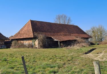
Trail Walking Lessard-en-Bresse - mesnay confiture - Photo
© OpenStreetMap contributors
Length
Length
65 km
Max alt
Max alt
399 m
Uphill gradient
Uphill gradient
971 m
Km-Effort
Km-Effort  
78 km
Min alt
Min alt
179 m
Downhill gradient
Downhill gradient
850 m
Boucle
Boucle
No
Creation date :
2022-03-09 10:23:15.042
Updated on :
2022-03-09 17:32:57.683

(0 Reviews)

Walking
Walking
2h52
Difficulty : Easy

Scan this QR Code to open this trail in the SityTrail application

FREE GPS app for hiking

Logo SityTrail SityTrail

IGN / Geographical institutes

Download SityTrail from the App Store Download SityTrail from Google Play

Logo SityTrail SityTrail World

The world is yours!

Download SityTrail from the App Store Download SityTrail from Google Play Download SityTrail on Huawei AppGallery

About

Trail Walking of 65 km to be discovered at Bourgogne-Franche-Comté, Saône-et-Loire, Lessard-en-Bresse. This trail is proposed by claudia71440.

Description

randonnée confiture

Elevation profile

Photos

Positioning

Country:
France
Region :
Bourgogne-Franche-Comté
Department/Province :
Saône-et-Loire
Municipality :
Lessard-en-Bresse
Location:
Unknown
Start:(UTM)
660846 ; 5179246 (31T) N.

Trails nearby

Trail Hybrid bike Diconne - Les Jacquards  - Photo
Hybrid bike
mallovon

Hybrid bike

Very easy
Diconne, Bourgogne-Franche-Comté, Saône-et-Loire, France
5.6 km | 6.1 km-effort
44min
Yes
Trail On foot Diconne - Diconne , les Lorys , la Foret , le Pioché et retour par la Croix  - Photo
On foot
jeanpaulcheyssac

On foot

Easy
Diconne, Bourgogne-Franche-Comté, Saône-et-Loire, France
6.6 km | 7.3 km-effort
1h 38min
Yes
Trail On foot Diconne - Autour de Diconne par les Gauthey , Taillefer , Diombe et les bois  - Photo
On foot
jeanpaulcheyssac

On foot

Easy
Diconne, Bourgogne-Franche-Comté, Saône-et-Loire, France
9.9 km | 10.9 km-effort
2h 28min
Yes
Trail On foot Diconne - TP - Diconne et autour des étangs . - Photo
On foot
jeanpaulcheyssac

On foot

Easy
Diconne, Bourgogne-Franche-Comté, Saône-et-Loire, France
5.7 km | 6.2 km-effort
1h 24min
Yes
Trail On foot Saint-Martin-en-Bresse - TP la Madeleine , Les Marlins , Bellefond , la grande rue  - Photo
On foot
jeanpaulcheyssac

On foot

Easy
Saint-Martin-en-Bresse, Bourgogne-Franche-Comté, Saône-et-Loire, France
6.8 km | 7.5 km-effort
1h 42min
Yes
Trail On foot Tronchy - P . Tronchy - Les Cottins - La Vendue - Les Vallots - Abbaye des Barres - Le GD Creuilly et retour .  - Photo
On foot
jeanpaulcheyssac

On foot

Easy
Tronchy, Bourgogne-Franche-Comté, Saône-et-Loire, France
9.6 km | 10.9 km-effort
2h 28min
Yes
Trail On foot Tronchy - P . Tronchy - Etang EDF - Le GD Creuilliy- Abbaye des Barres - Les Vallots et retour au Cottins  - Photo
On foot
jeanpaulcheyssac

On foot

Easy
Tronchy, Bourgogne-Franche-Comté, Saône-et-Loire, France
6.9 km | 8 km-effort
1h 48min
Yes
Trail Walking Tronchy - G . Tronchy - Etang Gilet - Les Vallots - Corberan - Le Villey - Les moissons - La Coudre et retour .  - Photo
Walking
jeanpaulcheyssac

Walking

Medium
Tronchy, Bourgogne-Franche-Comté, Saône-et-Loire, France
10.5 km | 11.8 km-effort
2h 40min
Yes
Trail Walking Saint-Martin-en-Bresse - G . La Madeleine - Les Marlins - La Foret - Colnand - Bellefond - et retour  - Photo
Walking
jeanpaulcheyssac

Walking

Difficult
Saint-Martin-en-Bresse, Bourgogne-Franche-Comté, Saône-et-Loire, France
13.4 km | 14.8 km-effort
3h 22min
Yes


Close
My subscriptions