


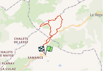

9.7 km | 15.3 km-effort

User GUIDE


FREE GPS app for hiking
 SityTrail
IGN / Geographical institutes
SityTrail World
The world is yours!
Trail Touring skiing of 14.6 km to be discovered at Auvergne-Rhône-Alpes, Upper Savoy, Le Grand-Bornand. This trail is proposed by nadd73.
Départ de Chinallon bout.
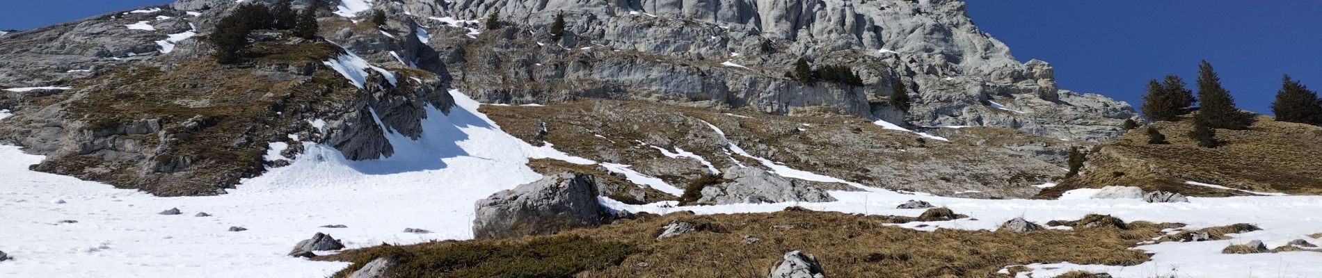
Le couloir de Balafrasse étant gelé, j'ai décidé de monter le couloir de la pointe du midi de descendre le couloir ouest "Cu Deri 35/40° sur 150m".
La traversée en haut pour arriver au col de la Colombière n'étant pas possible (manque de neige), je suis remontée à pied.
Un magnifique tour.


Walking

Walking

Walking

Touring skiing

Touring skiing

Touring skiing

Mountain bike

Mountain bike

Mountain bike