![](/images/other/stat-length.png)
![Trail Walking Villemontais - Villemontais : Chérier et Haut Ste-Agathe - Photo](https://media.geolcdn.com/t/1900/400/43288f42-5353-465e-b07f-32492fc85c11.jpg&format=pjpeg&maxdim=2)
Villemontais : Chérier et Haut Ste-Agathe
Jgar
User
![Length](/images/other/stat-length.png)
![Max alt](https://static1.geolcdn.com/siteimages/upload/files/1508320355ic_sort_altitude_max_24dp.png)
![Uphill gradient](https://static1.geolcdn.com/siteimages/upload/files/1508320355ic_sort_den_pos_24dp.png)
![Km-Effort](/images/other/stat-length.png)
![Min alt](https://static1.geolcdn.com/siteimages/upload/files/1508320355ic_sort_altitude_min_24dp.png)
![Downhill gradient](https://static1.geolcdn.com/siteimages/upload/files/1508320355ic_sort_den_neg_24dp.png)
![Boucle](https://static1.geolcdn.com/siteimages/upload/files/16400158638029165_repeat_loop_refresh_sync_direction_icon.png)
![Walking](https://static1.geolcdn.com/sitytour/trail-icons/101.png)
4h22
Difficulty : Difficult
![Scan this QR Code to open this trail in the SityTrail application](https://capi.geolives.com/qq0zvz2zws4bq2lad0pu/sitytour/trails/3158712/qr.png?size=200)
FREE GPS app for hiking
About
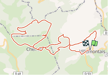
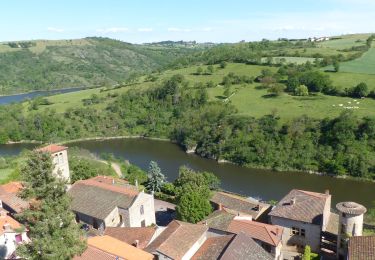
Trail Walking of 15.1 km to be discovered at Auvergne-Rhône-Alpes, Loire, Villemontais. This trail is proposed by Jgar.
Description
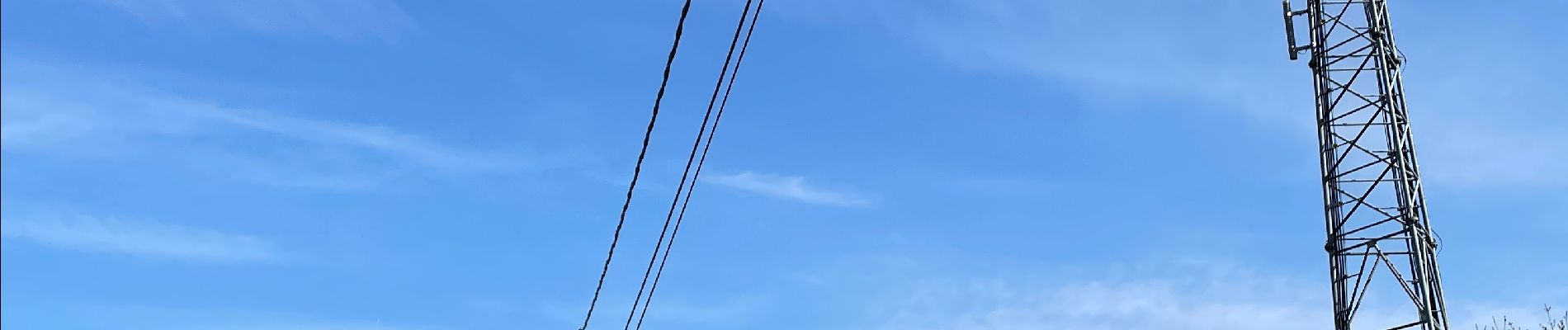
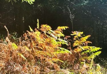
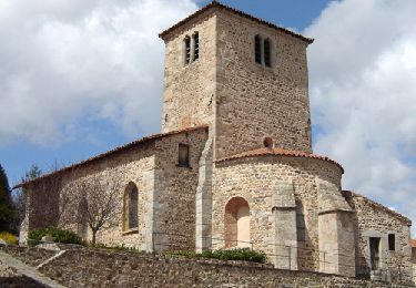
A partir de la mairie, prendre la rue du Parc puis la rue St-Roch pour atteindre le cimetière. Descendre la Pr 23 bleue à gauche. A l'intersection, monter à gauche le chemin de la Côte puis celui des Vignes Vaques. Passer devant 2 antennes (Free à droite et Orange à gauche). A l'orée des bois, tourner à droite pour atteindre un carrefour. A gauche, tourner sur Goutte Rouge. Monter en forêt en suivant une ligne électrique. Aux Fragnes (les frênes), quitter la PR 23 pour rejoindre en face le bourg de Chérier. Tourner à droite le chemin de la Barrière puis celui des Roches de Ste-Agathe. Faire un aller-retour à l'aire de décollage des parapentistes et redescendre à gauche vers le lieu-dit les Roches.
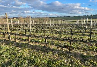
Suivre la PR 34 rouge jusqu'à la cote 706-710. Continuer à l'ouest et traverser la zone dite La Pierre Charbon (probablement à cause des anciens charbonniers) pour remonter par le chemin de Juju à la cote 841. Tourner à gauche pour rejoindre le chemin qui redescend à Chérier. Descendre vers le Poyet et à gauche, vers la croix des Fragnes.
Tourner à droite en suivant la PR 33 rouge. Descendre vers une cabane de Gallochières et tourner à gauche. A l'intersection, descendre à droite en passant au lieu-dit le Bois pour regagner Villemontais.
Positioning
Comments
Trails nearby
![Trail Walking Saint-Jean-Saint-Maurice-sur-Loire - Autour des Gorges de la Loire - PR N° 9 : Sur le pas des pèlerins - Saint-Jean-Saint-Maurice-sur-Loire - Photo](https://media.geolcdn.com/t/375/260/ext.jpg?maxdim=2&url=https%3A%2F%2Fservices.sitytrail.com%2FGeolivesWS%2FDownloadMedia.ashx%3FTrailID%3D215167%26Media%3D15769_6.jpg)
![Walking Walking](https://static1.geolcdn.com/sitytour/trail-icons/101.png)
Walking
![](/images/other/stat-length.png)
![](https://static1.geolcdn.com/siteimages/upload/files/16400158638029165_repeat_loop_refresh_sync_direction_icon.png)
![Trail Walking Saint-Jean-Saint-Maurice-sur-Loire - Saint -Jean Saint -Maurice sur Loire - Photo](https://media.geolcdn.com/t/375/260/1053c594-4557-4a01-9659-5504d28a00d0.jpg&format=jpg&maxdim=2)
![Walking Walking](https://static1.geolcdn.com/sitytour/trail-icons/101.png)
Walking
![](/images/other/stat-length.png)
![](https://static1.geolcdn.com/siteimages/upload/files/16400158638029165_repeat_loop_refresh_sync_direction_icon.png)
![Trail Walking - Randonnée sur les plateaux au dessus du village de Moulins -Chérier - Photo](https://media.geolcdn.com/t/375/260/328a50ea-b5e1-4410-88c7-07bd0b3b435c.jpg&format=jpg&maxdim=2)
![Walking Walking](https://static1.geolcdn.com/sitytour/trail-icons/101.png)
Walking
![](/images/other/stat-length.png)
![](https://static1.geolcdn.com/siteimages/upload/files/16400158638029165_repeat_loop_refresh_sync_direction_icon.png)
![Trail sport Saint-Jean-Saint-Maurice-sur-Loire - Retour bis - Photo](https://media.geolcdn.com/t/375/260/ext.jpg?maxdim=2&url=https%3A%2F%2Fsecurestorage.geolives.com%2Fsitytour%2Ftrail-bg%2Fdefault.jpg)
sport
![](/images/other/stat-length.png)
![](https://static1.geolcdn.com/siteimages/upload/files/16400158638029165_repeat_loop_refresh_sync_direction_icon.png)
![Trail Walking Arcon - Arcon: Roche Corbière-Quatre Murs - Photo](https://media.geolcdn.com/t/375/260/f084a593-c8ab-4485-bad9-4355d9e9f1a8.jpg&format=jpg&maxdim=2)
![Walking Walking](https://static1.geolcdn.com/sitytour/trail-icons/101.png)
Walking
![](/images/other/stat-length.png)
![](https://static1.geolcdn.com/siteimages/upload/files/16400158638029165_repeat_loop_refresh_sync_direction_icon.png)
![Trail Walking Cherier - rando à Moulin Charier - Photo](https://media.geolcdn.com/t/375/260/3886ddf7-94b0-4692-af5c-3d0753f12223.jpg&format=jpg&maxdim=2)
![Walking Walking](https://static1.geolcdn.com/sitytour/trail-icons/101.png)
Walking
![](/images/other/stat-length.png)
![](https://static1.geolcdn.com/siteimages/upload/files/16400158638029165_repeat_loop_refresh_sync_direction_icon.png)
![Trail Walking Ouches - Ouches : de la plaine à la côte roannaise - Photo](https://media.geolcdn.com/t/375/260/6b9e8121-0a01-4791-9e45-beccd7d62b78.jpg&format=jpg&maxdim=2)
![Walking Walking](https://static1.geolcdn.com/sitytour/trail-icons/101.png)
Walking
![](/images/other/stat-length.png)
![](https://static1.geolcdn.com/siteimages/upload/files/16400158638029165_repeat_loop_refresh_sync_direction_icon.png)
![Trail On foot Cherier - Les Moulins Chérier - boucles autour du vieux bourg - Photo](https://media.geolcdn.com/t/375/260/02a5a11d-56eb-4a94-af63-ae9a9466184f.jpg&format=jpg&maxdim=2)
![On foot On foot](https://static1.geolcdn.com/sitytour/trail-icons/100.png)
On foot
![](/images/other/stat-length.png)
![](https://static1.geolcdn.com/siteimages/upload/files/16400158638029165_repeat_loop_refresh_sync_direction_icon.png)
![Trail Walking Saint-Jean-Saint-Maurice-sur-Loire - St Jean-St Maurice 18km - Photo](https://media.geolcdn.com/t/375/260/930956ea-3504-4ab8-b415-5247c26b90ff.jpg&format=jpg&maxdim=2)
![Walking Walking](https://static1.geolcdn.com/sitytour/trail-icons/101.png)
Walking
![](/images/other/stat-length.png)
![](https://static1.geolcdn.com/siteimages/upload/files/16400158638029165_repeat_loop_refresh_sync_direction_icon.png)