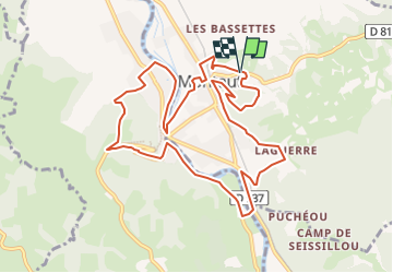
![](/images/other/stat-length.png)
![Trail On foot Montaut - SityTrail - Lestelle Bétharram les Bastides - Photo](https://media.geolcdn.com/t/1900/400/ext.pjpeg?maxdim=2&url=https%3A%2F%2Fstatic1.geolcdn.com%2Fsiteimages%2Fupload%2Ffiles%2F1545311037marcheuse_200dpi.jpg)
SityTrail - Lestelle Bétharram les Bastides
marmotte65
User GUIDE
![Length](/images/other/stat-length.png)
![Max alt](https://static1.geolcdn.com/siteimages/upload/files/1508320355ic_sort_altitude_max_24dp.png)
![Uphill gradient](https://static1.geolcdn.com/siteimages/upload/files/1508320355ic_sort_den_pos_24dp.png)
![Km-Effort](/images/other/stat-length.png)
![Min alt](https://static1.geolcdn.com/siteimages/upload/files/1508320355ic_sort_altitude_min_24dp.png)
![Downhill gradient](https://static1.geolcdn.com/siteimages/upload/files/1508320355ic_sort_den_neg_24dp.png)
![Boucle](https://static1.geolcdn.com/siteimages/upload/files/16400158638029165_repeat_loop_refresh_sync_direction_icon.png)
![On foot](https://static1.geolcdn.com/sitytour/trail-icons/100.png)
3h34
Difficulty : Easy
![Scan this QR Code to open this trail in the SityTrail application](https://capi.geolives.com/qq0zvz2zws4bq2lad0pu/sitytour/trails/3150656/qr.png?size=200)
FREE GPS app for hiking
About
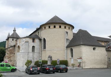
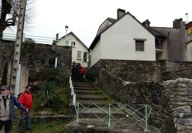
Trail On foot of 11.8 km to be discovered at New Aquitaine, Pyrénées-Atlantiques, Montaut. This trail is proposed by marmotte65.
Description
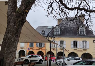
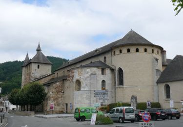
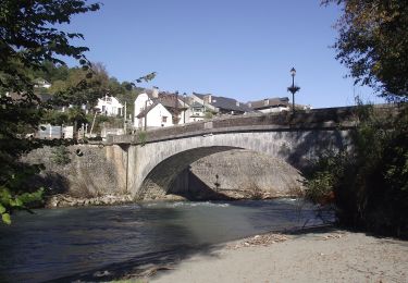
Lestelle Bétharram les Bastides Cette randonnée facile prend de la hauteur en passant sur les collines qui dominent le gave de Pau. Ne manquez pas de faire un détour pour visiter les villages de Lestelle et Montaut qui sont d’anciennes bastides. Téléchargez la Fiche de la randonnée au format pdf!
Positioning
Comments
Trails nearby
![Trail Walking Lestelle-Bétharram - Lestelle les grottes G4 - Photo](https://media.geolcdn.com/t/375/260/7f7b50d2-f2bb-47c5-8f12-711bf0f3d7e6.jpg&format=jpg&maxdim=2)
![Walking Walking](https://static1.geolcdn.com/sitytour/trail-icons/101.png)
Walking
![](/images/other/stat-length.png)
![](https://static1.geolcdn.com/siteimages/upload/files/16400158638029165_repeat_loop_refresh_sync_direction_icon.png)
![Trail On foot Saint-Pé-de-Bigorre - SAINT PE DE BIGORRE Le grand tour de saint pe](https://media.geolcdn.com/t/375/260/d4e35e12-fcd4-45d8-ab2c-c6eef77cd69d.jpg&format=jpg&maxdim=2)
![On foot On foot](https://static1.geolcdn.com/sitytour/trail-icons/100.png)
On foot
![](/images/other/stat-length.png)
![](https://static1.geolcdn.com/siteimages/upload/files/16400158638029165_repeat_loop_refresh_sync_direction_icon.png)
![Trail On foot Saint-Pé-de-Bigorre - Le Plateau du Mousqué - Photo](https://media.geolcdn.com/t/375/260/42583d43-4f8c-4618-a872-ff80c3533f76.jpeg&format=jpg&maxdim=2)
![On foot On foot](https://static1.geolcdn.com/sitytour/trail-icons/100.png)
On foot
![](/images/other/stat-length.png)
![](https://static1.geolcdn.com/siteimages/upload/files/16400158638029165_repeat_loop_refresh_sync_direction_icon.png)
![Trail On foot Saint-Pé-de-Bigorre - Lengous et Montagnou - Photo](https://media.geolcdn.com/t/375/260/3d171576-7edb-45cf-8fd4-ef8c6e3c3bb3.jpeg&format=jpg&maxdim=2)
![On foot On foot](https://static1.geolcdn.com/sitytour/trail-icons/100.png)
On foot
![](/images/other/stat-length.png)
![](https://static1.geolcdn.com/siteimages/upload/files/16400158638029165_repeat_loop_refresh_sync_direction_icon.png)
![Trail On foot Saint-Pé-de-Bigorre - Les Coteaux de Saint-Pé - Photo](https://media.geolcdn.com/t/375/260/a489e4e4-1a5e-4103-b616-7e0cacda4ef5.jpeg&format=jpg&maxdim=2)
![On foot On foot](https://static1.geolcdn.com/sitytour/trail-icons/100.png)
On foot
![](/images/other/stat-length.png)
![](https://static1.geolcdn.com/siteimages/upload/files/16400158638029165_repeat_loop_refresh_sync_direction_icon.png)
![Trail Walking Saint-Pé-de-Bigorre - SAINT PE de BIGORRE et ses côteaux G4 faite avec LPC](https://media.geolcdn.com/t/375/260/80dcc544-2fa3-498d-9bdc-669b61c91573.jpg&format=jpg&maxdim=2)
![Walking Walking](https://static1.geolcdn.com/sitytour/trail-icons/101.png)
Walking
![](/images/other/stat-length.png)
![](https://static1.geolcdn.com/siteimages/upload/files/16400158638029165_repeat_loop_refresh_sync_direction_icon.png)
![Trail Walking Lestelle-Bétharram - 2023 10 10 CHEMIN du PIÉMONT PYRÉNÉEN - 18ème étape : Lestelle-Bétharram - Asson - Bruges - Mifaget - Ste Colome - Arudy - Photo](https://media.geolcdn.com/t/375/260/cf775eff-bc3f-4ffa-8e7c-bf58d3fbf382.jpg&format=jpg&maxdim=2)
![Walking Walking](https://static1.geolcdn.com/sitytour/trail-icons/101.png)
Walking
![](/images/other/stat-length.png)
![](https://static1.geolcdn.com/siteimages/upload/files/16400158638029165_repeat_loop_refresh_sync_direction_icon.png)
![Trail Walking Asson - ASSON Igon Touyas de Capsus](https://media.geolcdn.com/t/375/260/693cb2b3-525d-47a7-bda6-b1f6e19b3dcb.jpg&format=jpg&maxdim=2)
![Walking Walking](https://static1.geolcdn.com/sitytour/trail-icons/101.png)
Walking
![](/images/other/stat-length.png)
![](https://static1.geolcdn.com/siteimages/upload/files/16400158638029165_repeat_loop_refresh_sync_direction_icon.png)
![Trail On foot Saint-Pé-de-Bigorre - Le sentier du Bénac - Photo](https://media.geolcdn.com/t/375/260/3d171576-7edb-45cf-8fd4-ef8c6e3c3bb3.jpeg&format=jpg&maxdim=2)
![On foot On foot](https://static1.geolcdn.com/sitytour/trail-icons/100.png)
On foot
![](/images/other/stat-length.png)
![](https://static1.geolcdn.com/siteimages/upload/files/16400158638029165_repeat_loop_refresh_sync_direction_icon.png)