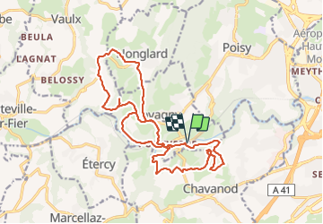
![](/images/other/stat-length.png)
![Trail Walking Lovagny - 28/02/2022 - Gorges du Fier - Nonglard - Lovagny - Chavanod - Photo](https://media.geolcdn.com/t/1900/400/03500606-e21f-4d38-a3f6-549dc5117f26.jpg&format=pjpeg&maxdim=2)
28/02/2022 - Gorges du Fier - Nonglard - Lovagny - Chavanod
Kargil
User GUIDE
![Length](/images/other/stat-length.png)
![Max alt](https://static1.geolcdn.com/siteimages/upload/files/1508320355ic_sort_altitude_max_24dp.png)
![Uphill gradient](https://static1.geolcdn.com/siteimages/upload/files/1508320355ic_sort_den_pos_24dp.png)
![Km-Effort](/images/other/stat-length.png)
![Min alt](https://static1.geolcdn.com/siteimages/upload/files/1508320355ic_sort_altitude_min_24dp.png)
![Downhill gradient](https://static1.geolcdn.com/siteimages/upload/files/1508320355ic_sort_den_neg_24dp.png)
![Boucle](https://static1.geolcdn.com/siteimages/upload/files/16400158638029165_repeat_loop_refresh_sync_direction_icon.png)
![Walking](https://static1.geolcdn.com/sitytour/trail-icons/101.png)
5h11
Difficulty : Medium
![Scan this QR Code to open this trail in the SityTrail application](https://capi.geolives.com/qq0zvz2zws4bq2lad0pu/sitytour/trails/3149756/qr.png?size=200)
FREE GPS app for hiking
About
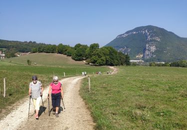
Trail Walking of 20 km to be discovered at Auvergne-Rhône-Alpes, Upper Savoy, Lovagny. This trail is proposed by Kargil.
Description
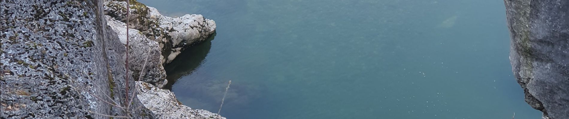
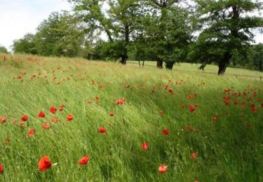
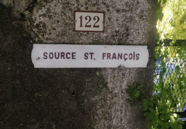
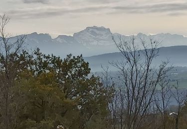
Beaucoup de belles vues, les gorges du Fier, la Tournette et Parmelan sans compter tous le reste, le château de Montrottier.
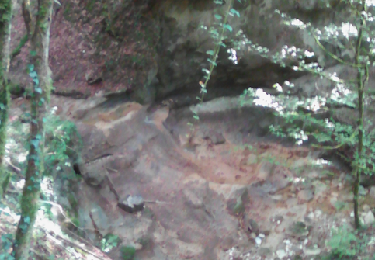
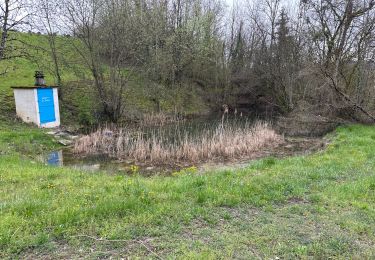
J'ai tenté de passer par le ruisseau des Courbes mais trop d'eau pour rester au sec. Cela doit passer sans problème en été, c'est sauvage et confidentiel.
Positioning
Comments
Trails nearby
![Trail Walking Chavanod - CHAVANOD - Photo](https://media.geolcdn.com/t/375/260/ext.jpg?maxdim=2&url=https%3A%2F%2Fservices.sitytrail.com%2FGeolivesWS%2FDownloadMedia.ashx%3FTrailID%3D642834%26Media%3Dcf99f68d-cd6d-4093-a6f9-aa7a1c09564a.png)
![Walking Walking](https://static1.geolcdn.com/sitytour/trail-icons/101.png)
Walking
![](/images/other/stat-length.png)
![](https://static1.geolcdn.com/siteimages/upload/files/16400158638029165_repeat_loop_refresh_sync_direction_icon.png)
![Trail Mountain bike Marcellaz-Albanais - Site VTT FFC de l'Albanais - Circuit N°4 Bois aux Loups - Marcellaz-Albanais - Photo](https://media.geolcdn.com/t/375/260/ext.jpg?maxdim=2&url=https%3A%2F%2Fservices.sitytrail.com%2FGeolivesWS%2FDownloadMedia.ashx%3FTrailID%3D191600%26Media%3D15236_1.jpg)
![Mountain bike Mountain bike](https://static1.geolcdn.com/sitytour/trail-icons/202.png)
Mountain bike
![](/images/other/stat-length.png)
![](https://static1.geolcdn.com/siteimages/upload/files/16400158638029165_repeat_loop_refresh_sync_direction_icon.png)
![Trail Cycle Annecy - semnoz par quintal - Photo](https://media.geolcdn.com/t/375/260/ext.jpg?maxdim=2&url=https%3A%2F%2Fstatic1.geolcdn.com%2Fsiteimages%2Fupload%2Ffiles%2F1524743154velo.jpg)
![Cycle Cycle](https://static1.geolcdn.com/sitytour/trail-icons/200.png)
Cycle
![](/images/other/stat-length.png)
![](https://static1.geolcdn.com/siteimages/upload/files/16400158638029165_repeat_loop_refresh_sync_direction_icon.png)
![Trail Walking Vaulx - Autour de la commune de Vaulx 74150 - Photo](https://media.geolcdn.com/t/375/260/35bef058-8551-405b-b358-defe586c3f49.jpg&format=jpg&maxdim=2)
![Walking Walking](https://static1.geolcdn.com/sitytour/trail-icons/101.png)
Walking
![](/images/other/stat-length.png)
![](https://static1.geolcdn.com/siteimages/upload/files/16400158638029165_repeat_loop_refresh_sync_direction_icon.png)
![Trail Walking Chavanod - CHAVANOD ... vers Montagny-les-Lanches. - Photo](https://media.geolcdn.com/t/375/260/9cf02be8-0d43-4c97-a143-e34f6de46c37.jpg&format=jpg&maxdim=2)
![Walking Walking](https://static1.geolcdn.com/sitytour/trail-icons/101.png)
Walking
![](/images/other/stat-length.png)
![](https://static1.geolcdn.com/siteimages/upload/files/16400158638029165_repeat_loop_refresh_sync_direction_icon.png)
![Trail Walking Chavanod - CHAVANOD ... les Gorges du Fier. - Photo](https://media.geolcdn.com/t/375/260/b76880dc-3a6b-4b5d-9dee-7a400ed01ca2.jpg&format=jpg&maxdim=2)
![Walking Walking](https://static1.geolcdn.com/sitytour/trail-icons/101.png)
Walking
![](/images/other/stat-length.png)
![](https://static1.geolcdn.com/siteimages/upload/files/16400158638029165_repeat_loop_refresh_sync_direction_icon.png)
![Trail sport Lovagny - 20230411 RANDONNÉE LOVAGNY - Photo](https://media.geolcdn.com/t/375/260/db936043-ccfb-4d87-a656-a3bf3f515ba1.jpg&format=jpg&maxdim=2)
sport
![](/images/other/stat-length.png)
![](https://static1.geolcdn.com/siteimages/upload/files/16400158638029165_repeat_loop_refresh_sync_direction_icon.png)
![Trail Walking Poisy - Marais de poisy, chemin de Poësy et vergers de Macully - Photo](https://media.geolcdn.com/t/375/260/a99db235-e5a5-4581-aa0a-754977e54cbf.jpg&format=jpg&maxdim=2)
![Walking Walking](https://static1.geolcdn.com/sitytour/trail-icons/101.png)
Walking
![](/images/other/stat-length.png)
![](https://static1.geolcdn.com/siteimages/upload/files/16400158638029165_repeat_loop_refresh_sync_direction_icon.png)
![Trail Walking Nonglard - Nonglard - Photo](https://media.geolcdn.com/t/375/260/1114e87f-940a-474b-8007-57d0b40aba43.jpg&format=jpg&maxdim=2)
![Walking Walking](https://static1.geolcdn.com/sitytour/trail-icons/101.png)
Walking
![](/images/other/stat-length.png)
![](https://static1.geolcdn.com/siteimages/upload/files/16400158638029165_repeat_loop_refresh_sync_direction_icon.png)