![](/images/other/stat-length.png)
![Trail On foot Esternay - ESTERNAY : à l'est d'Esternay - Photo](https://media.geolcdn.com/t/1900/400/ef715eb6-5042-4b0c-bba1-ea2151ed1ed2.jpg&format=pjpeg&maxdim=2)
ESTERNAY : à l'est d'Esternay
jeannine grandjean
User
![Length](/images/other/stat-length.png)
![Max alt](https://static1.geolcdn.com/siteimages/upload/files/1508320355ic_sort_altitude_max_24dp.png)
![Uphill gradient](https://static1.geolcdn.com/siteimages/upload/files/1508320355ic_sort_den_pos_24dp.png)
![Km-Effort](/images/other/stat-length.png)
![Min alt](https://static1.geolcdn.com/siteimages/upload/files/1508320355ic_sort_altitude_min_24dp.png)
![Downhill gradient](https://static1.geolcdn.com/siteimages/upload/files/1508320355ic_sort_den_neg_24dp.png)
![Boucle](https://static1.geolcdn.com/siteimages/upload/files/16400158638029165_repeat_loop_refresh_sync_direction_icon.png)
![On foot](https://static1.geolcdn.com/sitytour/trail-icons/100.png)
4h00
Difficulty : Easy
![Scan this QR Code to open this trail in the SityTrail application](https://capi.geolives.com/qq0zvz2zws4bq2lad0pu/sitytour/trails/3148623/qr.png?size=200)
FREE GPS app for hiking
About
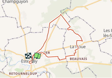
Trail On foot of 15.6 km to be discovered at Grand Est, Marne, Esternay. This trail is proposed by jeannine grandjean.
Description
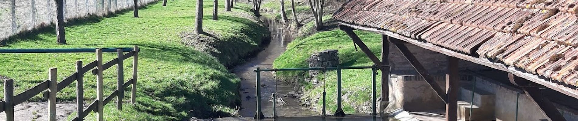
Après un rapide passage au centre de la petite ville, le circuit est varié, d'abord sur l'ancienne voie ferrée, jusqu'à l'orée de la forêt, puis à travers champs et pâtures. Jolis petits villages, lavoirs et nombreuses noues. Ne pas manquer le Château des Granges, Attention ! Le PR au départ du village de la Noue n'existe plus. Aire de pique-nique au bord de l'étang, à l'entrée du village de la Noue.
Positioning
Comments
Trails nearby
![Trail Walking Esternay - Esteray château des GrangesLa Noue - Photo](https://media.geolcdn.com/t/375/260/8f3048d2-3959-4ccd-aa37-79a561427a1d.jpg&format=jpg&maxdim=2)
![Walking Walking](https://static1.geolcdn.com/sitytour/trail-icons/101.png)
Walking
![](/images/other/stat-length.png)
![](https://static1.geolcdn.com/siteimages/upload/files/16400158638029165_repeat_loop_refresh_sync_direction_icon.png)
![Trail On foot Châtillon-sur-Morin - Châtillon sur Morin, la pyramide, Seu - Photo](https://media.geolcdn.com/t/375/260/ext.jpg?maxdim=2&url=https%3A%2F%2Fstatic1.geolcdn.com%2Fsiteimages%2Fupload%2Ffiles%2F1545311037marcheuse_200dpi.jpg)
![On foot On foot](https://static1.geolcdn.com/sitytour/trail-icons/100.png)
On foot
![](/images/other/stat-length.png)
![](https://static1.geolcdn.com/siteimages/upload/files/16400158638029165_repeat_loop_refresh_sync_direction_icon.png)
![Trail Walking Châtillon-sur-Morin - Yves - Photo](https://media.geolcdn.com/t/375/260/ext.jpg?maxdim=2&url=https%3A%2F%2Fstatic1.geolcdn.com%2Fsiteimages%2Fupload%2Ffiles%2F1553511878bg_sport_marche.png)
![Walking Walking](https://static1.geolcdn.com/sitytour/trail-icons/101.png)
Walking
![](/images/other/stat-length.png)
![](https://static1.geolcdn.com/siteimages/upload/files/16400158638029165_repeat_loop_refresh_sync_direction_icon.png)