


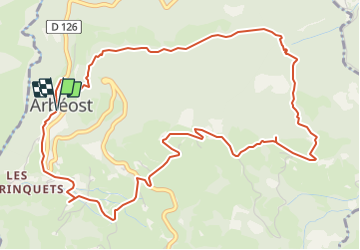

6.7 km | 12.3 km-effort

User GUIDE


FREE GPS app for hiking
 SityTrail
IGN / Geographical institutes
SityTrail World
The world is yours!
Trail Walking of 7.1 km to be discovered at Occitania, Hautespyrenees, Arbéost. This trail is proposed by LouisROGER.
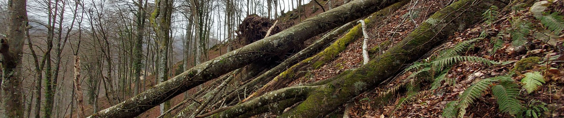
Reconnaissance à refaire. chutes d'arbres et glissements de terrain sur le "chemin des morts"
départ préférable du parking devant la mairie


On foot

Walking

Running


sport

On foot

On foot

Walking
Walking

Walking