Trail Snowshoes École - Bauges col d'Arclusaz - Photo

Bauges col d'Arclusaz

 c.gourme
c.gourme

User

© OpenStreetMap contributors
Length
Length
13.2 km
Max alt
Max alt
1541 m
Uphill gradient
Uphill gradient
800 m
Km-Effort
Km-Effort  
24 km
Min alt
Min alt
810 m
Downhill gradient
Downhill gradient
796 m
Boucle
Boucle
Yes
Creation date :
2022-02-24 08:13:18.0
Updated on :
2022-02-25 07:43:24.52

(0 Reviews)

Snowshoes
Snowshoes
5h37
Difficulty : Difficult

Scan this QR Code to open this trail in the SityTrail application

FREE GPS app for hiking

Logo SityTrail SityTrail

IGN / Geographical institutes

Download SityTrail from the App Store Download SityTrail from Google Play

Logo SityTrail SityTrail World

The world is yours!

Download SityTrail from the App Store Download SityTrail from Google Play Download SityTrail on Huawei AppGallery

About

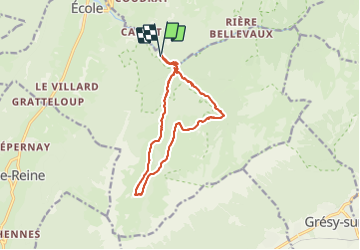
Trail Snowshoes of 13.2 km to be discovered at Auvergne-Rhône-Alpes, Savoy, École. This trail is proposed by c.gourme.

Description

Attention zone d'avalanche au début le long du ruisseau de la Lanche.
On peut aller directement au col en prenant le chemin en sens inverse, c'est plus court. D'ailleurs ds l'autre sens avec H et B ils n'ont pas voulu aller au col !!

Elevation profile

Positioning

Country:
France
Region :
Auvergne-Rhône-Alpes
Department/Province :
Savoy
Municipality :
École
Location:
Unknown
Start:(UTM)
281176 ; 5057770 (32T) N.

Trails nearby

Trail Walking Jarsy - BAUGES: PRECHEREL - CROIX D'ALLANT - PLAN DE LA LIMACE - en direction du Mont de la Coche - Photo
Walking
djeepee74

Walking

Difficult
(1)
Jarsy, Auvergne-Rhône-Alpes, Savoy, France
13.1 km | 24 km-effort
4h 45min
Yes
Trail Walking Doucy-en-Bauges - Traversée du Mont Trélod, 2181m - Photo
Walking
tracegps

Walking

Medium
(1)
Doucy-en-Bauges, Auvergne-Rhône-Alpes, Savoy, France
10.9 km | 28 km-effort
7h 30min
No
Trail Walking Jarsy - parc à moutons  - Photo
Walking
GUIDE
nadd73

Walking

Medium
Jarsy, Auvergne-Rhône-Alpes, Savoy, France
11.3 km | 25 km-effort
6h 0min
No
Trail Walking Aillon-le-Jeune -  Bauges  le Colombier et des crêtes  - Photo
Walking
c.gourme

Walking

Medium
(1)
Aillon-le-Jeune, Auvergne-Rhône-Alpes, Savoy, France
14.2 km | 28 km-effort
5h 35min
Yes
Trail Walking Le Châtelard - Roc poyet - Photo
Walking
GUIDE
nadd73

Walking

Medium
Le Châtelard, Auvergne-Rhône-Alpes, Savoy, France
8.2 km | 19.8 km-effort
5h 6min
Yes
Trail Walking École - Dent et col d'Arclusaz par le col de la cochette - Photo
Walking
GUIDE
nadd73

Walking

Difficult
École, Auvergne-Rhône-Alpes, Savoy, France
15.9 km | 33 km-effort
6h 18min
Yes
Trail Walking Jarsy - col orgeval - Photo
Walking
remy7436

Walking

Easy
(1)
Jarsy, Auvergne-Rhône-Alpes, Savoy, France
11.9 km | 22 km-effort
Unknown
Yes
Trail Walking Jarsy - Croix d'Allant et Plan de la Limace  - Photo
Walking
GuyVachet

Walking

Very difficult
Jarsy, Auvergne-Rhône-Alpes, Savoy, France
14.6 km | 26 km-effort
6h 29min
Yes
Trail Touring skiing École - pointe des Arlicots - Photo
Touring skiing
GUIDE
nadd73

Touring skiing

Medium
École, Auvergne-Rhône-Alpes, Savoy, France
9.2 km | 23 km-effort
4h 56min
No


Close
My subscriptions