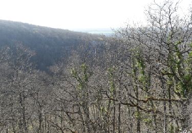
Trail Walking Francheville - Francheville Combe Nonceuil - Photo
 mricard
mricard

User

© OpenStreetMap contributors
Length
Length
18 km
Max alt
Max alt
554 m
Uphill gradient
Uphill gradient
292 m
Km-Effort
Km-Effort  
22 km
Min alt
Min alt
336 m
Downhill gradient
Downhill gradient
292 m
Boucle
Boucle
Yes
Creation date :
2022-02-24 20:21:39.552
Updated on :
2022-02-24 20:41:51.704

(1 Reviews)

Walking
Walking
4h58
Difficulty : Easy

Scan this QR Code to open this trail in the SityTrail application

FREE GPS app for hiking

Logo SityTrail SityTrail

IGN / Geographical institutes

Download SityTrail from the App Store Download SityTrail from Google Play

Logo SityTrail SityTrail World

The world is yours!

Download SityTrail from the App Store Download SityTrail from Google Play Download SityTrail on Huawei AppGallery

About

Trail Walking of 18 km to be discovered at Bourgogne-Franche-Comté, Côte-d'Or, Francheville. This trail is proposed by mricard.

Elevation profile

Positioning

Country:
France
Region :
Bourgogne-Franche-Comté
Department/Province :
Côte-d'Or
Municipality :
Francheville
Location:
Unknown
Start:(UTM)
641832 ; 5257518 (31T) N.

Comments

Please log in to post a review or rate the element


balade simple au fond des bois. un chat sauvage observé mais grand chemin blanc monotone. Alain et Véro


Trails nearby

Trail Walking Val-Suzon - Val Suzon crête et combes près d'Etaule - Photo
Walking
yew

Walking

Medium
Val-Suzon, Bourgogne-Franche-Comté, Côte-d'Or, France
5.3 km | 7.6 km-effort
1h 42min
Yes
Trail On foot Val-Suzon - val suzon francheville curtil - Photo
On foot
mpstoop

On foot

Difficult
Val-Suzon, Bourgogne-Franche-Comté, Côte-d'Or, France
28 km | 38 km-effort
8h 38min
No
Trail On foot Francheville - Francheville Sommiere de Nonceuil - Photo
On foot
mricard

On foot

Easy
Francheville, Bourgogne-Franche-Comté, Côte-d'Or, France
12.1 km | 15.1 km-effort
3h 20min
Yes
Trail Walking Vaux-Saules - ' - Photo
Walking
HARBULOT

Walking

Very easy
Vaux-Saules, Bourgogne-Franche-Comté, Côte-d'Or, France
5.6 km | 6.6 km-effort
2h 52min
No
Trail Walking Curtil-Saint-Seine - Saussy michel - Photo
Walking
jeanyvesjacquetton

Walking

Very difficult
Curtil-Saint-Seine, Bourgogne-Franche-Comté, Côte-d'Or, France
21 km | 27 km-effort
8h 14min
Yes
Trail Walking Val-Suzon - Balade st fou - Photo
Walking
rd21

Walking

Easy
Val-Suzon, Bourgogne-Franche-Comté, Côte-d'Or, France
29 km | 36 km-effort
2h 23min
No
Trail On foot Francheville - Francheville vers Frenois - Photo
On foot
mricard

On foot

Easy
Francheville, Bourgogne-Franche-Comté, Côte-d'Or, France
15.4 km | 19.6 km-effort
4h 27min
Yes
Trail Walking Étaules - val suzon 3 - Photo
Walking
rando-patara

Walking

Very easy
Étaules, Bourgogne-Franche-Comté, Côte-d'Or, France
5.1 km | 6.6 km-effort
1h 36min
Yes
Trail Walking Curtil-Saint-Seine - Tour de Curtil saint Seine - Photo
Walking
patmam

Walking

Curtil-Saint-Seine, Bourgogne-Franche-Comté, Côte-d'Or, France
20 km | 28 km-effort
5h 43min
Yes


Close
My subscriptions