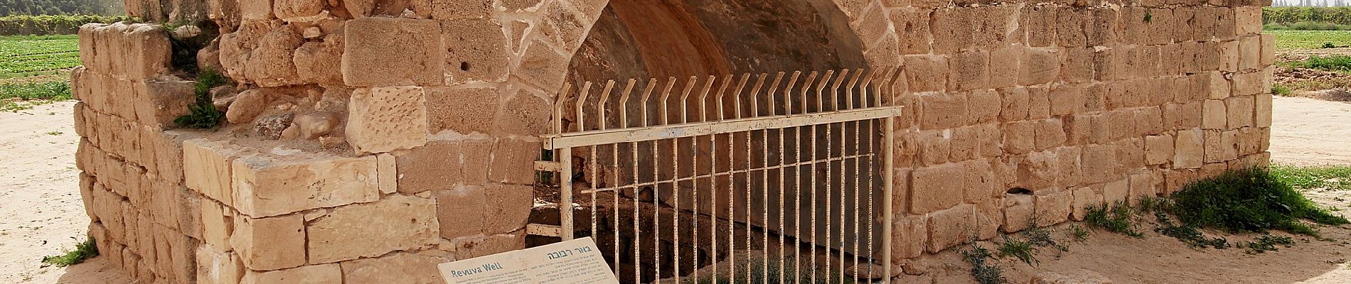
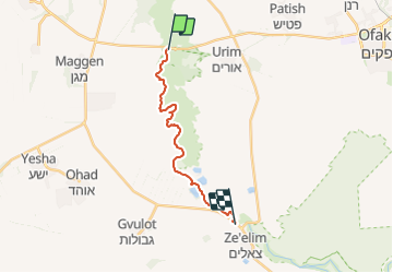
Trail On foot Merhavim Regional Council - נחל הבשור - דרך נוף - Photo

נחל הבשור - דרך נוף

Tous les sentiers balisés d’Europe GUIDE+

© OpenStreetMap contributors
Length
Length
17.8 km
Max alt
Max alt
140 m
Uphill gradient
Uphill gradient
241 m
Km-Effort
Km-Effort  
21 km
Min alt
Min alt
65 m
Downhill gradient
Downhill gradient
178 m
Boucle
Boucle
No
Signpost
Signpost
Creation date :
2022-02-22 08:22:05.821
Updated on :
2022-03-09 05:13:52.466

(0 Reviews)

On foot
On foot
4h43
Difficulty : Medium

Scan this QR Code to open this trail in the SityTrail application

FREE GPS app for hiking

Logo SityTrail SityTrail

IGN / Geographical institutes

Download SityTrail from the App Store Download SityTrail from Google Play

Logo SityTrail SityTrail World

The world is yours!

Download SityTrail from the App Store Download SityTrail from Google Play Download SityTrail on Huawei AppGallery

About

Trail On foot of 17.8 km to be discovered at South District, Unknown, Merhavim Regional Council. This trail is proposed by SityTrail - itinéraires balisés pédestres.

Description

Trail created by itc.


Website: http://www.nelech.co.il/מסלולים/מידע/דרך-נוף-נחל-הבשור

Elevation profile

Photos

Positioning

Country:
Israel
Region :
South District
Department/Province :
Unknown
Municipality :
Merhavim Regional Council
Location:
Unknown
Start:(UTM)
641396 ; 3464895 (36R) N.

Trails nearby


Close
My subscriptions