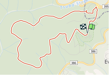

6.7 km | 9.1 km-effort


Tous les sentiers balisés d’Europe GUIDE+


FREE GPS app for hiking
 SityTrail
IGN / Geographical institutes
SityTrail World
The world is yours!
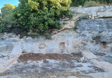
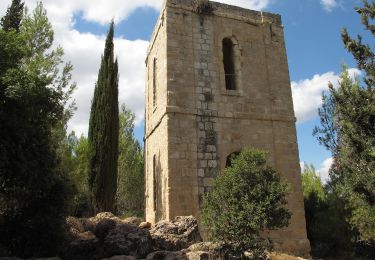
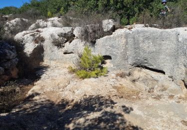
Trail On foot of 7.8 km to be discovered at Jerusalem District. This trail is proposed by SityTrail - itinéraires balisés pédestres.
Trail created by itc.
Website: http://nelech.co.il/2020/04/26/שביל-הר-איתן/


On foot
On foot

On foot

On foot

On foot

On foot