Trail On foot Unknown - Alternative Vestfoldveien - Photo

Alternative Vestfoldveien

Tous les sentiers balisés d’Europe GUIDE+

© OpenStreetMap contributors
Length
Length
22 km
Max alt
Max alt
176 m
Uphill gradient
Uphill gradient
411 m
Km-Effort
Km-Effort  
27 km
Min alt
Min alt
15 m
Downhill gradient
Downhill gradient
297 m
Boucle
Boucle
No
Signpost
Signpost
Creation date :
2022-02-21 11:27:57.603
Updated on :
2022-03-09 04:09:32.697

(0 Reviews)

On foot
On foot
6h05
Difficulty : Medium

Scan this QR Code to open this trail in the SityTrail application

FREE GPS app for hiking

Logo SityTrail SityTrail

IGN / Geographical institutes

Download SityTrail from the App Store Download SityTrail from Google Play

Logo SityTrail SityTrail World

The world is yours!

Download SityTrail from the App Store Download SityTrail from Google Play Download SityTrail on Huawei AppGallery

About

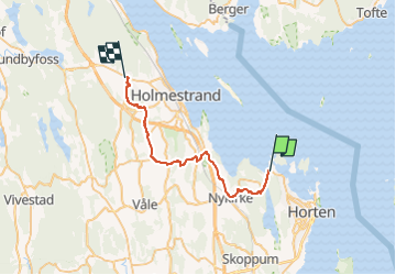
Trail On foot of 22 km to be discovered at Vestfold og Telemark. This trail is proposed by SityTrail - itinéraires balisés pédestres.

Description

Alternative Pilgrimspath from Tunisberg (Tønsberg) to Oslo; mapped to Øverland; from here same route as Gudbrandsdalsleden to Oslo

Symbol: red_cross

Elevation profile

Photos

Positioning

Country:
Norway
Region :
Vestfold og Telemark
Department/Province :
Unknown
Municipality :
Unknown
Location:
Unknown
Start:(UTM)
581299 ; 6590095 (32V) N.

Trails nearby

Trail Camping car  - 2024-05-19 - Photo
Camping car
petole

Camping car

, Vestfold og Telemark, , Norway
81 km | 99 km-effort
1h 19min
No


Close
My subscriptions