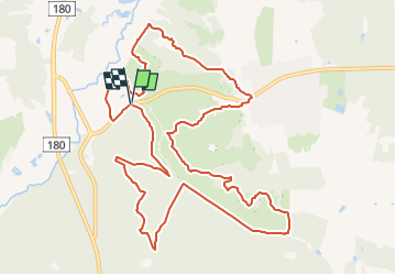
Trail On foot Unknown - Rebild Bakker Ruten - Photo

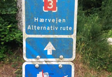
Tous les sentiers balisés d’Europe GUIDE+

© OpenStreetMap contributors
Length
Length
10.7 km
Max alt
Max alt
103 m
Uphill gradient
Uphill gradient
278 m
Km-Effort
Km-Effort  
14.4 km
Min alt
Min alt
7 m
Downhill gradient
Downhill gradient
277 m
Boucle
Boucle
Yes
Signpost
Signpost
Creation date :
2022-02-21 11:10:14.385
Updated on :
2022-03-09 02:10:34.378

(0 Reviews)

On foot
On foot
3h16
Difficulty : Easy

Scan this QR Code to open this trail in the SityTrail application

FREE GPS app for hiking

Logo SityTrail SityTrail

IGN / Geographical institutes

Download SityTrail from the App Store Download SityTrail from Google Play

Logo SityTrail SityTrail World

The world is yours!

Download SityTrail from the App Store Download SityTrail from Google Play Download SityTrail on Huawei AppGallery

About

Trail On foot of 10.7 km to be discovered at North Denmark Region. This trail is proposed by SityTrail - itinéraires balisés pédestres.

Description

Rebild Bakker ruten er en certificeret vandrerute på 10,8 km. Ruten tager dig igennem nogle af de smukkeste områder i Rebild Bakker.

Website: https://www.rebildporten.dk/rebild-bakker-ruten-og-gravlev-aadal-vandring-gdk1096614
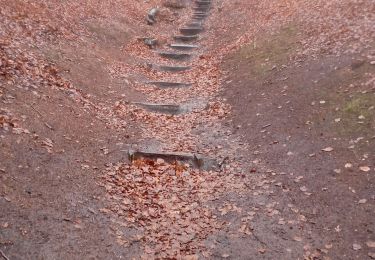
Elevation profile

Photos

Positioning

Country:
Denmark
Region :
North Denmark Region
Department/Province :
Unknown
Municipality :
Unknown
Location:
Unknown
Start:(UTM)
550334 ; 6298961 (32V) N.

Trails nearby

Trail On foot  - Gul - Photo
On foot
GUIDE+

On foot

Easy
, North Denmark Region, , Denmark
4 km | 5.1 km-effort
1h 9min
Yes
Trail Walking  - Tour du lac Rold  - Photo
Walking
etilan

Walking

Very easy
, North Denmark Region, , Denmark
3.9 km | 4.4 km-effort
50min
Yes


Close
My subscriptions