![](/images/other/stat-length.png)
![Trail On foot Öttömös - S Petróczi iskola (AK) - Csongrád megye magaspontja - Öttömös - Photo](https://media.geolcdn.com/t/1900/400/a82c7bfb-4361-4273-b4d7-09b6380ef5d1.jpeg&format=pjpeg&maxdim=2)
S Petróczi iskola (AK) - Csongrád megye magaspontja - Öttömös
SityTrail - itinéraires balisés pédestres
Tous les sentiers balisés d’Europe GUIDE+
![Length](/images/other/stat-length.png)
Length
12.9 km
![Max alt](https://static1.geolcdn.com/siteimages/upload/files/1508320355ic_sort_altitude_max_24dp.png)
Max alt
136 m
![Uphill gradient](https://static1.geolcdn.com/siteimages/upload/files/1508320355ic_sort_den_pos_24dp.png)
Uphill gradient
91 m
![Km-Effort](/images/other/stat-length.png)
Km-Effort
14.2 km
![Min alt](https://static1.geolcdn.com/siteimages/upload/files/1508320355ic_sort_altitude_min_24dp.png)
Min alt
114 m
![Downhill gradient](https://static1.geolcdn.com/siteimages/upload/files/1508320355ic_sort_den_neg_24dp.png)
Downhill gradient
92 m
![Boucle](https://static1.geolcdn.com/siteimages/upload/files/16400158638029165_repeat_loop_refresh_sync_direction_icon.png)
Boucle
No
Signpost
Creation date :
2022-02-21 10:40:41.851
Updated on :
2022-03-08 23:29:26.656
![On foot](https://static1.geolcdn.com/sitytour/trail-icons/100.png)
3h13
Difficulty : Easy
![Scan this QR Code to open this trail in the SityTrail application](https://capi.geolives.com/qq0zvz2zws4bq2lad0pu/sitytour/trails/3139301/qr.png?size=200)
FREE GPS app for hiking
About
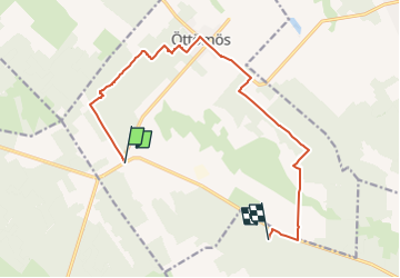
Trail On foot of 12.9 km to be discovered at Great Plain and North, Csongrád-Csanád County, Öttömös. This trail is proposed by SityTrail - itinéraires balisés pédestres.
Description
Trail created by CSMTSZ.
Symbol: Yellow bar on white background
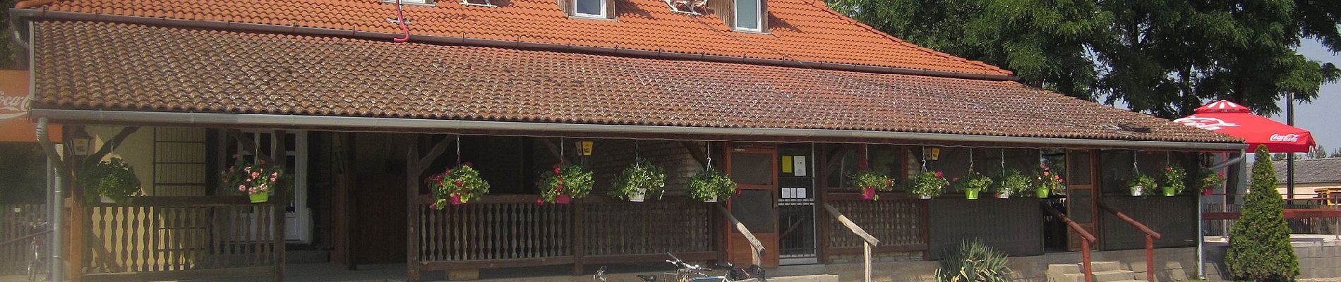
Positioning
Country:
Hungary
Region :
Great Plain and North
Department/Province :
Csongrád-Csanád County
Municipality :
Öttömös
Location:
Unknown
Start:(Dec)
Start:(UTM)
396560 ; 5123303 (34T) N.
Comments
Trails nearby
![Trail On foot Ásotthalom - K+ Back-Kápolna – Ásotthalom - Photo](https://media.geolcdn.com/t/375/260/de4d4e3c-ebf1-4757-a120-635e29f48c49.jpeg&format=jpg&maxdim=2)
![On foot On foot](https://static1.geolcdn.com/sitytour/trail-icons/100.png)
K+ Back-Kápolna – Ásotthalom
On foot
Easy
Ásotthalom,
Great Plain and North,
Csongrád-Csanád County,
Hungary
![](/images/other/stat-length.png)
16.2 km | 17.5 km-effort
3h 58min
![](https://static1.geolcdn.com/siteimages/upload/files/16400158638029165_repeat_loop_refresh_sync_direction_icon.png)
No
![Trail On foot Ásotthalom - K4 AKT - Bűbáj-birtok - Ásotthalmi elágazás am - Photo](https://media.geolcdn.com/t/375/260/ext.jpg?maxdim=2&url=https%3A%2F%2Fstatic1.geolcdn.com%2Fsiteimages%2Fupload%2Ffiles%2F1545311037marcheuse_200dpi.jpg)
![On foot On foot](https://static1.geolcdn.com/sitytour/trail-icons/100.png)
K4 AKT - Bűbáj-birtok - Ásotthalmi elágazás am
On foot
Easy
Ásotthalom,
Great Plain and North,
Csongrád-Csanád County,
Hungary
![](/images/other/stat-length.png)
3.8 km | 4.2 km-effort
56min
![](https://static1.geolcdn.com/siteimages/upload/files/16400158638029165_repeat_loop_refresh_sync_direction_icon.png)
No