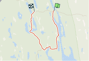
![](/images/other/stat-length.png)
![Trail On foot Unknown - Tresticklaleden - Photo](https://media.geolcdn.com/t/1900/400/3eaa04b4-5413-4a5c-a1f0-2feec1b6a2c5.jpeg&format=pjpeg&maxdim=2)
Tresticklaleden
SityTrail - itinéraires balisés pédestres
Tous les sentiers balisés d’Europe GUIDE+
![Length](/images/other/stat-length.png)
Length
4.3 km
![Max alt](https://static1.geolcdn.com/siteimages/upload/files/1508320355ic_sort_altitude_max_24dp.png)
Max alt
244 m
![Uphill gradient](https://static1.geolcdn.com/siteimages/upload/files/1508320355ic_sort_den_pos_24dp.png)
Uphill gradient
76 m
![Km-Effort](/images/other/stat-length.png)
Km-Effort
5.3 km
![Min alt](https://static1.geolcdn.com/siteimages/upload/files/1508320355ic_sort_altitude_min_24dp.png)
Min alt
211 m
![Downhill gradient](https://static1.geolcdn.com/siteimages/upload/files/1508320355ic_sort_den_neg_24dp.png)
Downhill gradient
56 m
![Boucle](https://static1.geolcdn.com/siteimages/upload/files/16400158638029165_repeat_loop_refresh_sync_direction_icon.png)
Boucle
No
Signpost
Creation date :
2022-02-21 10:38:18.53
Updated on :
2022-03-08 23:06:39.43
![On foot](https://static1.geolcdn.com/sitytour/trail-icons/100.png)
1h11
Difficulty : Easy
![Scan this QR Code to open this trail in the SityTrail application](https://capi.geolives.com/qq0zvz2zws4bq2lad0pu/sitytour/trails/3139170/qr.png?size=200)
FREE GPS app for hiking
About
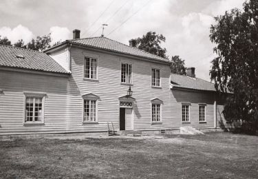
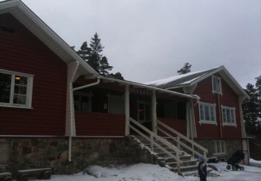
Trail On foot of 4.3 km to be discovered at Västra Götaland County. This trail is proposed by SityTrail - itinéraires balisés pédestres.
Description
Sidan kunde inte hittas, den kan ha flyttats eller tagits bort helt.
Website: https://www.sverigesnationalparker.se/park/tresticklans-nationalpark/upplevelser/tresticklaleden/
Positioning
Country:
Sweden
Region :
Västra Götaland County
Department/Province :
Unknown
Municipality :
Unknown
Location:
Unknown
Start:(Dec)
Start:(UTM)
659004 ; 6548449 (32V) N.
Comments
Trails nearby
![Trail On foot - Bergstien - Photo](https://media.geolcdn.com/t/375/260/6dc4a648-d565-4053-a5e5-7a5e5fcd82b3.jpeg&format=jpg&maxdim=2)
![On foot On foot](https://static1.geolcdn.com/sitytour/trail-icons/100.png)
![Trail On foot - Gul løype (Høiåsmarka) - Photo](https://media.geolcdn.com/t/375/260/fe45cd4e-ec6a-418e-ae3b-83100e30c597.jpeg&format=jpg&maxdim=2)
![On foot On foot](https://static1.geolcdn.com/sitytour/trail-icons/100.png)
![Trail On foot - Olavsleden - Photo](https://media.geolcdn.com/t/375/260/ext.jpg?maxdim=2&url=https%3A%2F%2Fstatic1.geolcdn.com%2Fsiteimages%2Fupload%2Ffiles%2F1545311037marcheuse_200dpi.jpg)
![On foot On foot](https://static1.geolcdn.com/sitytour/trail-icons/100.png)