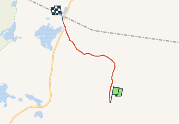
![](/images/other/stat-length.png)
![Trail On foot Unknown - NO-RON68X - Photo](https://media.geolcdn.com/t/1900/400/44138286-017f-4921-906b-c9285aed8456.jpeg&format=pjpeg&maxdim=2)
NO-RON68X
SityTrail - itinéraires balisés pédestres
Tous les sentiers balisés d’Europe GUIDE+
![Length](/images/other/stat-length.png)
Length
4.4 km
![Max alt](https://static1.geolcdn.com/siteimages/upload/files/1508320355ic_sort_altitude_max_24dp.png)
Max alt
1200 m
![Uphill gradient](https://static1.geolcdn.com/siteimages/upload/files/1508320355ic_sort_den_pos_24dp.png)
Uphill gradient
72 m
![Km-Effort](/images/other/stat-length.png)
Km-Effort
5.6 km
![Min alt](https://static1.geolcdn.com/siteimages/upload/files/1508320355ic_sort_altitude_min_24dp.png)
Min alt
1061 m
![Downhill gradient](https://static1.geolcdn.com/siteimages/upload/files/1508320355ic_sort_den_neg_24dp.png)
Downhill gradient
147 m
![Boucle](https://static1.geolcdn.com/siteimages/upload/files/16400158638029165_repeat_loop_refresh_sync_direction_icon.png)
Boucle
No
Signpost
Creation date :
2022-02-21 10:18:51.507
Updated on :
2022-03-08 16:59:22.806
![On foot](https://static1.geolcdn.com/sitytour/trail-icons/100.png)
1h16
Difficulty : Easy
![Scan this QR Code to open this trail in the SityTrail application](https://capi.geolives.com/qq0zvz2zws4bq2lad0pu/sitytour/trails/3137813/qr.png?size=200)
FREE GPS app for hiking
About
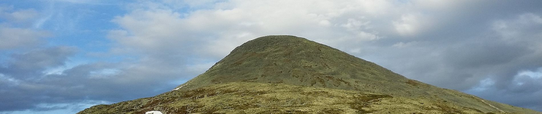
Trail On foot of 4.4 km to be discovered at Innlandet. This trail is proposed by SityTrail - itinéraires balisés pédestres.
Description
Trail created by Den Norske Turistforening.
Website: http://www2.turistforeningen.no/trail.php?tr_code=ron68
Positioning
Country:
Norway
Region :
Innlandet
Department/Province :
Unknown
Municipality :
Unknown
Location:
Unknown
Start:(Dec)
Start:(UTM)
563738 ; 6840912 (32V) N.
Comments