![](/images/other/stat-length.png)
![Trail On foot Alpirsbach - Flößerpfad Kinzigtal: Route Teil 2a - Photo](https://media.geolcdn.com/t/1900/400/ext.pjpeg?maxdim=2&url=https%3A%2F%2Fstatic1.geolcdn.com%2Fsiteimages%2Fupload%2Ffiles%2F1545311037marcheuse_200dpi.jpg)
Flößerpfad Kinzigtal: Route Teil 2a
SityTrail - itinéraires balisés pédestres
Tous les sentiers balisés d’Europe GUIDE+
![Length](/images/other/stat-length.png)
Length
4.5 km
![Max alt](https://static1.geolcdn.com/siteimages/upload/files/1508320355ic_sort_altitude_max_24dp.png)
Max alt
462 m
![Uphill gradient](https://static1.geolcdn.com/siteimages/upload/files/1508320355ic_sort_den_pos_24dp.png)
Uphill gradient
96 m
![Km-Effort](/images/other/stat-length.png)
Km-Effort
5.9 km
![Min alt](https://static1.geolcdn.com/siteimages/upload/files/1508320355ic_sort_altitude_min_24dp.png)
Min alt
385 m
![Downhill gradient](https://static1.geolcdn.com/siteimages/upload/files/1508320355ic_sort_den_neg_24dp.png)
Downhill gradient
144 m
![Boucle](https://static1.geolcdn.com/siteimages/upload/files/16400158638029165_repeat_loop_refresh_sync_direction_icon.png)
Boucle
No
Signpost
Creation date :
2022-02-21 08:28:54.497
Updated on :
2022-02-21 08:28:54.497
![On foot](https://static1.geolcdn.com/sitytour/trail-icons/100.png)
1h20
Difficulty : Easy
![Scan this QR Code to open this trail in the SityTrail application](https://capi.geolives.com/qq0zvz2zws4bq2lad0pu/sitytour/trails/3137318/qr.png?size=200)
FREE GPS app for hiking
About
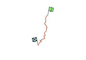
Trail On foot of 4.5 km to be discovered at Baden-Württemberg, Landkreis Freudenstadt, Alpirsbach. This trail is proposed by SityTrail - itinéraires balisés pédestres.
Description
Symbol: Rafter on raft on water (white) on blue background
Positioning
Country:
Germany
Region :
Baden-Württemberg
Department/Province :
Landkreis Freudenstadt
Municipality :
Alpirsbach
Location:
Unknown
Start:(Dec)
Start:(UTM)
455391 ; 5354727 (32U) N.
Comments
Trails nearby
![Trail On foot Schenkenzell - Flößerpfad Kinzigtal: Route Teil 2b - Photo](https://media.geolcdn.com/t/375/260/ext.jpg?maxdim=2&url=https%3A%2F%2Fstatic1.geolcdn.com%2Fsiteimages%2Fupload%2Ffiles%2F1545311037marcheuse_200dpi.jpg)
![On foot On foot](https://static1.geolcdn.com/sitytour/trail-icons/100.png)
Flößerpfad Kinzigtal: Route Teil 2b
On foot
Easy
Schenkenzell,
Baden-Württemberg,
Landkreis Rottweil,
Germany
![](/images/other/stat-length.png)
10.1 km | 12.7 km-effort
2h 53min
![](https://static1.geolcdn.com/siteimages/upload/files/16400158638029165_repeat_loop_refresh_sync_direction_icon.png)
No
![Trail On foot Alpirsbach - Flößerpfad Kinzigtal: Route Teil 1c - Photo](https://media.geolcdn.com/t/375/260/ext.jpg?maxdim=2&url=https%3A%2F%2Fstatic1.geolcdn.com%2Fsiteimages%2Fupload%2Ffiles%2F1545311037marcheuse_200dpi.jpg)
![On foot On foot](https://static1.geolcdn.com/sitytour/trail-icons/100.png)
Flößerpfad Kinzigtal: Route Teil 1c
On foot
Easy
Alpirsbach,
Baden-Württemberg,
Landkreis Freudenstadt,
Germany
![](/images/other/stat-length.png)
4.6 km | 5.7 km-effort
1h 17min
![](https://static1.geolcdn.com/siteimages/upload/files/16400158638029165_repeat_loop_refresh_sync_direction_icon.png)
No
![Trail On foot Schenkenzell - Geologischer Lehrpfad Wittichen - Photo](https://media.geolcdn.com/t/375/260/ext.jpg?maxdim=2&url=https%3A%2F%2Fstatic1.geolcdn.com%2Fsiteimages%2Fupload%2Ffiles%2F1545311037marcheuse_200dpi.jpg)
![On foot On foot](https://static1.geolcdn.com/sitytour/trail-icons/100.png)
Geologischer Lehrpfad Wittichen
On foot
Easy
Schenkenzell,
Baden-Württemberg,
Landkreis Rottweil,
Germany
![](/images/other/stat-length.png)
6.8 km | 10 km-effort
2h 16min
![](https://static1.geolcdn.com/siteimages/upload/files/16400158638029165_repeat_loop_refresh_sync_direction_icon.png)
Yes
![Trail Walking Schenkenzell - JD 16/20 Forêt Noire Kinzig 1 - Photo](https://media.geolcdn.com/t/375/260/ext.jpg?maxdim=2&url=https%3A%2F%2Fstatic1.geolcdn.com%2Fsiteimages%2Fupload%2Ffiles%2F1553511878bg_sport_marche.png)
![Walking Walking](https://static1.geolcdn.com/sitytour/trail-icons/101.png)
JD 16/20 Forêt Noire Kinzig 1
Walking
Schenkenzell,
Baden-Württemberg,
Landkreis Rottweil,
Germany
![](/images/other/stat-length.png)
13.4 km | 19.4 km-effort
3h 42min
![](https://static1.geolcdn.com/siteimages/upload/files/16400158638029165_repeat_loop_refresh_sync_direction_icon.png)
Yes
![Trail Other activity Alpirsbach - alpisbach - Photo](https://media.geolcdn.com/t/375/260/ext.jpg?maxdim=2&url=https%3A%2F%2Fstatic1.geolcdn.com%2Fsiteimages%2Fupload%2Ffiles%2F1545311037marcheuse_200dpi.jpg)
![Other activity Other activity](https://static1.geolcdn.com/sitytour/trail-icons/900.png)
alpisbach
Other activity
Very easy
Alpirsbach,
Baden-Württemberg,
Landkreis Freudenstadt,
Germany
![](/images/other/stat-length.png)
17.4 km | 25 km-effort
3h 51min
![](https://static1.geolcdn.com/siteimages/upload/files/16400158638029165_repeat_loop_refresh_sync_direction_icon.png)
No