![](/images/other/stat-length.png)
![Trail On foot Reutlingen - hochgehwachsen - Photo](https://media.geolcdn.com/t/1900/400/ext.pjpeg?maxdim=2&url=https%3A%2F%2Fstatic1.geolcdn.com%2Fsiteimages%2Fupload%2Ffiles%2F1545311037marcheuse_200dpi.jpg)
hochgehwachsen
SityTrail - itinéraires balisés pédestres
Tous les sentiers balisés d’Europe GUIDE+
![Length](/images/other/stat-length.png)
![Max alt](https://static1.geolcdn.com/siteimages/upload/files/1508320355ic_sort_altitude_max_24dp.png)
![Uphill gradient](https://static1.geolcdn.com/siteimages/upload/files/1508320355ic_sort_den_pos_24dp.png)
![Km-Effort](/images/other/stat-length.png)
![Min alt](https://static1.geolcdn.com/siteimages/upload/files/1508320355ic_sort_altitude_min_24dp.png)
![Downhill gradient](https://static1.geolcdn.com/siteimages/upload/files/1508320355ic_sort_den_neg_24dp.png)
![Boucle](https://static1.geolcdn.com/siteimages/upload/files/16400158638029165_repeat_loop_refresh_sync_direction_icon.png)
![On foot](https://static1.geolcdn.com/sitytour/trail-icons/100.png)
1h32
Difficulty : Easy
![Scan this QR Code to open this trail in the SityTrail application](https://capi.geolives.com/qq0zvz2zws4bq2lad0pu/sitytour/trails/3137274/qr.png?size=200)
FREE GPS app for hiking
About
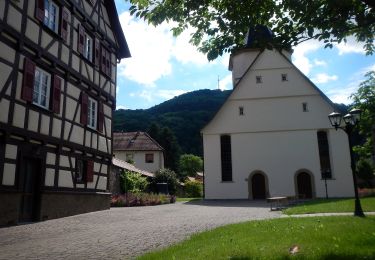
Trail On foot of 5.4 km to be discovered at Baden-Württemberg, Landkreis Reutlingen, Reutlingen. This trail is proposed by SityTrail - itinéraires balisés pédestres.
Description
Wandern Schwäbische Alb: Wanderwege, Wandertouren, Premiumwanderwege, Rundwanderwege, Genusswandern, Natur erleben, Kurze Auszeit, Wandern mit Kindern
Website: https://hochgehberge.de
Positioning
Comments
Trails nearby
![Trail On foot Reutlingen - blaue Gabel Reutlingen Bhf - Maienwald - Bongertwasen - Metzingen - Photo](https://media.geolcdn.com/t/375/260/48ee30b4-4bb1-4e45-8a38-e7eef88c9925.jpeg&format=jpg&maxdim=2)
![On foot On foot](https://static1.geolcdn.com/sitytour/trail-icons/100.png)
On foot
![](/images/other/stat-length.png)
![](https://static1.geolcdn.com/siteimages/upload/files/16400158638029165_repeat_loop_refresh_sync_direction_icon.png)
![Trail On foot Reutlingen - Gönningen-Hochwiesen Pfullinger Berg - Photo](https://media.geolcdn.com/t/375/260/d39dd07d-14c9-4b95-94d1-8bcb82828149.jpeg&format=jpg&maxdim=2)
![On foot On foot](https://static1.geolcdn.com/sitytour/trail-icons/100.png)
On foot
![](/images/other/stat-length.png)
![](https://static1.geolcdn.com/siteimages/upload/files/16400158638029165_repeat_loop_refresh_sync_direction_icon.png)
![Trail On foot Gomadingen - Pfullinger Sagenweg - Photo](https://media.geolcdn.com/t/375/260/09c1b2dd-2a43-485c-bf10-a3441be2fbb3.jpeg&format=jpg&maxdim=2)
![On foot On foot](https://static1.geolcdn.com/sitytour/trail-icons/100.png)
On foot
![](/images/other/stat-length.png)
![](https://static1.geolcdn.com/siteimages/upload/files/16400158638029165_repeat_loop_refresh_sync_direction_icon.png)
![Trail On foot Eningen unter Achalm - Panoramaweg »Rund um Eningen« - Photo](https://media.geolcdn.com/t/375/260/6948c8bf-c99c-49b4-a0b0-7f37ea99bd9f.jpeg&format=jpg&maxdim=2)
![On foot On foot](https://static1.geolcdn.com/sitytour/trail-icons/100.png)
On foot
![](/images/other/stat-length.png)
![](https://static1.geolcdn.com/siteimages/upload/files/16400158638029165_repeat_loop_refresh_sync_direction_icon.png)
![Trail On foot Pfullingen - Pfullingen-Breitenbach - Photo](https://media.geolcdn.com/t/375/260/c4deaad0-02cd-4afe-928f-cf7818d2f9bf.jpeg&format=jpg&maxdim=2)
![On foot On foot](https://static1.geolcdn.com/sitytour/trail-icons/100.png)
On foot
![](/images/other/stat-length.png)
![](https://static1.geolcdn.com/siteimages/upload/files/16400158638029165_repeat_loop_refresh_sync_direction_icon.png)
![Trail On foot Lichtenstein - Oberhausen-Nebelhöhle - Photo](https://media.geolcdn.com/t/375/260/bc5f63ba-3d50-4901-aa42-e160467fb0b1.jpeg&format=jpg&maxdim=2)
![On foot On foot](https://static1.geolcdn.com/sitytour/trail-icons/100.png)
On foot
![](/images/other/stat-length.png)
![](https://static1.geolcdn.com/siteimages/upload/files/16400158638029165_repeat_loop_refresh_sync_direction_icon.png)
![Trail On foot Lichtenstein - Unterhausen-Schoenberg - Photo](https://media.geolcdn.com/t/375/260/4faa2ed2-adf2-483e-9137-e78d433d643b.jpeg&format=jpg&maxdim=2)
![On foot On foot](https://static1.geolcdn.com/sitytour/trail-icons/100.png)
On foot
![](/images/other/stat-length.png)
![](https://static1.geolcdn.com/siteimages/upload/files/16400158638029165_repeat_loop_refresh_sync_direction_icon.png)
![Trail On foot Reutlingen - Betzingen-Breitenbach-Ruoffseck - Photo](https://media.geolcdn.com/t/375/260/c5d8f6cb-12ab-4efd-94ef-eba08f6e7146.jpeg&format=jpg&maxdim=2)
![On foot On foot](https://static1.geolcdn.com/sitytour/trail-icons/100.png)
On foot
![](/images/other/stat-length.png)
![](https://static1.geolcdn.com/siteimages/upload/files/16400158638029165_repeat_loop_refresh_sync_direction_icon.png)
![Trail On foot Wannweil - Rund um Wannweil - Photo](https://media.geolcdn.com/t/375/260/c5d8f6cb-12ab-4efd-94ef-eba08f6e7146.jpeg&format=jpg&maxdim=2)
![On foot On foot](https://static1.geolcdn.com/sitytour/trail-icons/100.png)
On foot
![](/images/other/stat-length.png)
![](https://static1.geolcdn.com/siteimages/upload/files/16400158638029165_repeat_loop_refresh_sync_direction_icon.png)