


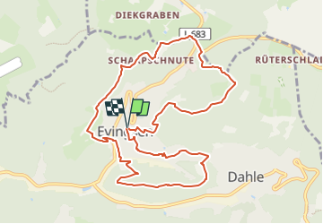

16.6 km | 24 km-effort


Tous les sentiers balisés d’Europe GUIDE+


FREE GPS app for hiking
 SityTrail
IGN / Geographical institutes
SityTrail World
The world is yours!
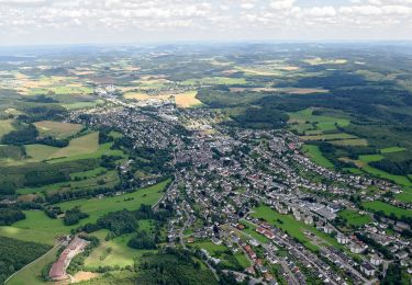
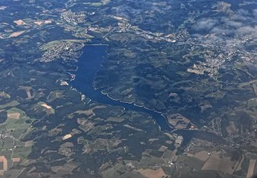
Trail On foot of 10.1 km to be discovered at North Rhine-Westphalia, Märkischer Kreis, Altena. This trail is proposed by SityTrail - itinéraires balisés pédestres.
Trail created by Sauerländischer Gebirgsverein (SGV).
![Trail On foot Altena - [-] Oberhalb der Nette - Photo](https://media.geolcdn.com/t/375/260/19ece288-5282-46fa-9081-4f184482635d.jpeg&format=jpg&maxdim=2)
On foot
![Trail On foot Altena - [Quadrat] Selve-Weg - Photo](https://media.geolcdn.com/t/375/260/74410322-3dfd-4fe7-8aae-7e51b37f7b3a.jpeg&format=jpg&maxdim=2)
On foot
![Trail On foot Altena - [A1] Am Schwarzenstein - Photo](https://media.geolcdn.com/t/375/260/4104e1fa-73a0-495c-b42d-1a5934faf322.jpeg&format=jpg&maxdim=2)
On foot
On foot
![Trail On foot Altena - [A2] Um den Tiergarten - Photo](https://media.geolcdn.com/t/375/260/ac541118-8fb3-4eda-991b-ceab80b85a33.jpeg&format=jpg&maxdim=2)
On foot
On foot
On foot
On foot
On foot