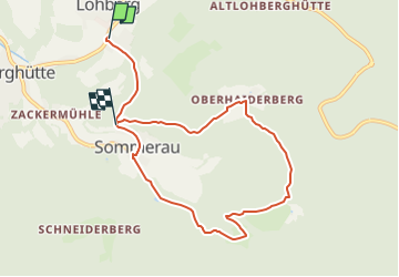
Trail On foot Unknown - Lo 4 Postbotensteig (Lohberg) - Photo

Lo 4 Postbotensteig (Lohberg)

Tous les sentiers balisés d’Europe PRO

© OpenStreetMap contributors
Length
Length
7.6 km
Max alt
Max alt
893 m
Uphill gradient
Uphill gradient
313 m
Km-Effort
Km-Effort  
11.6 km
Min alt
Min alt
643 m
Downhill gradient
Downhill gradient
253 m
Boucle
Boucle
No
Signpost
Signpost
Creation date :
2022-02-21 08:18:32.227
Updated on :
2022-02-21 08:18:32.227

(0 Reviews)

On foot
On foot
2h38
Difficulty : Easy

Scan this QR Code to open this trail in the SityTrail application

FREE GPS app for hiking

Logo SityTrail SityTrail

IGN / Geographical institutes

Download SityTrail from the App Store Download SityTrail from Google Play

Logo SityTrail SityTrail World

The world is yours!

Download SityTrail from the App Store Download SityTrail from Google Play Download SityTrail on Huawei AppGallery

About

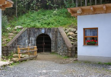
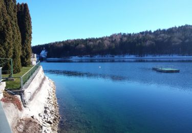
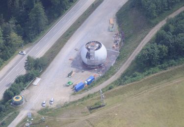
Trail On foot of 7.6 km to be discovered at Bavaria, Landkreis Cham. This trail is proposed by SityTrail - itinéraires balisés pédestres.

Description

Trail created by Naturpark Oberer Bayerischer Wald.

Symbol: Auf oben weißem / unten rotem, rechteckigem Hintergrund in schwarz die Wegnummer

Positioning

Country:
Germany
Region :
Bavaria
Department/Province :
Landkreis Cham
Municipality :
Unknown
Location:
Unknown
Start:(UTM)
361971 ; 5448416 (33U) N.

Trails nearby

Trail On foot Lam - LP Lamer Panoramaweg - Photo
On foot
PRO

On foot

Easy
Lam, Bavaria, Landkreis Cham, Germany
5 km | 7.4 km-effort
1h 41min
No
Trail On foot  - Lo 1 Osserpfad (Lohberg) - Photo
On foot
PRO

On foot

Easy
, Bavaria, Landkreis Cham, Germany
4.6 km | 10.7 km-effort
2h 25min
No
Trail On foot  - Lo 7 Schwarzecker Rundweg (Lohberg) - Photo
On foot
PRO

On foot

Easy
, Bavaria, Landkreis Cham, Germany
4.7 km | 6.5 km-effort
1h 28min
No
Trail On foot Lohberg - Lo 3 Lohberg - Erlebnispfad Brennes - kleiner Arbersee - Photo
On foot
PRO

On foot

Easy
Lohberg, Bavaria, Landkreis Cham, Germany
6.4 km | 11.5 km-effort
2h 37min
No
Trail On foot Bayerisch Eisenstein - Wanderweg 9 - Photo
On foot
PRO

On foot

Easy
Bayerisch Eisenstein, Bavaria, Landkreis Regen, Germany
3.3 km | 6.5 km-effort
1h 29min
No
Trail On foot Drachselsried - 4 Schareben-Drachselsried - Photo
On foot
PRO

On foot

Easy
Drachselsried, Bavaria, Landkreis Regen, Germany
3.2 km | 4.5 km-effort
1h 1min
No
Trail On foot  - Lo 2 Osserhochstraße (Lohberg) - Photo
On foot
PRO

On foot

Easy
, Bavaria, Landkreis Cham, Germany
7.1 km | 11 km-effort
2h 30min
No
Trail On foot Arnbruck - L 6 Lam
On foot
PRO

On foot

Easy
Arnbruck, Bavaria, Landkreis Regen, Germany
3.5 km | 4.9 km-effort
1h 6min
No
Trail On foot Drachselsried - Rundwanderweg 10 Schareben - Reischflecksattel - Photo
On foot
PRO

On foot

Easy
Drachselsried, Bavaria, Landkreis Regen, Germany
3.2 km | 5.1 km-effort
1h 10min
Yes


Close
My subscriptions