Trail On foot Goldisthal - Goldpfad - Photo

Tous les sentiers balisés d’Europe GUIDE+

© OpenStreetMap contributors
Length
Length
28 km
Max alt
Max alt
818 m
Uphill gradient
Uphill gradient
644 m
Km-Effort
Km-Effort  
37 km
Min alt
Min alt
411 m
Downhill gradient
Downhill gradient
799 m
Boucle
Boucle
No
Signpost
Signpost
Creation date :
2022-02-21 08:14:28.748
Updated on :
2022-02-21 08:14:28.748

(0 Reviews)

On foot
On foot
8h24
Difficulty : Difficult

Scan this QR Code to open this trail in the SityTrail application

FREE GPS app for hiking

Logo SityTrail SityTrail

IGN / Geographical institutes

Download SityTrail from the App Store Download SityTrail from Google Play

Logo SityTrail SityTrail World

The world is yours!

Download SityTrail from the App Store Download SityTrail from Google Play Download SityTrail on Huawei AppGallery

About

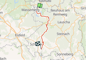
Trail On foot of 28 km to be discovered at Thuringia, Landkreis Sonneberg, Goldisthal. This trail is proposed by SityTrail - itinéraires balisés pédestres.

Description

Symbol: Goldsäckchen auf rotem Grund; als Symbol im Renderer ectl. gelbes G auf rotem Grund

Elevation profile

Positioning

Country:
Germany
Region :
Thuringia
Department/Province :
Landkreis Sonneberg
Municipality :
Goldisthal
Location:
Unknown
Start:(UTM)
642174 ; 5597982 (32U) N.

Trails nearby

Trail On foot Goldisthal - Talsperrenrundweg - Photo
On foot
GUIDE+

On foot

Easy
Goldisthal, Thuringia, Landkreis Sonneberg, Germany
6.3 km | 9.6 km-effort
2h 10min
No
Trail On foot Neuhaus am Rennweg - Sagen-& Märchenpfad - Photo
On foot
GUIDE+

On foot

Easy
Neuhaus am Rennweg, Thuringia, Landkreis Sonneberg, Germany
9.6 km | 13.1 km-effort
2h 59min
Yes
Trail On foot Neuhaus am Rennweg - Wissens- und Spielewanderweg - Photo
On foot
GUIDE+

On foot

Easy
Neuhaus am Rennweg, Thuringia, Landkreis Sonneberg, Germany
4.9 km | 6.3 km-effort
1h 25min
Yes


Close
My subscriptions