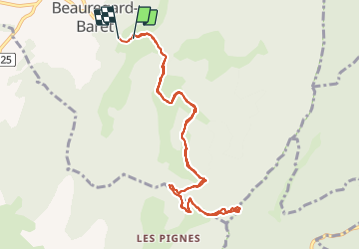
![](/images/other/stat-length.png)
![Trail Walking Beauregard-Baret - Pas de la pierre par le Col des Tourniers - Photo](https://media.geolcdn.com/t/1900/400/52294e58-e9d6-4383-99f3-e61f7e4bc941.jpg&format=pjpeg&maxdim=2)
Pas de la pierre par le Col des Tourniers
Noiraude
User
![Length](/images/other/stat-length.png)
![Max alt](https://static1.geolcdn.com/siteimages/upload/files/1508320355ic_sort_altitude_max_24dp.png)
![Uphill gradient](https://static1.geolcdn.com/siteimages/upload/files/1508320355ic_sort_den_pos_24dp.png)
![Km-Effort](/images/other/stat-length.png)
![Min alt](https://static1.geolcdn.com/siteimages/upload/files/1508320355ic_sort_altitude_min_24dp.png)
![Downhill gradient](https://static1.geolcdn.com/siteimages/upload/files/1508320355ic_sort_den_neg_24dp.png)
![Boucle](https://static1.geolcdn.com/siteimages/upload/files/16400158638029165_repeat_loop_refresh_sync_direction_icon.png)
![Walking](https://static1.geolcdn.com/sitytour/trail-icons/101.png)
3h22
Difficulty : Difficult
![Scan this QR Code to open this trail in the SityTrail application](https://capi.geolives.com/qq0zvz2zws4bq2lad0pu/sitytour/trails/3136073/qr.png?size=200)
FREE GPS app for hiking
About
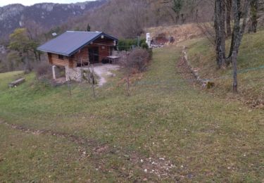
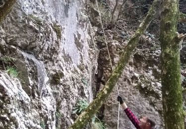
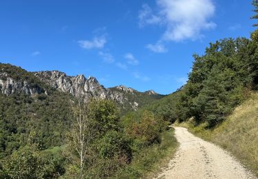
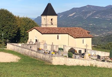
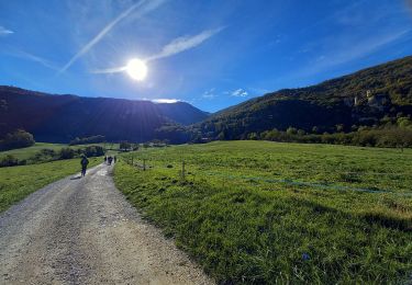
Trail Walking of 11.1 km to be discovered at Auvergne-Rhône-Alpes, Drôme, Beauregard-Baret. This trail is proposed by Noiraude.
Description
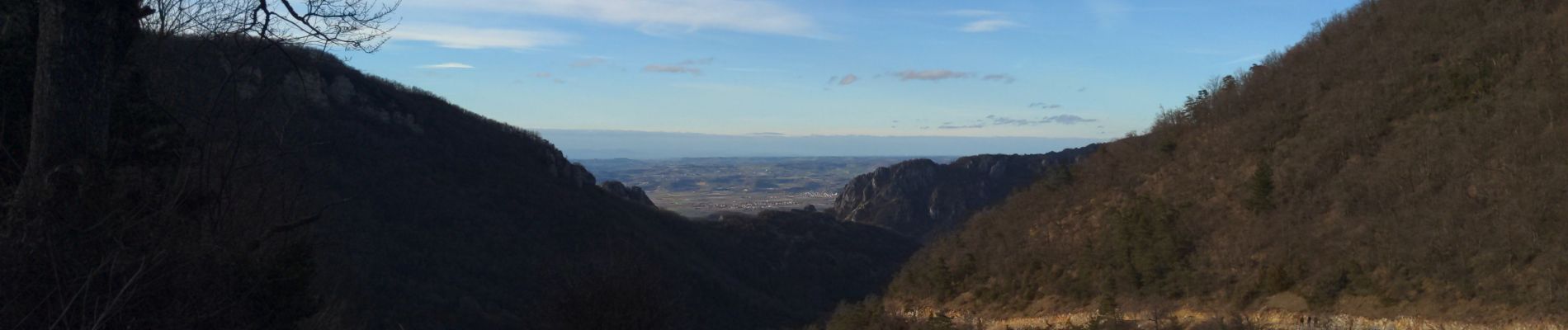
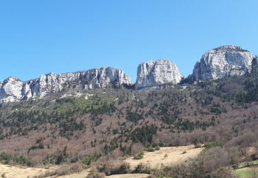
Belle randonnée avec de très beaux panoramas malgré la proximité de la plaine.
Une première partie très facile mais un dernier kilomètre bien raide (300m de dénivelé sur les derniers 800m).
A faire de préférence par temps sec, les chemins sont plutot terreux et doivent être gras par temps humide.
Positioning
Comments
Trails nearby
![Trail Walking Beauregard-Baret - Pré de Cinq Sous - Beauregard Baret - Photo](https://media.geolcdn.com/t/375/260/ext.jpg?maxdim=2&url=https%3A%2F%2Fservices.sitytrail.com%2FGeolivesWS%2FDownloadMedia.ashx%3FTrailID%3D214828%26Media%3D15342_3.jpg)
![Walking Walking](https://static1.geolcdn.com/sitytour/trail-icons/101.png)
Walking
![](/images/other/stat-length.png)
![](https://static1.geolcdn.com/siteimages/upload/files/16400158638029165_repeat_loop_refresh_sync_direction_icon.png)
![Trail Walking Rochefort-Samson - Les Vachères - Combe d'oyans - Photo](https://media.geolcdn.com/t/375/260/b496d0d5-f9c5-4087-8105-422c092be197.jpg&format=jpg&maxdim=2)
![Walking Walking](https://static1.geolcdn.com/sitytour/trail-icons/101.png)
Walking
![](/images/other/stat-length.png)
![](https://static1.geolcdn.com/siteimages/upload/files/16400158638029165_repeat_loop_refresh_sync_direction_icon.png)
![Trail Walking Beauregard-Baret - reco cx st Gervais b baret - Photo](https://media.geolcdn.com/t/375/260/62f4b6af-f36d-4d7e-9bf7-cff82879ff65.jpg&format=jpg&maxdim=2)
![Walking Walking](https://static1.geolcdn.com/sitytour/trail-icons/101.png)
Walking
![](/images/other/stat-length.png)
![](https://static1.geolcdn.com/siteimages/upload/files/16400158638029165_repeat_loop_refresh_sync_direction_icon.png)
![Trail Walking Beauregard-Baret - croix st Gervais et Pas du loup - Photo](https://media.geolcdn.com/t/375/260/31db5131-e481-415d-9c06-0a841965de22.jpg&format=jpg&maxdim=2)
![Walking Walking](https://static1.geolcdn.com/sitytour/trail-icons/101.png)
Walking
![](/images/other/stat-length.png)
![](https://static1.geolcdn.com/siteimages/upload/files/16400158638029165_repeat_loop_refresh_sync_direction_icon.png)
![Trail Walking Barbières - 26 pierre chauve barbieres zel - Photo](https://media.geolcdn.com/t/375/260/92caf138-cce3-4645-835e-f3491e5ff577.jpg&format=jpg&maxdim=2)
![Walking Walking](https://static1.geolcdn.com/sitytour/trail-icons/101.png)
Walking
![](/images/other/stat-length.png)
![](https://static1.geolcdn.com/siteimages/upload/files/16400158638029165_repeat_loop_refresh_sync_direction_icon.png)
![Trail sport Beauregard-Baret - Pierre rousse pas de pourceau l’eau basse - Photo](https://media.geolcdn.com/t/375/260/8f7985a7-111f-4318-9d67-55ef317841a8.jpg&format=jpg&maxdim=2)
sport
![](/images/other/stat-length.png)
![](https://static1.geolcdn.com/siteimages/upload/files/16400158638029165_repeat_loop_refresh_sync_direction_icon.png)
![Trail Walking Barbières - Traversée Barbières Beauregard-Baret - Photo](https://media.geolcdn.com/t/375/260/2a3121e4-a036-4b19-8247-21a832e98ad8.jpg&format=jpg&maxdim=2)
![Walking Walking](https://static1.geolcdn.com/sitytour/trail-icons/101.png)
Walking
![](/images/other/stat-length.png)
![](https://static1.geolcdn.com/siteimages/upload/files/16400158638029165_repeat_loop_refresh_sync_direction_icon.png)
![Trail Walking Rochechinard - Rochechinard la Ragnole les Berthonettes - Photo](https://media.geolcdn.com/t/375/260/eb114973-ed3b-48be-acc9-8ba47652e0e1.jpg&format=jpg&maxdim=2)
![Walking Walking](https://static1.geolcdn.com/sitytour/trail-icons/101.png)
Walking
![](/images/other/stat-length.png)
![](https://static1.geolcdn.com/siteimages/upload/files/16400158638029165_repeat_loop_refresh_sync_direction_icon.png)
![Trail Walking Rochechinard - Chateau de Rochechinard - Photo](https://media.geolcdn.com/t/375/260/437f04f8-c584-4410-9de2-2a66f532620f.jpg&format=jpg&maxdim=2)
![Walking Walking](https://static1.geolcdn.com/sitytour/trail-icons/101.png)
Walking
![](/images/other/stat-length.png)
![](https://static1.geolcdn.com/siteimages/upload/files/16400158638029165_repeat_loop_refresh_sync_direction_icon.png)