


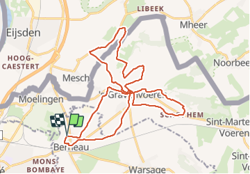

10.9 km | 12.6 km-effort

User


FREE GPS app for hiking
 SityTrail
IGN / Geographical institutes
SityTrail World
The world is yours!
Trail Walking of 21 km to be discovered at Wallonia, Liège, Dalhem. This trail is proposed by jeangulu.
Point de départ : Centre Culturel " Al Vile Cinse " - Rue des Trixhes, 63 - 4607 BERNEAU.
Organisateur : LG 183 - AL VILE CINSE DE BERNEAU.
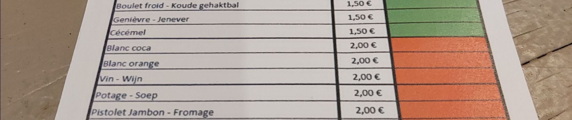
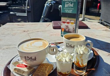
Très belle randonnée avec le beau temps parcours campagnard à refaire


Walking

Walking

Walking

Walking

Walking

Walking
Walking

Walking

Walking