


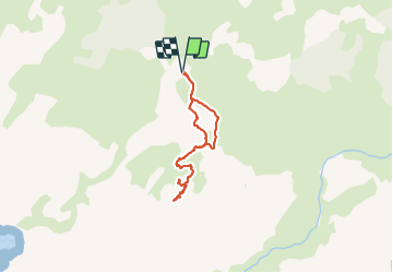

4.4 km | 6.8 km-effort


User


FREE GPS app for hiking
 SityTrail
IGN / Geographical institutes
SityTrail World
The world is yours!
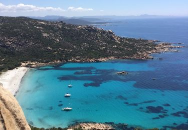
Trail Walking of 6.8 km to be discovered at Corsica, South Corsica, Sartène. This trail is proposed by philippenl.
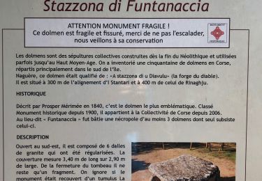
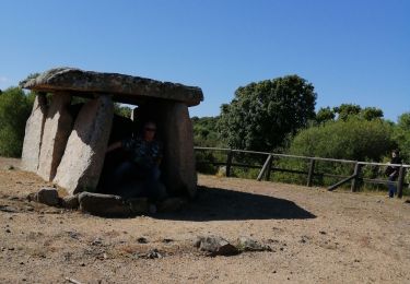
Depuis le plateau de Cauria, le tracé passe par les alignements de Stantari et de Renaju puis le dolmen de Fontanaccia. Il aboutit au nid d'aigle du castellu de la Punta di u Grecu, occupé sans interruption du néolithique au 18e siècle. Pour aboutir au plateau sommital et ses restes de constructions ainsi qu'au bel oriu qui servait d'abri, prévoir éventuellement une corde mais ce n'est pas obligatoire.
Walking

Walking
Walking
Walking
Walking
Walking
Walking
Walking
Walking