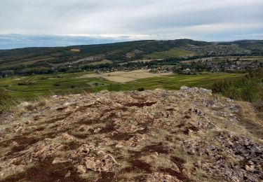
14.3 km | 19.4 km-effort
aluze corrigé
patourad
User
Length
12.7 km
Max alt
422 m
Uphill gradient
328 m
Km-Effort
17.1 km
Min alt
260 m
Downhill gradient
327 m
Boucle
Yes
Creation date :
2022-02-18 17:00:13.532
Updated on :
2022-02-18 17:01:15.332
3h52
Difficulty : Difficult
FREE GPS app for hiking
About
Trail Walking of 12.7 km to be discovered at Bourgogne-Franche-Comté, Saône-et-Loire, Aluze. This trail is proposed by patourad.
Description
randonnée
Positioning
Country:
France
Region :
Bourgogne-Franche-Comté
Department/Province :
Saône-et-Loire
Municipality :
Aluze
Location:
Unknown
Start:(Dec)
Start:(UTM)
628727 ; 5190017 (31T) N.
Comments
Trails nearby
SityTrail - G2 mellecey
Walking
Very difficult
(1)
Mellecey,
Bourgogne-Franche-Comté,
Saône-et-Loire,
France
4h 25min
Yes
Charrecey Le Montabon page 29
Walking
Difficult
(2)
Charrecey,
Bourgogne-Franche-Comté,
Saône-et-Loire,
France
12.9 km | 18 km-effort
3h 59min
Yes
Saint Martin sous Montaigu la croix de Teu page 31
Walking
Medium
(5)
Saint-Martin-sous-Montaigu,
Bourgogne-Franche-Comté,
Saône-et-Loire,
France
15.2 km | 21 km-effort
4h 16min
Yes
Mercurey circuit du mont Morin page 110
Walking
Medium
(4)
Mercurey,
Bourgogne-Franche-Comté,
Saône-et-Loire,
France
13.4 km | 17.3 km-effort
3h 33min
Yes
Fontaines 2024 01 14
Walking
Medium
(1)
Fontaines,
Bourgogne-Franche-Comté,
Saône-et-Loire,
France
8.9 km | 11.8 km-effort
2h 41min
Yes
Touches(Mercurey) Mellecey Aluze Touches
Walking
Difficult
Mercurey,
Bourgogne-Franche-Comté,
Saône-et-Loire,
France
20 km | 27 km-effort
4h 28min
Yes
Mercurey Aluze Mercurey
Walking
Medium
Mercurey,
Bourgogne-Franche-Comté,
Saône-et-Loire,
France
16.1 km | 22 km-effort
3h 54min
Yes
Mercurey Aluze Mercurey variante
Walking
Medium
Mercurey,
Bourgogne-Franche-Comté,
Saône-et-Loire,
France
16 km | 22 km-effort
4h 2min
Yes
Mercurey
Walking
Medium
Mercurey,
Bourgogne-Franche-Comté,
Saône-et-Loire,
France
10.6 km | 14.5 km-effort
2h 34min
Yes