Trail Walking Mouliherne - Mouliherne - Photo

Autour de la randonnée

© OpenStreetMap contributors
Length
Length
10.9 km
Max alt
Max alt
102 m
Uphill gradient
Uphill gradient
139 m
Km-Effort
Km-Effort  
12.8 km
Min alt
Min alt
55 m
Downhill gradient
Downhill gradient
137 m
Boucle
Boucle
Yes
Creation date :
2016-03-25 00:00:00.0
Updated on :
2022-02-18 12:29:50.615

(0 Reviews)

Walking
Walking
2h47
Difficulty : Medium

Scan this QR Code to open this trail in the SityTrail application

FREE GPS app for hiking

Logo SityTrail SityTrail

IGN / Geographical institutes

Download SityTrail from the App Store Download SityTrail from Google Play

Logo SityTrail SityTrail World

The world is yours!

Download SityTrail from the App Store Download SityTrail from Google Play Download SityTrail on Huawei AppGallery

About

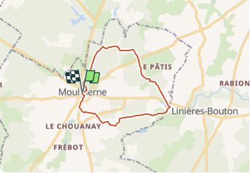
Trail Walking of 10.9 km to be discovered at Pays de la Loire, Maine-et-Loire, Mouliherne. This trail is proposed by Association ARCA49.

Description

Départ Place Emile Delétang

Elevation profile

Positioning

Country:
France
Region :
Pays de la Loire
Department/Province :
Maine-et-Loire
Municipality :
Mouliherne
Location:
Unknown
Start:(UTM)
275205 ; 5261377 (31T) N.

Trails nearby

Trail Walking Baugé-en-Anjou - Le Guedenau - Photo
Walking
palmi1

Walking

Medium
Baugé-en-Anjou, Pays de la Loire, Maine-et-Loire, France
16.3 km | 18.5 km-effort
3h 24min
Yes
Trail Walking Noyant-Villages - Pont ménard - Photo
Walking
laoj

Walking

Medium
Noyant-Villages, Pays de la Loire, Maine-et-Loire, France
5.6 km | 6.4 km-effort
1h 27min
Yes
Trail Walking Mouliherne - Au pays de l'escargot - Photo
Walking
laoj

Walking

Difficult
(1)
Mouliherne, Pays de la Loire, Maine-et-Loire, France
11.2 km | 13 km-effort
2h 50min
Yes
Trail Walking Baugé-en-Anjou - Guédéniau - Photo
Walking
Polenade

Walking

Difficult
Baugé-en-Anjou, Pays de la Loire, Maine-et-Loire, France
16.4 km | 18.6 km-effort
4h 56min
Yes
Trail Walking Baugé-en-Anjou - Le Guédeniau-Jaune - Photo
Walking

Walking

Difficult
Baugé-en-Anjou, Pays de la Loire, Maine-et-Loire, France
12.8 km | 14.6 km-effort
3h 32min
Yes
Trail Walking Baugé-en-Anjou - randogps49-123 - Photo
Walking
bubuserge

Walking

Difficult
Baugé-en-Anjou, Pays de la Loire, Maine-et-Loire, France
11.2 km | 12.8 km-effort
2h 48min
Yes


Close
My subscriptions