![](/images/other/stat-length.png)
![Trail Walking Brissac-Loire-Aubance - Boucle de la Loire - Photo](https://media.geolcdn.com/t/1900/400/ext.pjpeg?maxdim=2&url=https%3A%2F%2Fstatic1.geolcdn.com%2Fsiteimages%2Fupload%2Ffiles%2F1553511878bg_sport_marche.png)
Boucle de la Loire
Association ARCA49
Autour de la randonnée
![Length](/images/other/stat-length.png)
Length
12.2 km
![Max alt](https://static1.geolcdn.com/siteimages/upload/files/1508320355ic_sort_altitude_max_24dp.png)
Max alt
81 m
![Uphill gradient](https://static1.geolcdn.com/siteimages/upload/files/1508320355ic_sort_den_pos_24dp.png)
Uphill gradient
192 m
![Km-Effort](/images/other/stat-length.png)
Km-Effort
14.7 km
![Min alt](https://static1.geolcdn.com/siteimages/upload/files/1508320355ic_sort_altitude_min_24dp.png)
Min alt
14 m
![Downhill gradient](https://static1.geolcdn.com/siteimages/upload/files/1508320355ic_sort_den_neg_24dp.png)
Downhill gradient
198 m
![Boucle](https://static1.geolcdn.com/siteimages/upload/files/16400158638029165_repeat_loop_refresh_sync_direction_icon.png)
Boucle
Yes
Creation date :
2015-03-23 00:00:00.0
Updated on :
2022-05-04 08:12:50.73
![Walking](https://static1.geolcdn.com/sitytour/trail-icons/101.png)
3h20
Difficulty : Difficult
![Scan this QR Code to open this trail in the SityTrail application](https://capi.geolives.com/qq0zvz2zws4bq2lad0pu/sitytour/trails/3132051/qr.png?size=200)
FREE GPS app for hiking
About
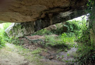
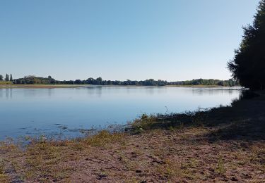
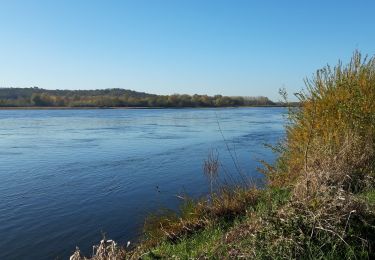
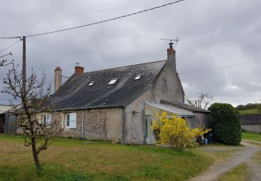
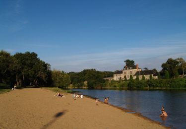
Trail Walking of 12.2 km to be discovered at Pays de la Loire, Maine-et-Loire, Brissac-Loire-Aubance. This trail is proposed by Association ARCA49.
Description
Boucle au bord de la Loire. Point de départ au pont entre Saint Mathurin sur Loire et Saint Rémy la Varenne
Positioning
Country:
France
Region :
Pays de la Loire
Department/Province :
Maine-et-Loire
Municipality :
Brissac-Loire-Aubance
Location:
Unknown
Start:(Dec)
Start:(UTM)
702227 ; 5253640 (30T) N.
Comments
Trails nearby
![Trail On foot Gennes-Val-de-Loire - De Loire et Forêt - Photo](https://media.geolcdn.com/t/375/260/5de94cdf-0f77-4880-98ea-e0c0aebf5951.jpeg&format=jpg&maxdim=2)
![On foot On foot](https://static1.geolcdn.com/sitytour/trail-icons/100.png)
De Loire et Forêt
On foot
Easy
Gennes-Val-de-Loire,
Pays de la Loire,
Maine-et-Loire,
France
![](/images/other/stat-length.png)
7.4 km | 9.1 km-effort
2h 4min
![](https://static1.geolcdn.com/siteimages/upload/files/16400158638029165_repeat_loop_refresh_sync_direction_icon.png)
Yes
![Trail Walking Brissac-Loire-Aubance - St Rémy la Varenne - Gennes - Photo](https://media.geolcdn.com/t/375/260/fd426757-904c-4439-934e-1e922d6cb724.jpg&format=jpg&maxdim=2)
![Walking Walking](https://static1.geolcdn.com/sitytour/trail-icons/101.png)
St Rémy la Varenne - Gennes
Walking
Medium
Brissac-Loire-Aubance,
Pays de la Loire,
Maine-et-Loire,
France
![](/images/other/stat-length.png)
18 km | 22 km-effort
5h 8min
![](https://static1.geolcdn.com/siteimages/upload/files/16400158638029165_repeat_loop_refresh_sync_direction_icon.png)
No
![Trail Walking Brissac-Loire-Aubance - St Rémy la Varenne - Photo](https://media.geolcdn.com/t/375/260/0ad2ae6f-a65c-4370-9717-5c16c4accc77.jpg&format=jpg&maxdim=2)
![Walking Walking](https://static1.geolcdn.com/sitytour/trail-icons/101.png)
St Rémy la Varenne
Walking
Very difficult
Brissac-Loire-Aubance,
Pays de la Loire,
Maine-et-Loire,
France
![](/images/other/stat-length.png)
16.8 km | 19.4 km-effort
4h 24min
![](https://static1.geolcdn.com/siteimages/upload/files/16400158638029165_repeat_loop_refresh_sync_direction_icon.png)
Yes
![Trail Walking Loire-Authion - St Mathurin sur Loire - Photo](https://media.geolcdn.com/t/375/260/10cae68a-3ba9-46cf-9d58-bf2a2a8054f5.jpg&format=jpg&maxdim=2)
![Walking Walking](https://static1.geolcdn.com/sitytour/trail-icons/101.png)
St Mathurin sur Loire
Walking
Difficult
Loire-Authion,
Pays de la Loire,
Maine-et-Loire,
France
![](/images/other/stat-length.png)
24 km | 26 km-effort
4h 4min
![](https://static1.geolcdn.com/siteimages/upload/files/16400158638029165_repeat_loop_refresh_sync_direction_icon.png)
Yes
![Trail Walking Blaison-Saint-Sulpice - Blaison-Gohier - Photo](https://media.geolcdn.com/t/375/260/b6bc34ef-545f-4ef4-91f2-1a689f1a681e.jpg&format=jpg&maxdim=2)
![Walking Walking](https://static1.geolcdn.com/sitytour/trail-icons/101.png)
Blaison-Gohier
Walking
Easy
Blaison-Saint-Sulpice,
Pays de la Loire,
Maine-et-Loire,
France
![](/images/other/stat-length.png)
9.7 km | 11.6 km-effort
3h 12min
![](https://static1.geolcdn.com/siteimages/upload/files/16400158638029165_repeat_loop_refresh_sync_direction_icon.png)
Yes
![Trail Walking Gennes-Val-de-Loire - De Loire en forêt - Le Thoureil - Photo](https://media.geolcdn.com/t/375/260/ext.jpg?maxdim=2&url=https%3A%2F%2Fservices.sitytrail.com%2FGeolivesWS%2FDownloadMedia.ashx%3FTrailID%3D108834%26Media%3D2338_1.jpg)
![Walking Walking](https://static1.geolcdn.com/sitytour/trail-icons/101.png)
De Loire en forêt - Le Thoureil
Walking
Medium
Gennes-Val-de-Loire,
Pays de la Loire,
Maine-et-Loire,
France
![](/images/other/stat-length.png)
7.3 km | 9.1 km-effort
2h 15min
![](https://static1.geolcdn.com/siteimages/upload/files/16400158638029165_repeat_loop_refresh_sync_direction_icon.png)
Yes
![Trail Walking Gennes-Val-de-Loire - /49/Gennes-Val de Loire/Le Thoureil - Photo](https://media.geolcdn.com/t/375/260/ext.jpg?maxdim=2&url=https%3A%2F%2Fstatic1.geolcdn.com%2Fsiteimages%2Fupload%2Ffiles%2F1553511878bg_sport_marche.png)
![Walking Walking](https://static1.geolcdn.com/sitytour/trail-icons/101.png)
/49/Gennes-Val de Loire/Le Thoureil
Walking
Difficult
Gennes-Val-de-Loire,
Pays de la Loire,
Maine-et-Loire,
France
![](/images/other/stat-length.png)
11.2 km | 13.5 km-effort
3h 2min
![](https://static1.geolcdn.com/siteimages/upload/files/16400158638029165_repeat_loop_refresh_sync_direction_icon.png)
Yes
![Trail Walking Brissac-Loire-Aubance - /49/Brissac Loire Aubance/Coutures - Photo](https://media.geolcdn.com/t/375/260/ext.jpg?maxdim=2&url=https%3A%2F%2Fstatic1.geolcdn.com%2Fsiteimages%2Fupload%2Ffiles%2F1553511878bg_sport_marche.png)
![Walking Walking](https://static1.geolcdn.com/sitytour/trail-icons/101.png)
/49/Brissac Loire Aubance/Coutures
Walking
Difficult
Brissac-Loire-Aubance,
Pays de la Loire,
Maine-et-Loire,
France
![](/images/other/stat-length.png)
10.7 km | 12.7 km-effort
2h 52min
![](https://static1.geolcdn.com/siteimages/upload/files/16400158638029165_repeat_loop_refresh_sync_direction_icon.png)
Yes
![Trail Walking Blaison-Saint-Sulpice - blason Gohier - Photo](https://media.geolcdn.com/t/375/260/ext.jpg?maxdim=2&url=https%3A%2F%2Fstatic1.geolcdn.com%2Fsiteimages%2Fupload%2Ffiles%2F1553511878bg_sport_marche.png)
![Walking Walking](https://static1.geolcdn.com/sitytour/trail-icons/101.png)
blason Gohier
Walking
Difficult
Blaison-Saint-Sulpice,
Pays de la Loire,
Maine-et-Loire,
France
![](/images/other/stat-length.png)
10.1 km | 12.7 km-effort
2h 46min
![](https://static1.geolcdn.com/siteimages/upload/files/16400158638029165_repeat_loop_refresh_sync_direction_icon.png)
Yes