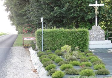

La voie romaine
SityTrail - itinéraires balisés pédestres
Tous les sentiers balisés d’Europe GUIDE+

Length
7.2 km

Max alt
156 m

Uphill gradient
69 m

Km-Effort
8.2 km

Min alt
121 m

Downhill gradient
71 m
Boucle
Yes
Signpost
Creation date :
2022-02-17 11:06:05.887
Updated on :
2022-03-03 23:24:47.139
1h51
Difficulty : Easy

FREE GPS app for hiking
About
Trail On foot of 7.2 km to be discovered at Normandy, Seine-Maritime, Étoutteville. This trail is proposed by SityTrail - itinéraires balisés pédestres.
Description
Trail created by Communauté de communes d'Yerville - Plateau de Caux.
Positioning
Country:
France
Region :
Normandy
Department/Province :
Seine-Maritime
Municipality :
Étoutteville
Location:
Unknown
Start:(Dec)
Start:(UTM)
340984 ; 5503719 (31U) N.
Comments
Trails nearby

Circuit d'Ectot-les-Baons - Relais du Gal


On foot
Easy
Ectot-lès-Baons,
Normandy,
Seine-Maritime,
France

6.7 km | 7.2 km-effort
1h 37min
No

Circuit de Motteville et Flamanville


On foot
Easy
Motteville,
Normandy,
Seine-Maritime,
France

4 km | 4.3 km-effort
58min
No

ouville l'abbaye


Walking
Easy
Ouville-l'Abbaye,
Normandy,
Seine-Maritime,
France

6.3 km | 7.1 km-effort
1h 33min
Yes

Haute Normandie - Ligne 358 - Motteville - Saint-Valery-en-Caux


Other activity
Very easy
Motteville,
Normandy,
Seine-Maritime,
France

31 km | 34 km-effort
5min
No

Yvetot Caudebec en Caux


Walking
Easy
Yvetot,
Normandy,
Seine-Maritime,
France

18.1 km | 22 km-effort
4h 44min
No

Montagne de la Durdent


Mountain bike
Difficult
Yvetot,
Normandy,
Seine-Maritime,
France

55 km | 65 km-effort
3h 0min
Yes

Vers Harcanville


Walking
Medium
Hautot-Saint-Sulpice,
Normandy,
Seine-Maritime,
France

11.1 km | 13.2 km-effort
2h 59min
Yes

AUTRETOT


Walking
Medium
(1)
Les Hauts-de-Caux,
Normandy,
Seine-Maritime,
France

10.5 km | 11.4 km-effort
2h 35min
Yes

Autretot


Walking
Medium
Les Hauts-de-Caux,
Normandy,
Seine-Maritime,
France

9.9 km | 10.8 km-effort
2h 27min
Yes


 SityTrail


