![](/images/other/stat-length.png)
![Trail On foot Kitzeck im Sausal - Kitzecker Weinwanderweg - Photo](https://media.geolcdn.com/t/1900/400/7e10fea9-101d-4851-89bf-24da7b930c4d.jpeg&format=pjpeg&maxdim=2)
Kitzecker Weinwanderweg
SityTrail - itinéraires balisés pédestres
Tous les sentiers balisés d’Europe GUIDE+
![Length](/images/other/stat-length.png)
Length
9.8 km
![Max alt](https://static1.geolcdn.com/siteimages/upload/files/1508320355ic_sort_altitude_max_24dp.png)
Max alt
558 m
![Uphill gradient](https://static1.geolcdn.com/siteimages/upload/files/1508320355ic_sort_den_pos_24dp.png)
Uphill gradient
452 m
![Km-Effort](/images/other/stat-length.png)
Km-Effort
15.8 km
![Min alt](https://static1.geolcdn.com/siteimages/upload/files/1508320355ic_sort_altitude_min_24dp.png)
Min alt
341 m
![Downhill gradient](https://static1.geolcdn.com/siteimages/upload/files/1508320355ic_sort_den_neg_24dp.png)
Downhill gradient
456 m
![Boucle](https://static1.geolcdn.com/siteimages/upload/files/16400158638029165_repeat_loop_refresh_sync_direction_icon.png)
Boucle
Yes
Signpost
Creation date :
2022-02-16 17:11:05.011
Updated on :
2022-03-03 17:30:17.276
![On foot](https://static1.geolcdn.com/sitytour/trail-icons/100.png)
3h35
Difficulty : Easy
![Scan this QR Code to open this trail in the SityTrail application](https://capi.geolives.com/qq0zvz2zws4bq2lad0pu/sitytour/trails/3129015/qr.png?size=200)
FREE GPS app for hiking
About
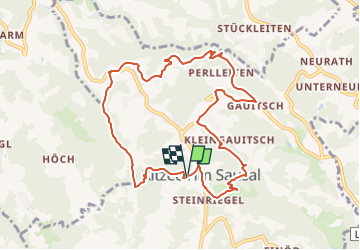
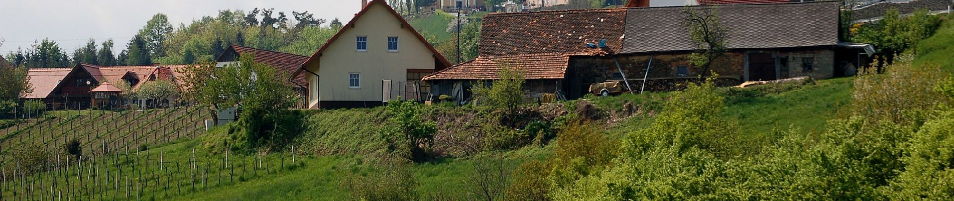
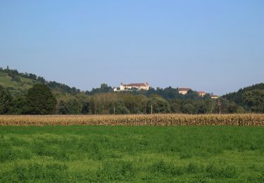
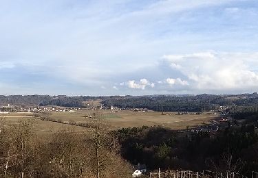
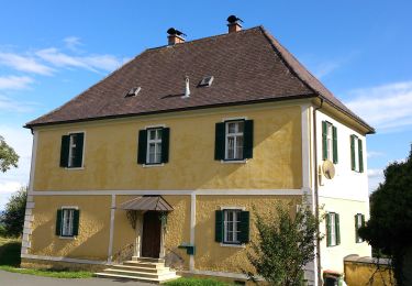
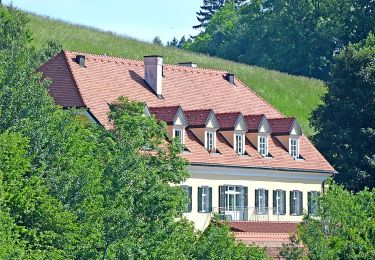
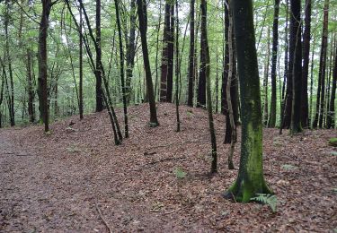
Trail On foot of 9.8 km to be discovered at Styria, Bezirk Leibnitz, Kitzeck im Sausal. This trail is proposed by SityTrail - itinéraires balisés pédestres.
Description
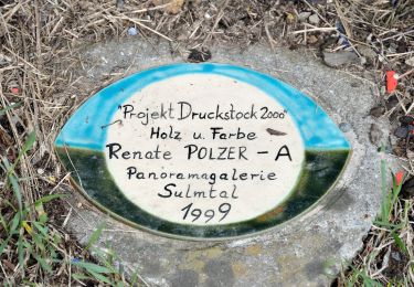
Trail created by TV Sulmtal Sausal.
Symbol: Rot-Weiss-Rot 8
Website: https://www.sulmtal-sausal.at/fileadmin/dokumente/2015/block_kitzeck_web.pdf
Positioning
Country:
Austria
Region :
Styria
Department/Province :
Bezirk Leibnitz
Municipality :
Kitzeck im Sausal
Location:
Unknown
Start:(Dec)
Start:(UTM)
534454 ; 5180905 (33T) N.
Comments
Trails nearby
![Trail On foot Sankt Nikolai im Sausal - Sankt Nikolaier Panoramaweg - Photo](https://media.geolcdn.com/t/375/260/33fdc3b6-b554-4244-940f-a65186848cfa.jpeg&format=jpg&maxdim=2)
![On foot On foot](https://static1.geolcdn.com/sitytour/trail-icons/100.png)
Sankt Nikolaier Panoramaweg
On foot
Easy
Sankt Nikolai im Sausal,
Styria,
Bezirk Leibnitz,
Austria
![](/images/other/stat-length.png)
5 km | 6.8 km-effort
1h 32min
![](https://static1.geolcdn.com/siteimages/upload/files/16400158638029165_repeat_loop_refresh_sync_direction_icon.png)
No
![Trail On foot Kitzeck im Sausal - Heimschuher Runde Nord - Photo](https://media.geolcdn.com/t/375/260/5e835b4d-412c-4b29-acde-d26c18047373.jpeg&format=jpg&maxdim=2)
![On foot On foot](https://static1.geolcdn.com/sitytour/trail-icons/100.png)
Heimschuher Runde Nord
On foot
Medium
Kitzeck im Sausal,
Styria,
Bezirk Leibnitz,
Austria
![](/images/other/stat-length.png)
16.4 km | 23 km-effort
5h 12min
![](https://static1.geolcdn.com/siteimages/upload/files/16400158638029165_repeat_loop_refresh_sync_direction_icon.png)
No
![Trail On foot Kitzeck im Sausal - Panoramagalerie Sulmtal - Sausal - Kunst und Wein - Photo](https://media.geolcdn.com/t/375/260/f44117f1-fadb-4f68-b6a1-42f775b74e2b.jpeg&format=jpg&maxdim=2)
![On foot On foot](https://static1.geolcdn.com/sitytour/trail-icons/100.png)
Panoramagalerie Sulmtal - Sausal - Kunst und Wein
On foot
Easy
Kitzeck im Sausal,
Styria,
Bezirk Leibnitz,
Austria
![](/images/other/stat-length.png)
7.5 km | 10.4 km-effort
2h 21min
![](https://static1.geolcdn.com/siteimages/upload/files/16400158638029165_repeat_loop_refresh_sync_direction_icon.png)
No
![Trail On foot Heimschuh - Heimschuher Runde Süd Abschneider - Photo](https://media.geolcdn.com/t/375/260/2362ecfc-84e2-4131-943e-419711be3284.jpeg&format=jpg&maxdim=2)
![On foot On foot](https://static1.geolcdn.com/sitytour/trail-icons/100.png)
Heimschuher Runde Süd Abschneider
On foot
Easy
Heimschuh,
Styria,
Bezirk Leibnitz,
Austria
![](/images/other/stat-length.png)
3.4 km | 4.7 km-effort
1h 4min
![](https://static1.geolcdn.com/siteimages/upload/files/16400158638029165_repeat_loop_refresh_sync_direction_icon.png)
No
![Trail On foot Heimschuh - Heimschuher Runde Süd - Photo](https://media.geolcdn.com/t/375/260/f44117f1-fadb-4f68-b6a1-42f775b74e2b.jpeg&format=jpg&maxdim=2)
![On foot On foot](https://static1.geolcdn.com/sitytour/trail-icons/100.png)
Heimschuher Runde Süd
On foot
Medium
Heimschuh,
Styria,
Bezirk Leibnitz,
Austria
![](/images/other/stat-length.png)
17 km | 24 km-effort
5h 22min
![](https://static1.geolcdn.com/siteimages/upload/files/16400158638029165_repeat_loop_refresh_sync_direction_icon.png)
Yes
![Trail On foot Kitzeck im Sausal - Sausaler Rundwanderweg - Photo](https://media.geolcdn.com/t/375/260/848859ba-c51a-4e50-99c2-e71179601368.jpeg&format=jpg&maxdim=2)
![On foot On foot](https://static1.geolcdn.com/sitytour/trail-icons/100.png)
Sausaler Rundwanderweg
On foot
Medium
Kitzeck im Sausal,
Styria,
Bezirk Leibnitz,
Austria
![](/images/other/stat-length.png)
19.9 km | 31 km-effort
7h 2min
![](https://static1.geolcdn.com/siteimages/upload/files/16400158638029165_repeat_loop_refresh_sync_direction_icon.png)
Yes
![Trail On foot Sankt Andrä-Höch - Kitzeck - Demmerkogel Runde - Photo](https://media.geolcdn.com/t/375/260/b14e8b6f-f9d8-469c-90f8-bd7163a2ded5.jpeg&format=jpg&maxdim=2)
![On foot On foot](https://static1.geolcdn.com/sitytour/trail-icons/100.png)
Kitzeck - Demmerkogel Runde
On foot
Easy
Sankt Andrä-Höch,
Styria,
Bezirk Leibnitz,
Austria
![](/images/other/stat-length.png)
12.2 km | 18.9 km-effort
4h 17min
![](https://static1.geolcdn.com/siteimages/upload/files/16400158638029165_repeat_loop_refresh_sync_direction_icon.png)
Yes
![Trail On foot Großklein - Fürstengräberweg - Photo](https://media.geolcdn.com/t/375/260/8bf3754a-1218-4a24-90ab-70d73aad4833.jpeg&format=jpg&maxdim=2)
![On foot On foot](https://static1.geolcdn.com/sitytour/trail-icons/100.png)
Fürstengräberweg
On foot
Easy
Großklein,
Styria,
Bezirk Leibnitz,
Austria
![](/images/other/stat-length.png)
12.7 km | 18.1 km-effort
4h 6min
![](https://static1.geolcdn.com/siteimages/upload/files/16400158638029165_repeat_loop_refresh_sync_direction_icon.png)
Yes
![Trail On foot Sankt Andrä-Höch - Fresing - Demmerkogel Runde - Photo](https://media.geolcdn.com/t/375/260/b14e8b6f-f9d8-469c-90f8-bd7163a2ded5.jpeg&format=jpg&maxdim=2)
![On foot On foot](https://static1.geolcdn.com/sitytour/trail-icons/100.png)
Fresing - Demmerkogel Runde
On foot
Easy
Sankt Andrä-Höch,
Styria,
Bezirk Leibnitz,
Austria
![](/images/other/stat-length.png)
10.2 km | 14.6 km-effort
3h 19min
![](https://static1.geolcdn.com/siteimages/upload/files/16400158638029165_repeat_loop_refresh_sync_direction_icon.png)
Yes