![](/images/other/stat-length.png)
![Trail On foot Gemeinde Mühldorf - Mühldorf-Wolfenreith - Photo](https://media.geolcdn.com/t/1900/400/503345dc-36ce-4ac2-b4eb-c64d833be577.jpeg&format=pjpeg&maxdim=2)
Mühldorf-Wolfenreith
SityTrail - itinéraires balisés pédestres
Tous les sentiers balisés d’Europe GUIDE+
![Length](/images/other/stat-length.png)
![Max alt](https://static1.geolcdn.com/siteimages/upload/files/1508320355ic_sort_altitude_max_24dp.png)
![Uphill gradient](https://static1.geolcdn.com/siteimages/upload/files/1508320355ic_sort_den_pos_24dp.png)
![Km-Effort](/images/other/stat-length.png)
![Min alt](https://static1.geolcdn.com/siteimages/upload/files/1508320355ic_sort_altitude_min_24dp.png)
![Downhill gradient](https://static1.geolcdn.com/siteimages/upload/files/1508320355ic_sort_den_neg_24dp.png)
![Boucle](https://static1.geolcdn.com/siteimages/upload/files/16400158638029165_repeat_loop_refresh_sync_direction_icon.png)
![On foot](https://static1.geolcdn.com/sitytour/trail-icons/100.png)
1h55
Difficulty : Easy
![Scan this QR Code to open this trail in the SityTrail application](https://capi.geolives.com/qq0zvz2zws4bq2lad0pu/sitytour/trails/3128806/qr.png?size=200)
FREE GPS app for hiking
About
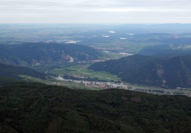
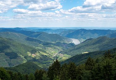
Trail On foot of 4.5 km to be discovered at Lower Austria, Bezirk Krems, Gemeinde Mühldorf. This trail is proposed by SityTrail - itinéraires balisés pédestres.
Description
Der ÖTK gilt als Pionier des Fremdenverkehrs. Heute ist der ÖTK mit über 360 Kursen und geführten Touren in 50 Freizeitsportarten der größte Anbieter im Outdoor-Segment in Österreich.
Website: https://www.oetk.at/
Positioning
Comments
Trails nearby
![Trail On foot Gemeinde Spitz - Schwallenbach-Ruine Hinterhaus-Spitz - Photo](https://media.geolcdn.com/t/375/260/80a4842e-07bc-421f-b7f6-a45fb5110c0e.jpeg&format=jpg&maxdim=2)
![On foot On foot](https://static1.geolcdn.com/sitytour/trail-icons/100.png)
On foot
![](/images/other/stat-length.png)
![](https://static1.geolcdn.com/siteimages/upload/files/16400158638029165_repeat_loop_refresh_sync_direction_icon.png)
![Trail On foot Gemeinde Weinzierl am Walde - Wolfenreith-Mühldorf - Photo](https://media.geolcdn.com/t/375/260/503345dc-36ce-4ac2-b4eb-c64d833be577.jpeg&format=jpg&maxdim=2)
![On foot On foot](https://static1.geolcdn.com/sitytour/trail-icons/100.png)
On foot
![](/images/other/stat-length.png)
![](https://static1.geolcdn.com/siteimages/upload/files/16400158638029165_repeat_loop_refresh_sync_direction_icon.png)
![Trail On foot Gemeinde Spitz - Rotes Tor Rundwanderung - Photo](https://media.geolcdn.com/t/375/260/c880dc64-65cd-498b-bb2f-39dd5bb6708b.jpeg&format=jpg&maxdim=2)
![On foot On foot](https://static1.geolcdn.com/sitytour/trail-icons/100.png)
On foot
![](/images/other/stat-length.png)
![](https://static1.geolcdn.com/siteimages/upload/files/16400158638029165_repeat_loop_refresh_sync_direction_icon.png)
![Trail On foot Gemeinde Spitz - Buchberg Rundwanderung - Photo](https://media.geolcdn.com/t/375/260/4796baa1-b9a2-42af-9e74-5dc91b432f87.jpeg&format=jpg&maxdim=2)
![On foot On foot](https://static1.geolcdn.com/sitytour/trail-icons/100.png)
On foot
![](/images/other/stat-length.png)
![](https://static1.geolcdn.com/siteimages/upload/files/16400158638029165_repeat_loop_refresh_sync_direction_icon.png)
![Trail On foot Gemeinde Spitz - Welterbesteig Wachau Etappe 4 - Photo](https://media.geolcdn.com/t/375/260/d6852376-5127-4a91-b069-a62de62c5455.jpeg&format=jpg&maxdim=2)
![On foot On foot](https://static1.geolcdn.com/sitytour/trail-icons/100.png)
On foot
![](/images/other/stat-length.png)
![](https://static1.geolcdn.com/siteimages/upload/files/16400158638029165_repeat_loop_refresh_sync_direction_icon.png)
![Trail On foot Gemeinde Mühldorf - Welterbesteig Wachau Etappe 5 - Photo](https://media.geolcdn.com/t/375/260/7a31ccdf-f01f-4abd-8752-f6aab2cd5a2d.jpeg&format=jpg&maxdim=2)
![On foot On foot](https://static1.geolcdn.com/sitytour/trail-icons/100.png)
On foot
![](/images/other/stat-length.png)
![](https://static1.geolcdn.com/siteimages/upload/files/16400158638029165_repeat_loop_refresh_sync_direction_icon.png)