![](/images/other/stat-length.png)
![Trail On foot Gemeinde Erl - Weidau-Runde - Photo](https://media.geolcdn.com/t/1900/400/ext.pjpeg?maxdim=2&url=https%3A%2F%2Fmedia.geolcdn.com%2Ff%2F8ecaf8ec-7ce0-4d74-b523-83156d484c9f.jpeg)
Weidau-Runde
SityTrail - itinéraires balisés pédestres
Tous les sentiers balisés d’Europe PRO
![Length](/images/other/stat-length.png)
Length
3.5 km
![Max alt](https://static1.geolcdn.com/siteimages/upload/files/1508320355ic_sort_altitude_max_24dp.png)
Max alt
488 m
![Uphill gradient](https://static1.geolcdn.com/siteimages/upload/files/1508320355ic_sort_den_pos_24dp.png)
Uphill gradient
35 m
![Km-Effort](/images/other/stat-length.png)
Km-Effort
4 km
![Min alt](https://static1.geolcdn.com/siteimages/upload/files/1508320355ic_sort_altitude_min_24dp.png)
Min alt
463 m
![Downhill gradient](https://static1.geolcdn.com/siteimages/upload/files/1508320355ic_sort_den_neg_24dp.png)
Downhill gradient
35 m
![Boucle](https://static1.geolcdn.com/siteimages/upload/files/16400158638029165_repeat_loop_refresh_sync_direction_icon.png)
Boucle
Yes
Signpost
Creation date :
2022-02-16 16:50:12.501
Updated on :
2022-03-03 12:50:18.31
![On foot](https://static1.geolcdn.com/sitytour/trail-icons/100.png)
54m
Difficulty : Easy
![Scan this QR Code to open this trail in the SityTrail application](https://capi.geolives.com/qq0zvz2zws4bq2lad0pu/sitytour/trails/3128043/qr.png?size=200)
FREE GPS app for hiking
About
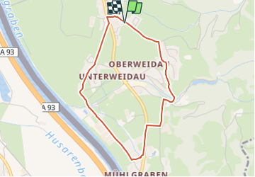
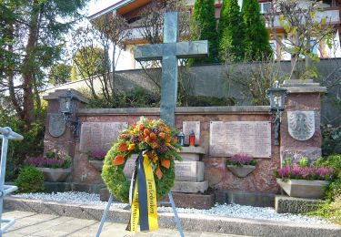
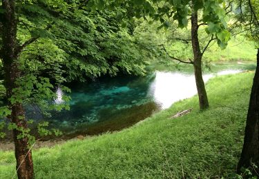
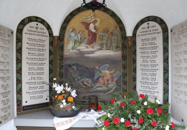
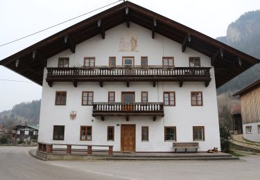
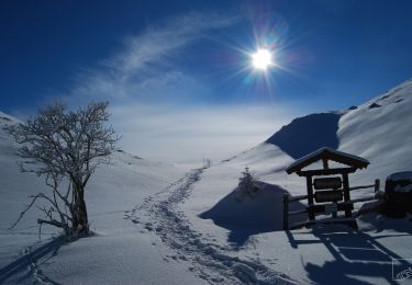
Trail On foot of 3.5 km to be discovered at Tyrol, Bezirk Kufstein, Gemeinde Erl. This trail is proposed by SityTrail - itinéraires balisés pédestres.
Description
Trail created by Kufsteinerland.
Symbol: Weiße Schilder mit Richtungspfeil und pinkem Streifen mit dem Namen "Weidau-Runde"
Positioning
Country:
Austria
Region :
Tyrol
Department/Province :
Bezirk Kufstein
Municipality :
Gemeinde Erl
Location:
Unknown
Start:(Dec)
Start:(UTM)
288573 ; 5284659 (33T) N.
Comments
Trails nearby
![Trail On foot Gemeinde Ebbs - Inn Rundweg - Photo](https://media.geolcdn.com/t/375/260/ext.jpg?maxdim=2&url=https%3A%2F%2Fmedia.geolcdn.com%2Ff%2Fdaaecc59-bccf-4b5e-b34b-e9247f0a0214.jpeg)
![On foot On foot](https://static1.geolcdn.com/sitytour/trail-icons/100.png)
Inn Rundweg
On foot
Easy
Gemeinde Ebbs,
Tyrol,
Bezirk Kufstein,
Austria
![](/images/other/stat-length.png)
4.1 km | 4.4 km-effort
1h 0min
![](https://static1.geolcdn.com/siteimages/upload/files/16400158638029165_repeat_loop_refresh_sync_direction_icon.png)
Yes
![Trail On foot Gemeinde Erl - Euregio Marien-Wege - Photo](https://media.geolcdn.com/t/375/260/ext.jpg?maxdim=2&url=https%3A%2F%2Fmedia.geolcdn.com%2Ff%2F797c713e-12d0-48f6-8c0e-6e9af5a814a9.jpeg)
![On foot On foot](https://static1.geolcdn.com/sitytour/trail-icons/100.png)
Euregio Marien-Wege
On foot
Easy
Gemeinde Erl,
Tyrol,
Bezirk Kufstein,
Austria
![](/images/other/stat-length.png)
3.4 km | 3.8 km-effort
51min
![](https://static1.geolcdn.com/siteimages/upload/files/16400158638029165_repeat_loop_refresh_sync_direction_icon.png)
No
![Trail On foot Gemeinde Ebbs - Fohlenhof-Runde - Photo](https://media.geolcdn.com/t/375/260/ext.jpg?maxdim=2&url=https%3A%2F%2Fmedia.geolcdn.com%2Ff%2F7bfaa8d7-3efe-4f72-977e-6085ad17dacd.jpeg)
![On foot On foot](https://static1.geolcdn.com/sitytour/trail-icons/100.png)
Fohlenhof-Runde
On foot
Easy
Gemeinde Ebbs,
Tyrol,
Bezirk Kufstein,
Austria
![](/images/other/stat-length.png)
7 km | 7.8 km-effort
1h 46min
![](https://static1.geolcdn.com/siteimages/upload/files/16400158638029165_repeat_loop_refresh_sync_direction_icon.png)
Yes
![Trail On foot Gemeinde Niederndorf - Dorf-Runde - Photo](https://media.geolcdn.com/t/375/260/ext.jpg?maxdim=2&url=https%3A%2F%2Fmedia.geolcdn.com%2Ff%2F03e886ce-5826-4b05-85ce-81e181092c50.jpeg)
![On foot On foot](https://static1.geolcdn.com/sitytour/trail-icons/100.png)
Dorf-Runde
On foot
Easy
Gemeinde Niederndorf,
Tyrol,
Bezirk Kufstein,
Austria
![](/images/other/stat-length.png)
3.9 km | 4.4 km-effort
59min
![](https://static1.geolcdn.com/siteimages/upload/files/16400158638029165_repeat_loop_refresh_sync_direction_icon.png)
Yes
![Trail On foot Gemeinde Erl - Schönau-Runde - Photo](https://media.geolcdn.com/t/375/260/ext.jpg?maxdim=2&url=https%3A%2F%2Fmedia.geolcdn.com%2Ff%2Fb1f09388-96e0-4eca-92f2-e261f74a2a6c.jpeg)
![On foot On foot](https://static1.geolcdn.com/sitytour/trail-icons/100.png)
Schönau-Runde
On foot
Easy
Gemeinde Erl,
Tyrol,
Bezirk Kufstein,
Austria
![](/images/other/stat-length.png)
5.4 km | 7.8 km-effort
1h 45min
![](https://static1.geolcdn.com/siteimages/upload/files/16400158638029165_repeat_loop_refresh_sync_direction_icon.png)
Yes
![Trail On foot Gemeinde Erl - Dorf-Runde - Photo](https://media.geolcdn.com/t/375/260/ext.jpg?maxdim=2&url=https%3A%2F%2Fmedia.geolcdn.com%2Ff%2F44387dbd-2b6b-460b-8631-eded4687f55a.jpeg)
![On foot On foot](https://static1.geolcdn.com/sitytour/trail-icons/100.png)
Dorf-Runde
On foot
Easy
Gemeinde Erl,
Tyrol,
Bezirk Kufstein,
Austria
![](/images/other/stat-length.png)
5.1 km | 5.8 km-effort
1h 19min
![](https://static1.geolcdn.com/siteimages/upload/files/16400158638029165_repeat_loop_refresh_sync_direction_icon.png)
Yes
![Trail On foot Gemeinde Erl - Scheiben-Runde - Photo](https://media.geolcdn.com/t/375/260/ext.jpg?maxdim=2&url=https%3A%2F%2Fmedia.geolcdn.com%2Ff%2F56087dc7-ffa6-4102-a9bb-c8ee2599a932.jpeg)
![On foot On foot](https://static1.geolcdn.com/sitytour/trail-icons/100.png)
Scheiben-Runde
On foot
Easy
Gemeinde Erl,
Tyrol,
Bezirk Kufstein,
Austria
![](/images/other/stat-length.png)
6.7 km | 8.1 km-effort
1h 50min
![](https://static1.geolcdn.com/siteimages/upload/files/16400158638029165_repeat_loop_refresh_sync_direction_icon.png)
Yes
![Trail On foot Nußdorf am Inn - Kranzhorn über Bubenaualm - Photo](https://media.geolcdn.com/t/375/260/ext.jpg?maxdim=2&url=https%3A%2F%2Fmedia.geolcdn.com%2Ff%2Fe3c5b70e-000e-4248-8f68-0461d1126b7e.jpeg)
![On foot On foot](https://static1.geolcdn.com/sitytour/trail-icons/100.png)
Kranzhorn über Bubenaualm
On foot
Easy
Nußdorf am Inn,
Bavaria,
Landkreis Rosenheim,
Germany
![](/images/other/stat-length.png)
3.1 km | 4.7 km-effort
1h 3min
![](https://static1.geolcdn.com/siteimages/upload/files/16400158638029165_repeat_loop_refresh_sync_direction_icon.png)
No
![Trail On foot Nußdorf am Inn - Wanderweg 4 - Kranzhorn - Photo](https://media.geolcdn.com/t/375/260/ext.jpg?maxdim=2&url=https%3A%2F%2Fmedia.geolcdn.com%2Ff%2Fe3c5b70e-000e-4248-8f68-0461d1126b7e.jpeg)
![On foot On foot](https://static1.geolcdn.com/sitytour/trail-icons/100.png)
Wanderweg 4 - Kranzhorn
On foot
Easy
Nußdorf am Inn,
Bavaria,
Landkreis Rosenheim,
Germany
![](/images/other/stat-length.png)
3 km | 6.3 km-effort
1h 25min
![](https://static1.geolcdn.com/siteimages/upload/files/16400158638029165_repeat_loop_refresh_sync_direction_icon.png)
No